
Golden Gate Park is an urban park between the Richmond and Sunset districts of San Francisco, California, United States. It is the second-largest park in the city, containing 1,017 acres (412 ha), and the third-most visited urban park in the United States, with an estimated 24 million visitors annually.

Mission Dolores Park, often abbreviated to Dolores Park, is a city park in San Francisco, California. It is located two blocks south of Mission Dolores at the western edge of the Mission District.

John McLaren Park is a park in southeastern San Francisco. At 312.54 acres (126.48 ha), McLaren Park is the third largest park in San Francisco by area, after Golden Gate Park and the Presidio. The park is surrounded mostly by the Excelsior, Crocker-Amazon, Visitacion Valley, Portola and University Mound neighborhoods.
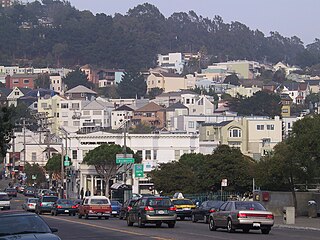
Glen Park is a residential neighborhood in San Francisco, California, located south of Twin Peaks and adjacent to Glen Canyon Park.

Duboce Park is a small urban park located between the Duboce Triangle and Lower Haight neighborhoods of San Francisco, California. The park is less than one block wide from north to south and two blocks wide from west to east. Its western boundary is Scott Street, and its eastern boundary is Steiner Street. The park is part of the Duboce Park Landmark District.

The Randall Museum is a museum in central San Francisco, California, owned and operated by the San Francisco Recreation & Parks Department with the support of the Randall Friends. The museum focuses on science, nature and the arts. On exhibit are live native animals and interactive displays about nature. Other facilities include a theater, a wood shop, and art and ceramics studios.
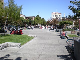
Portsmouth Square, formerly known as Portsmouth Plaza, and originally known as Plaza de Yerba Buena, or simply La Plaza, is a one-block plaza in Chinatown, San Francisco, California. Portsmouth Square is the first park in San Francisco, predating both Washington Square (1847) and Union Square (1850). Established in the early 19th century, during the period of Mexican California, the plaza was renamed following the U.S. Conquest of California in honor of the USS Portsmouth, the American ship which captured the city. It is bounded by Kearny Street on the east, Washington Street on the north, Clay Street on the south, and Walter Lum Place on the west.
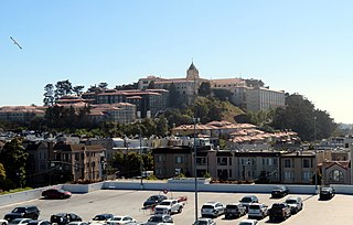
Lone Mountain is a neighborhood and a historic hill in west-central San Francisco, California. It is the present site of the northern half of the University of San Francisco's main campus. It was once the location of the Lone Mountain Cemetery, a complex encompassing the Laurel Hill, Calvary, Masonic and Odd Fellows Cemeteries.

DeWitt Clinton Park is a 5.8-acre (23,000 m2) New York City public park in the Hell's Kitchen neighborhood of Manhattan, New York City, between West 52nd and 54th Streets, and Eleventh and Twelfth Avenues.
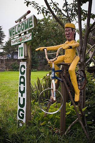
Cayuga Park is a neighborhood park and playground in San Francisco, at the edge of the Cayuga Terrace neighborhood. Its history, location and aesthetics make it unique among the parks of San Francisco.
The San Francisco Recreation & Parks Department is the city agency responsible for governing and maintaining all city-owned parks and recreational facilities in San Francisco, as well as Sharp Park Golf Course in Pacifica and Camp Mather in Tuolumne County. Current facilities include 4,113 acres (1,664 ha) of total recreational and open space with 3,400 acres (1,376 ha) of that land within San Francisco. The department runs 179 playgrounds and play areas, 82 recreation centers and clubhouses, nine swimming pools, five golf courses, 151 tennis courts, 72 basketball courts, 59 soccer fields, numerous baseball diamonds, and other sports venues.
Bremen Street Park is an 18-acre urban park, located in East Boston, Boston, Massachusetts. The park runs parallel to both Bremen Street and the Mass Pike/Route 1A and acts as a green space buffer between Logan International Airport and the residential neighborhoods of East Boston. The park is owned, operated and patrolled by the Massachusetts Port Authority (MassPort). It is also part of the East Boston Greenway, a linear park and shared use path.

Civic Center Plaza, also known as Joseph Alioto Piazza, is the 4.53-acre (1.83 ha) plaza immediately east of San Francisco City Hall in Civic Center, San Francisco, in the U.S. state of California. Civic Center Plaza occupies two blocks bounded by McAllister, Larkin, Grove, and Carlton B. Goodlett, divided into a north block and south block by the former alignment of Fulton Street. The block north of Fulton is built over a three-story parking garage ; the block south of Fulton lies over a former exhibition space, Brooks Hall.

United Nations Plaza is a 2.6-acre (1.1 ha) plaza located on the former alignments of Fulton and Leavenworth Streets—in the block bounded by Market, Hyde, McAllister, and 7th Street—in the Civic Center of San Francisco, California. It is located 1⁄4 mi (0.40 km) east of City Hall and is connected to it by the Fulton Mall and Civic Center Plaza. Public transit access is provided by the BART and Muni Metro stops at the Civic Center/UN Plaza station, which has a station entrance within the plaza itself.

In Chan Kaajal Park is a public park in the Mission District of San Francisco, USA, located north of 17th Street between Folsom and Shotwell Street.

Central Park is the first public park in San Mateo, California, a 16.5-acre (7 ha) urban park bounded by El Camino Real, 5th Avenue, Laurel Avenue and 9th Avenue. It was established via a 1922 bond measure of US$80,000 to purchase the land originally owned by Charles B. Polhemus, and currently hosts a baseball field, tennis courts, sculptures, playground, Japanese tea garden, recreation center, miniature train, rose garden and the San Mateo Arboretum.

Boeddeker Park, more formally known as Father Alfred E. Boeddeker Park, is an urban park in the Tenderloin neighborhood of San Francisco. This 1-acre park was renovated and reopened in 2014, especially intended to serve the needs of people in the surrounding neighborhood who experience amongst the highest levels of poverty in the city. The park was completed with a large mural, Everyone Deserves a Home, on the building above the park in 2016.

Collis P. Huntington Park is a 1.3-acre (0.53 ha) park in the Nob Hill neighborhood of San Francisco, California.

