Franco Bianco Airport | |||||||||||||||
---|---|---|---|---|---|---|---|---|---|---|---|---|---|---|---|
Summary | |||||||||||||||
Airport type | Private | ||||||||||||||
Serves | Cerro Sombrero, Chile | ||||||||||||||
Elevation AMSL | 106 ft / 32 m | ||||||||||||||
Coordinates | 52°44′12″S69°20′05″W / 52.73667°S 69.33472°W Coordinates: 52°44′12″S69°20′05″W / 52.73667°S 69.33472°W | ||||||||||||||
Map | |||||||||||||||
Runways | |||||||||||||||
| |||||||||||||||
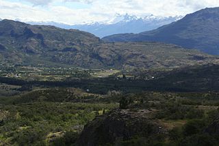
Franco Bianco Airport( IATA : SMB, ICAO : SCSB) is an airport 5 kilometres (3.1 mi) northwest of Cerro Sombrero, a petroleum production town in the Magallanes Region of Chile. Cerro Sombrero is near the eastern entrance to the Strait of Magellan.
An IATA airport code, also known as an IATA location identifier, IATA station code or simply a location identifier, is a three-letter code designating many airports around the world, defined by the International Air Transport Association (IATA). The characters prominently displayed on baggage tags attached at airport check-in desks are an example of a way these codes are used.
The ICAOairport code or location indicator is a four-letter code designating aerodromes around the world. These codes, as defined by the International Civil Aviation Organization and published in ICAO Document 7910: Location Indicators, are used by air traffic control and airline operations such as flight planning.
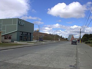
Cerro Sombrero is a village in southern Chile. It is located in the Primavera commune in the Magallanes Region, in the northern part of Tierra del Fuego, about 125 km from Porvenir. According to the 2002 census, it had 687 inhabitants.
The Cerro Sombrero non-directional beacon (Ident: SOM) is 0.85 nautical miles (1.6 km) west of the approach threshold of Runway 07. [4]
A non-directional (radio) beacon (NDB) is a radio transmitter at a known location, used as an aviation or marine navigational aid. As the name implies, the signal transmitted does not include inherent directional information, in contrast to other navigational aids such as low frequency radio range, VHF omnidirectional range (VOR) and TACAN. NDB signals follow the curvature of the Earth, so they can be received at much greater distances at lower altitudes, a major advantage over VOR. However, NDB signals are also affected more by atmospheric conditions, mountainous terrain, coastal refraction and electrical storms, particularly at long range.
Transport in Chile is mostly by road. The south of the country is not connected to central Chile by road, except through Argentina, and water transport also plays a part there. The railways were historically important in Chile, but now play a relatively small part in the country's transport system. Because of the country's geography and long distances between major cities, aviation is also important.
Andrés Sabella Gálvez International Airport is an airport serving Antofagasta, capital of the Antofagasta Region of Chile. It is 10 kilometres (6.2 mi) north of Antofagasta and 3 kilometres (1.9 mi) inland from the Pacific coastline.
Pupelde Airport is an airport serving Ancud, a Pacific port city in the Los Lagos Region of Chile. Ancud is on the northern shore of Chiloé Island.
Cerro Castillo Airport Spanish: Aeropuerto de Cerro Castillo, is an airstrip serving the village and border station at Cerro Castillo, in the Magallanes Region of Chile. Cerro Castillo is 6 kilometres (3.7 mi) west of the border with Argentina.
Cerro Paranal Airport is a desert airport 6 kilometres (4 mi) east-southeast of Cerro Paranal, Antofagasta, Chile. It serves the Paranal Observatory and Cerro Armazones Observatory scientific complexes.
Chile Chico Airport Spanish: Aeródromo Chile Chico, is an airport serving Chile Chico, a lakeside town in the Aysén Region of Chile. Chile Chico is on the south shore of General Carrera Lake, 3 kilometres (1.9 mi) west of the Argentina border. The airport is 5 kilometres (3.1 mi) southeast of the town.
Cochrane Airport Spanish: Aeródromo Cochrane, is an airport serving Cochrane, a town in the Aysén Region of Chile. The airport is just northwest of the town, at the foot of Cerro Tamanguito (sv).
Teniente Vidal Airport Spanish: Aeródromo Teniente Vidal, is an airport serving Coyhaique, capital of the Aysén Region of Chile. The airport is 3 kilometres (1.9 mi) southwest of Coyhaique.
Quivolgo Airport is an airport serving Constitución, a Pacific coastal city in the Maule Region of Chile. The airport is 3 kilometres (1.9 mi) northeast of Constitución, across the Maule River from the city.
Coposa Airport is an extremely high elevation airport serving the Pica commune in the Tarapacá Region of Chile. The airport is 73 kilometres (45 mi) east-southeast of the town of Pica, and 13 kilometres (8.1 mi) west of the Bolivia border.
Lago Colico Airport is a rural airstrip at the west end of Colico Lake in the Araucanía Region of Chile. The nearest town is Cunco, 14 kilometres (8.7 mi) to the north.
General Freire Airport Spanish: Aeródromo General Freire, is an airport serving Curicó, a city in the Maule Region of Chile. The airport is within the northeast part of the city.
Hualaihué Airport is an airport serving Hualaihué, a village in the Los Lagos Region of Chile.
Isla Apiao Airport is an airport serving Isla Apiao (es), an island in the archipelago separating the Gulf of Ancud from the Gulf of Corcovado in the Los Lagos Region of Chile.
Butachauques Airport is an airport serving Isla Butachauques (es), a central island in the Gulf of Ancud in Chile's Los Lagos Region.
Quenac Airport is an airstrip serving Isla Quenac (es), an island in the Los Lagos Region of Chile. The island is in the archipelago between the Gulf of Ancud and the Gulf of Corcovado.
San Rafael Airport Spanish: Aeródromo de San Rafael de Los Andes, is an airport serving Los Andes, a city in the Valparaíso Region of Chile. The airport is 5 kilometres (3.1 mi) west-northwest of the city.
Teniente Julio Gallardo Airport, is an airport serving Puerto Natales, a city in the Magallanes Region of Chile. The airport is 7 kilometres (4.3 mi) north-northwest of Puerto Natales, which is on the Admiral Montt Gulf (es), a long fjord that reaches inland close to the border with Argentina. The airport is 12 kilometres (7.5 mi) from the border.
El Mirador Airport, is an airport just southeast of Puerto Varas, a city in the Los Lagos Region of Chile. Puerto Varas is on the southwest shore of Llanquihue Lake.
Panguilemo Airport is an airport 5 kilometres (3.1 mi) northeast of Talca, capital of the Maule Region of Chile.
The Aviation Safety Network (ASN) is a website that keeps track of aviation accidents, incidents, and hijackings. Their database contains details of over 10,700 reports. The ASN includes an aviation database with aviation investigations, news, photos, and statistics.
This article about an airport in Chile is a stub. You can help Wikipedia by expanding it. |