El Mirador Airport

Last updated
El Mirador Airport
Summary
Airport typePublic
Serves Puerto Varas, Chile
Elevation  AMSL 430 ft / 131 m
Coordinates 41°20′55″S072°56′50″W / 41.34861°S 72.94722°W / -41.34861; -72.94722 (El Mirador Airport (Puerto Varas)) Coordinates: 41°20′55″S072°56′50″W / 41.34861°S 72.94722°W / -41.34861; -72.94722 (El Mirador Airport (Puerto Varas))
Map
Chile location map.svg
Airplane silhouette.svg
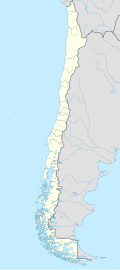
SCPV
Location of El Mirador Airport in Chile
Runways
Direction LengthSurface
mft
15/337802,559Asphalt
Source: Landings.com [1] Google Maps [2] GCM [3]

El Mirador Airport (Spanish : Aeropuerto El Mirador), ( IATA : PUX, ICAO : SCPV) is an airport just southeast of Puerto Varas, a city in the Los Lagos Region of Chile. Puerto Varas is on the southwest shore of Llanquihue Lake.

Contents

The Puerto Montt VOR-DME (Ident: MON) is located 8.1 nautical miles (15.0 km) southwest of the airport. [4]

See also

Related Research Articles

<span class="mw-page-title-main">Teniente R. Marsh Airport</span> Airport

The Teniente Rodolfo Marsh Martin Airport is on King George Island, part of Chile's Antártica commune in Antarctica, and is the northernmost airport in the continent. The airport serves the nearby village of Villa Las Estrellas and the Base Presidente Eduardo Frei Montalva.

Río Turbio Airport is an airport serving Río Turbio, a town in the Santa Cruz Province of Argentina. The airport is just south of 28 de Noviembre, a town 10 kilometres (6 mi) southeast of Rio Turbio.

Mocopulli Airport is an airport serving Dalcahue, a port city on Chiloé Island in the Los Lagos Region of Chile. The airport is 6 kilometres (3.7 mi) northwest of Dalcahue.

Pupelde Airport is an airport serving Ancud, a Pacific port city in the Los Lagos Region of Chile. Ancud is on the northern shore of Chiloé Island.

El Litral Airport (Spanish: Aeropuerto de El Litral, is an airport 7 kilometres southeast of Quillón, a city in Bío Bío Region of Chile. It is 12 kilometres southwest of Bulnes.

El Tapihue Airport (Spanish: Aeropuerto El Tapihue, is an airstrip 6 kilometres east of Casablanca, a city in the Valparaíso Region of Chile.

El Amarillo Airport Spanish: Aeropuerto El Amarillo, is an airstrip 21 kilometres (13 mi) east of Chaitén, a town in the Los Lagos Region of Chile. The Carretera Austral runs through the hamlet of El Amarillo, and passes the south end of the runway.

Cochamó Airport Spanish: Aeropuerto de Cochamó, is a public use airport serving Cochamó, a town in the Los Lagos Region of Chile. Cochamó is at the northern end of the Reloncaví Estuary.

Teniente Vidal Airport is an airport serving Coyhaique, capital of the Aysén Region of Chile. The airport is 3 kilometres (1.9 mi) southwest of Coyhaique.

Contao Airport Spanish: Aeropuerto de Contao, is an airport serving Contao, a village in the Los Lagos Region of Chile.

General Freire Airport is an airport serving Curicó, a city in the Maule Region of Chile. The airport is within the northeast part of the city.

Fundo Tehuén Airport, is an airstrip 6.8 kilometres (4.2 mi) northwest of Frutillar, a town in the Los Lagos Region of Chile.

Frutillar Airport is an airport serving Frutillar, a town at the western end of Llanquihue Lake in the Los Lagos Region of Chile.

Caleta Blanco Airport Spanish: Aeropuerto Caleta Blanco, is an airport serving the villages of Puerto Aguirre (es) and Caleta Andrade (es) on Isla Las Huichas (es), an island in the Aysén Region of Chile.

Puerto Sur Airport is an airport serving Isla Santa María, a Pacific island in the Bío Bío Region of Chile. The island is 31 kilometres (19 mi) west of Coronel.

San Rafael Airport Spanish: Aeródromo de San Rafael de Los Andes, is an airport serving Los Andes, a city in the Valparaíso Region of Chile. The airport is 5 kilometres (3.1 mi) west-northwest of the city.

Ñochaco Airport is an airport serving Puerto Octay in the Los Lagos Region of Chile. Ñochaco is in the countryside 9 kilometres (5.6 mi) north of Puerto Octay.

Marcel Marchant Airport, is an airport in the northeast section of Puerto Montt, a port city in the Los Lagos Region of Chile.

<span class="mw-page-title-main">Teniente Julio Gallardo Airport</span> Airport in Chile

Teniente Julio Gallardo Airport, is an airport serving Puerto Natales, a city in the Magallanes Region of Chile. The airport is 7 kilometres (4.3 mi) north-northwest of Puerto Natales, which is on the Admiral Montt Gulf (es), a long fjord that reaches inland close to the border with Argentina. The airport is 12 kilometres (7.5 mi) from the border.

El Boco Airport, is an airport serving Quillota, a city in the Valparaíso Region of Chile. The airport is 3 kilometres (1.9 mi) north of the city.

References

  1. Airport record for El Mirador Airport at Landings.com. Retrieved 2013-09-11
  2. Google (2013-09-11). "location of El Mirador Airport" (Map). Google Maps . Google. Retrieved 2013-09-11.
  3. Airport information for El Mirador Airport at Great Circle Mapper.
  4. Puerto Montt VOR