Related Research Articles

Contra Costa County is a county in the state of California in the United States. As of the 2010 census, the population was 1,049,025. The county seat is Martinez. It occupies the northern portion of the East Bay region of the San Francisco Bay Area, and is primarily suburban. The county's name is Spanish for "opposite coast", referring to its position on the other side of the bay from San Francisco. Contra Costa County is included in the San Francisco–Oakland–Berkeley, CA Metropolitan Statistical Area.

The Caldecott Tunnel is an east–west highway tunnel through the Berkeley Hills between Oakland and Orinda, California. Its four bores carry California State Route 24. Named after Thomas E. Caldecott, former mayor of Berkeley, it opened in 1937 as a two-bore tunnel. The third bore opened in 1964 and the fourth bore in 2013. Currently, the two oldest bores carry eastbound traffic and the two newest bores carry westbound traffic.

Area code 925 is a California telephone area code that was split from area code 510 on March 14, 1998. It covers the inland portions of the East Bay counties of Alameda and Contra Costa in the northern area of California.

The Claremont district is a neighborhood straddling the city limits of Oakland and Berkeley in the East Bay section of the San Francisco Bay Area in California, United States. The main thoroughfares are Claremont and Ashby Avenues.
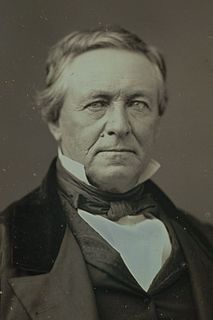
John Marsh. He was an early pioneer and settler in Alta California, the first Harvard graduate and the first to practice medicine there. He knew Hebrew, Latin and Greek, and was the first to compile a dictionary of the Sioux language. He became one of the wealthiest ranchers in California, and was one of the most influential men in the establishment of California statehood.
Wildcat Canyon is a narrow linear valley just east of the Berkeley Hills in the San Francisco Bay Area, situated in Contra Costa County, California. The canyon is bounded on its east side by the San Pablo Ridge, and is drained by Wildcat Creek which runs northwest to its outlet in San Pablo Bay. Two minor lakes or ponds lie along the creek: Jewel Lake and Lake Anza. The latter was enlarged by the construction of a small dam in the mid-20th century. An active tectonic fault, the Wildcat Fault, runs the length of the canyon. Wildcat Canyon was named for the mountain lions which used to be fairly common in the area. The southern end of the canyon adjacent to the city of Berkeley was incorporated into Tilden Regional Park in the 1930s and remains a major recreation area for local residents. Another regional park, Wildcat Canyon Regional Park, is situated at the northern end of the canyon.

West County Detention Center is a large coeducational adult medium security Contra Costa County prison in Richmond, California opened in 1991.

Carquinez Strait Regional Shoreline is a regional park, part of the East Bay Regional Park District system, located in northwestern Contra Costa County, California.

Radke Martinez Regional Shoreline (RMRS) is a regional park on the shoreline of Carquinez Strait in Martinez, located in northern Contra Costa County, California. Formerly known as the Martinez Regional Shoreline, it was renamed on December 6, 2016, in honor of the late Ted Radke and his late wife Kathy Radke.

Eckley was a city in Contra Costa County, California, which served as a train-ferry landing for crossings of the Carquinez Strait prior to the opening of the Benicia-Martinez railroad bridge. It lay on the Southern Pacific Railroad 4.5 miles (7.2 km) northwest of Martinez, at an elevation of 10 feet. The townspeople were very active in the sport of baseball, and about a dozen company teams were supported. The population decreased with the construction of the bridge, and in the late 20th century the last residents left. There was active farming and grazing in the area. Much of the population relocated to Crockett.
Giant was an unincorporated community, now within Point Pinole Regional Shoreline, and annexed to Richmond in Contra Costa County, California. It lies at an elevation of 23 feet.
Rancho Laguna de Los Palos Colorados was a 13,316-acre (53.89 km2) Mexican land grant in the Berkeley Hills within present-day Contra Costa County, California.
Rancho Acalanes was a 3,329-acre (13.47 km2) Mexican land grant in present-day Contra Costa County, California.
Rancho El Pinole was a 17,761-acre (71.88 km2) Mexican land grant along Carquinez Strait in present-day Contra Costa County, California.
Rancho Monte del Diablo was a 17,921-acre (72.52 km2) Mexican land grant in present-day Contra Costa County, California given in 1834 by Governor José Figueroa to Salvio Pacheco. The name "Monte del Diablo" means "thicket of the devil" in Spanish. The name was later incorrectly translated as Mount Diablo. The grant covered the area from the Walnut Creek channel east to the hills, and generally from the Mount Diablo foothills north along Lime Ridge to Avon on the Carquinez Strait of the Sacramento River, and included present day Concord and parts of Pleasant Hill. Pacheco and Clayton are outside of the Rancho Monte del Diablo grant.
Rancho Cañada del Hambre y Las Bolsas was a 13,354-acre (54.04 km2) Mexican land grant in present day northwestern Contra Costa County, California.
Rancho Las Juntas was a 13,293-acre (53.79 km2) Mexican land grant in present day Contra Costa County, California given in 1844 by Governor Manuel Micheltorena to William Welch. The name Las Juntas translates as "the Crossroads". The grant was located between Ygnacio Martinez’ Rancho El Pinole and Salvio Pacheco’s Rancho Monte del Diablo, and included northwestern Walnut Creek, all of Pleasant Hill, and the eastern portion of Martinez. The original borders of the claim were defined as the straits to the north, "Las Juntas" to the south, the Walnut creek to the east, the Reliz ridge to the west, and, to the northwest, the Alhambra creek.

Marsh Creek State Historic Park is a California state park in east Contra Costa County, California, United States. It was named as the newest California State Park on January 27, 2012. The newly named park contains 3,659 acres and is about 3.3 miles (5.3 km) south of downtown Brentwood. It is not open to the public as of January 2015. No opening date has been announced.
Bernardo Fernandez was an early pioneer of western Contra Costa County, California in the United States of America.
The Vicente Martinez Adobe is an historic adobe house near Martinez, California. The house was built in 1849 by Vicente J. Martinez on the Rancho El Pinole, a land grant that had been given to his father, Ignacio Martinez, in 1836. It was the first of its kind built in Contra Costa County. In 1853 the adobe was sold Edward Franklin, after whom the canyon where the adobe sits was named. The adobe became known as the Franklin Canyon Adobe.
References
- ↑ U.S. Geological Survey Geographic Names Information System: Franklin Canyon. Retrieved on 2020-07-10.
Coordinates: 37°59′50″N122°09′08″W / 37.99722°N 122.15222°W