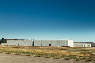
Apalachicola Regional Airport is a county-owned, public-use airport located two nautical miles (4 km) west of the central business district of Apalachicola, a city in Franklin County, Florida, United States. It is included in the National Plan of Integrated Airport Systems for 2011–2015, which categorized it as a general aviation facility. It was previously known as Apalachicola Municipal Airport. The airport supports general aviation activity in the area and provides service via a tenant fixed-base operator (FBO).

Franklin Municipal–John Beverly Rose Airport, also known as Franklin Municipal Airport or John Beverly Rose Field is a public airport in Isle of Wight County, Virginia, United States. The airport is owned by the City of Franklin and is located at 32470 John Beverly Rose Drive, two nautical miles (4 km) northeast of the city's central business district.
Phillips Flying Ranch Airport is a public airport located fifteen miles (24.1 km) southeast of the central business district (CBD) of Rockwall, in Rockwall County, Texas, United States. The airport itself is located in Hunt County.
Kenneth Copeland Airport is a public airport located eighteen miles (29 km) northwest of the central business district (CBD) of Fort Worth, in Tarrant County, Texas, United States.
Sycamore Strip Airport is a public airport located eight miles (12.9 km) southwest of the central business district (CBD) of Fort Worth, in Tarrant County, Texas, United States. It is owned by a local flight school, A & W Aircraft.
Airpark East Airport is a privately owned public-use airport located 6 nautical miles (11 km) northwest of the central business district of Terrell, Texas, United States. The airport is used solely for general aviation purposes. The airport is in both Rockwall and Kaufman counties.

Denton Enterprise Airport, also known as Denton Airport and previously Denton Municipal Airport, is a city-owned, public-use airport located three nautical miles (6 km) west of the central business district of Denton, a city in Denton County, Texas, United States.

Arlington Municipal Airport is five miles south of Arlington, in Tarrant County, Texas. The airport is at the intersection of Interstate 20 and South Collins Road; it is a reliever airport for Dallas/Fort Worth International Airport and Dallas Love Field.
Franklin County Airport is a public airport located one mile (2 km) east of the central business district of Sewanee, a census-designated place in Franklin County, Tennessee, United States. It is owned by Franklin County.
Franklin County Airport may refer to:
Houston Southwest Airport or Houston-Southwest Airport is a public-use airport located in Arcola, a city in Fort Bend County, Texas, United States, 15 miles (24 km) southwest of the central business district of Houston. It is privately owned by James Griffith, Jr.

Zelienople Municipal Airport is a public airport in Beaver County, Pennsylvania, a mile west of Zelienople, a borough in Butler County, Pennsylvania, in the Pittsburgh metropolitan area. The airport is owned by the Borough of Zelienople and operated by the Zelienople Municipal Authority. The National Plan of Integrated Airport Systems for 2011–2015 categorized it as a general aviation facility.
South Texas International Airport at Edinburg is in Hidalgo County, Texas, ten miles north of Edinburg. It received its name in July 2007, prior to which it was Edinburg International Airport.

Naval Outlying Landing Field Summerdale is an uncontrolled military use airport located in Summerdale, a town in Baldwin County, Alabama, United States. It is under the operational control of NAS Whiting Field and is used for flying training.

Tokeen Seaplane Base is a public use seaplane base located in Tokeen, in the Prince of Wales-Hyder Census Area in the U.S. state of Alaska.
Franklin Field is a county-owned public-use airport in Bullock County, Alabama, United States. It is located five nautical miles west of the central business district of Union Springs, Alabama. It is included in the FAA's National Plan of Integrated Airport Systems for 2011–2015, which categorized it as a general aviation facility.
Ferris Red Oak Muni Heliport is a city-owned public heliport in Ellis County, Texas, United States, serving the cities of Ferris, Texas and Red Oak, Texas. The heliport has no IATA or ICAO designation. The facility is alternatively known as the Ferris Red Oak Municipal Heliport.
Dallas South Port Airport is a privately owned public airport in Ferris, Ellis County, Texas, United States, that also serves the city Palmer, Texas, and is located approximately 3 nautical miles (5.6 km) north of the central business district. The airport has no IATA or ICAO designation.
Dallas CBD Vertiport is a city-owned public heliport/vertiport in the city of Dallas, Dallas County, Texas, United States. The facility is located at the south end of the Kay Bailey Hutchison Convention Center in the Dallas Central Business District, and is claimed to be the world's largest elevated heliport/vertiport.


