Frederiksted Historic District

Last updated
Frederiksted Historic District
Nekton Rorqual 2009, the Rorqual in Frederiksted Saint Croix.jpg
The Rorqual, 2009
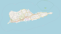
United States Virgin Islands Saint Croix location map.svg
Red pog.svg
USA Virgin Islands location map.svg
Red pog.svg
LocationRoughly bounded by Fisher St., the cemetery, Fort Frederick, Frederiksted, United States Virgin Islands
Coordinates 17°42′53″N64°53′29″W / 17.71472°N 64.89139°W / 17.71472; -64.89139 Coordinates: 17°42′53″N64°53′29″W / 17.71472°N 64.89139°W / 17.71472; -64.89139
Built1752
ArchitectMultiple
Architectural styleLate Victorian, Georgian, Gothic Revival
NRHP reference No. 76001853
Added to NRHPAugust 9, 1976 [1]

Frederiksted Historic District is a historic district located on the island of Saint Croix in the United States Virgin Islands. It was listed on the U.S. National Register of Historic Places in 1976. [1]

Contents

Frederiksted Historic District includes the original town laid out in a gridiron plan in 1751. Fort Frederik, which now houses a museum, was the original focal point of the town plan. The original buildings were destroyed in a fire in 1758. In 1878, plantation workers set fire to much of the town during the Fireburn insurrection. The fire damaged areas were rebuilt, with many of the buildings reflecting Georgian and Late Victorian architectural detailing. Significant buildings in the district include the Fort Frederik and the Customs House. [2] [3]
See also

Related Research Articles

Saint Croix One of the main islands of the United States Virgin Islands

Saint Croix is an island in the Caribbean Sea, and a county and constituent district of the United States Virgin Islands (USVI), an unincorporated territory of the United States.

Fort Matanzas National Monument Place in Florida (US) managed by the National Park Service

Fort Matanzas National Monument was designated a United States National Monument on October 15, 1924. The monument consists of a 1740 Spanish fort called Fort Matanzas, and about 100 acres (0.4 km²) of salt marsh and barrier islands along the Matanzas River on the northern Atlantic coast of Florida. It is operated by the National Park Service in conjunction with the Castillo de San Marcos National Monument in the city of St. Augustine.

Frederiksted, U.S. Virgin Islands Place in United States Virgin Islands

Frederiksted is both the town and one of the two administrative districts of St. Croix, U.S. Virgin Islands. It is a grid-planned city, designed by surveyor Jens Beckfor, originally to 14x14 blocks but built 7x7 to enhance the island commerce in the 1700s. Frederiksted has fewer than 1,000 people in the town proper, but nearly 10,000 in the greater western side of the island. Christiansted is about 30 years older but commerce was limited by its natural, shallow protective reef. Frederiksted was built in the leeward side of the island for calm seas and a naturally deep port. It is home to Fort Frederik, constructed to protect the town from pirate raids and attacks from rival imperialist nations and named after Frederick V of Denmark, who purchased the Danish West Indies in 1754.

Hassel Island, U.S. Virgin Islands United States historic place

Hassel Island is a small island of the U.S. Virgin Islands, a United States territory located in the Caribbean Sea. Hassel Island lies in the Charlotte Amalie harbor just south of Saint Thomas and east of Water Island, with which it is part of the sub-district of Water Island.

Christiansted National Historic Site 7 acres in St. Croix, US Virgin Islands managed by the National Park Service

Christiansted National Historic Site commemorates urban colonial development of the Virgin Islands. It features 18th and 19th century structures in the heart of Christiansted, the capital of the former Danish West Indies on St. Croix Island.

Fort Christian United States historic place

Fort Christian is a Dano-Norwegian-built fort in Charlotte Amalie, Saint Thomas, U.S. Virgin Islands. Built 1672-1680, early in the first successful colonial establishment on the island, the fort served as a critical point of defense and government during the entire period of Dano-Norwegian, and later Danish, administration, which ended in 1917 with the sale of the islands to the United States. It currently holds the St. Thomas Museum, which holds artifacts and art of the Dano-Norwegian period. It was designated a U.S. National Historic Landmark in 1977.

Savannah Historic District (Savannah, Georgia) United States historic place

The Savannah Historic District is a large urban U.S. historic district that roughly corresponds to the pre-civil war city limits of Savannah, Georgia. The area was declared a National Historic Landmark District in 1966, and is one of the largest urban, community-wide historic preservation districts in the United States. The district was made in recognition of the Oglethorpe Plan, a unique sort of urban planning begun by James Oglethorpe at the city's founding and propagated for the first century of its growth.

Fort Frederik United States historic place

Fort Frederik, also known as Frederiksfort, is a U.S. National Historic Landmark in Frederiksted, United States Virgin Islands. It was built between 1752 and 1760 by Denmark-Norway to defend the economic interests of the natural deep water port of Frederiksted and to ward off pirates. It has red and white painted walls, making it quite different then yellow and white of Fort Christiansværn on the other side of the island. It is located at the north end of Frederiksted, in St. Croix, south of the junction of Mahogany Road and VI 631. It should not be confused with Frederiks Fort, Fortberg Hill, on St. John, which is also listed on the National Register of Historic Places.

Virginville, Pennsylvania Census-designated place in Pennsylvania, United States

Virginville is a census-designated place in Richmond Township, Berks County, Pennsylvania. It is located at the junction of PA 143 and Crystal Ridge Road, and is approximately 7 miles to the south of the borough of Lenhartsville.

Harmar, Marietta United States historic place

Harmar is a historic neighborhood in the city of Marietta, Ohio, United States. Located at the western side of the confluence of the Muskingum and Ohio Rivers, it grew up around the early Fort Harmar in the 1780s, being settled in conjunction with Marietta. After a period of forming part of Marietta, it existed separately beginning in 1837 before rejoining the mother city in 1890. Connected by bridge to the rest of the city, it retains much of its nineteenth-century architecture and landscape, and most of the neighborhood is now a historic district on the National Register of Historic Places.

Charlotte Amalie Historic District United States historic place

The Charlotte Amalie Historic District in Charlotte Amalie in Saint Thomas, U.S. Virgin Islands is a 165.3 acres (0.669 km2) historic district which was listed on the National Register of Historic Places in 1976.

Christiansted Historic District United States historic place

The Christiansted Historic District is a 135.9 acres (0.550 km2) historic district in Christiansted, Saint Croix, Virgin Islands, which was listed on the National Register of Historic Places in 1976. It included 253 contributing buildings and two contributing sites.

Whim (United States Virgin Islands) United States historic place

Whim is a historic sugar plantation located in Southwest subdistrict about 1.7 miles (2.7 km) southeast of Frederiksted on Centerline Road on Saint Croix, U.S. Virgin Islands. It was listed on the National Register of Historic Places in 1976. The listing included three contributing buildings, one contributing site, and two contributing structures, on 10 acres (4.0 ha).

Estate Hogansborg United States historic place

Estate Hogansborg is located east of Frederiksted off Centerline Road in the Northwest district of Saint Croix, U.S. Virgin Islands, or the West End Quarter of Saint Croix. It dates back to 1757. It was listed on the U.S. National Register of Historic Places in 1978. The listing included four contributing buildings, two contributing structures, and three contributing sites on 4.6 acres (1.9 ha).

Slob Historic District United States historic place

Slob Historic District, near Christiansted, Virgin Islands, is a historic district which was listed on the National Register of Historic Places in 1987. The listing included nine contributing buildings, three contributing structures, and a contributing site on 9 acres (3.6 ha).

Columbus Civic Center (Ohio) Civic center in downtown Columbus, Ohio

The Columbus Civic Center is a civic center, a collection of government buildings, museums, and open park space in Downtown Columbus, Ohio. The site is located along the Scioto Mile recreation area and historically was directly on the banks of the Scioto River.

References

  1. 1 2 "National Register Information System". National Register of Historic Places . National Park Service. April 15, 2008.
  2. "Frederiksted Historic District". National Register of Historic Places. Retrieved March 25, 2016.
  3. "Frederiksted Historic District". The Virgin Islands Daily News. May 25, 1979. Retrieved March 25, 2016.