This article needs additional citations for verification .(May 2023) |
Freetown Sibun is a populated settlement located in the nation of Belize. It is a mainland village that is located in Belize District along the Sibun River.
This article needs additional citations for verification .(May 2023) |
Freetown Sibun is a populated settlement located in the nation of Belize. It is a mainland village that is located in Belize District along the Sibun River.
At the time of the 2010 census, Freetown Sibun had a population of 78. Of these, 51.3% were Creole, 42.3% Mestizo, 6.4% Mixed and 1.3% Ketchi Maya. [1]

Dangriga, formerly known as Stann Creek Town, is a town in southern Belize, located on the Caribbean coast at the mouth of the North Stann Creek River. It is the capital of Belize's Stann Creek District. Dangriga is served by the Dangriga Airport. Commonly known as the "culture capital of Belize" due to its influence on punta music and other forms of Garifuna culture, Dangriga is the largest settlement in southern Belize.

Stann Creek District is a district in the south east region of Belize. According to the 2010 census, the district had a population of 32,166 people. Its capital is the town of Dangriga, formerly known as "Stann Creek Town." Stann comes from "stanns," or safe havens used by colonialists coming from the "old world" to the "new world."

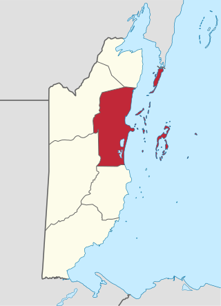
Belize District is a district of the nation of Belize. Its capital is Belize City.

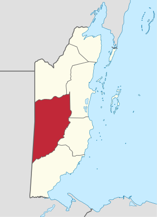
Cayo District is a district located in the west part of Belize. It is the most extensive, second-most populous and third-most densely populated of the six districts of Belize. The district's capital is the town of San Ignacio.

Hattieville is a village in the Belize District of the nation of Belize. It is located at 17N 88W, at an elevation of 196 feet above mean sea level, and has a population of about 1,300 people. Hattieville was established as a refugee camp after Hurricane Hattie made many people homeless in Belize City when it hit in 1961, but it became a permanent town.

East Troy is a Village in Walworth County, Wisconsin, United States. The population was 5,673 at the 2020 census. The Village is located southwest of the Town of East Troy. A small portion extends into the adjacent Town of Troy.

Indian Church is a small remote village in the Orange Walk District of Belize. It is located on the west bank of New River, neighbouring the town of San Carlos to its south, and the Maya ruins of Lamanai to its north. According to the 2010 census, Indian Church has a population of 267 people in 66 households. The village is named for the historic Spanish churches recovered among the ancient Maya ruins. The residents lived among the ruins until 1991 when the Government of Belize established the 2-square-mile (5.2 km2) Lamanai Archaeological Reserve maintained by Belize's Institute of Archaeology.

Hopkins Village is a coastal village in eastern Belize.

The Sibun River is a river in Belize which drains a large central portion of the country. The Sibun (Xibun) were ancient Maya people who inhabited the region.
Calcutta is a village in the Corozal District of Belize.

Freetown is an unincorporated community and census-designated place in Pershing Township, Jackson County, Indiana, United States. As of the 2010 census the population was 385.
Gardenia is a village in Belize District, Belize located about 20 miles (32 km) north of Belize City.

Xibun is an alternate Mayan spelling of Sibun that appears on some Spanish colonial-period maps of the region, and is sometimes used to refer to:
Bomba is a settlement located in the nation of Belize. It is a mainland village located in Belize District. On November 1, 2016 it was announced that the residents now have electricity.
Crooked Tree is a settlement located in the nation of Belize. It is a mainland village located in the Belize District.
Burrell Boom is on the Belize River twenty miles above Belize City, Belize. Tourists pass through this historic village on their way to the Community Baboon Sanctuary, where the population of black howler monkeys has grown to over 2,000.

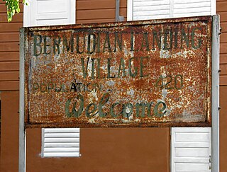
Bermudian Landing is a village in the nation of Belize, located near Scotland Halfmoon in Belize District. The name comes from the Bermuda grass planted by the early loggers to feed their oxen, who were used to drag the mahogany to the landing.
Double Head Cabbage is a village in Belize located in Belize District.
La Democracia is a populated settlement located in the nation of Belize. It is a mainland village that is located in Belize District.
Maya Beach Village is a village in the Stann Creek District of Belize located on the Placencia Peninsula, between Riversdale Village and Seine Bight. Based on the 2010 national census, Maya Beach has a population of 225 year round residents. The village is home to a number of resorts, boutique hotels, and vacation homes. Notable resorts include Maya Beach Hotel Bistro, Belize Ocean Club, and Naia Resort & Spa. The village is often considered a part of the peninsula's largest community and namesake, Placencia, which is a short drive from the village. Maya Beach is served by the Placencia Airport, with the closest international hub being Philip S. W. Goldson International Airport in Belize City.