
Hamilton is an inland city in the North Island of New Zealand. Located on the banks of the Waikato River, it is the seat and most populous city of the Waikato region. With a territorial population of 179,900, it is the country's fourth most-populous city. Encompassing a land area of about 110 km2 (42 sq mi), Hamilton is part of the wider Hamilton Urban Area, which also encompasses the nearby towns of Ngāruawāhia, Te Awamutu and Cambridge. In 2020, Hamilton was awarded the title of most beautiful large city in New Zealand.

Tainui is a tribal waka confederation of New Zealand Māori iwi. The Tainui confederation comprises four principal related Māori iwi of the central North Island of New Zealand: Hauraki, Ngāti Maniapoto, Ngāti Raukawa and Waikato. There are other Tainui iwi whose tribal areas lay outside the traditional Tainui boundaries – Ngāi Tai in the Auckland area, Ngāti Raukawa ki Te Tonga and Ngāti Toa in the Horowhenua, Kāpiti region, and Ngāti Rārua and Ngāti Koata in the northern South Island.

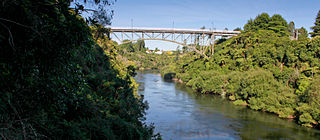
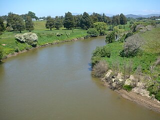
The Waikato River is the longest river in New Zealand, running for 425 kilometres (264 mi) through the North Island. It rises on the eastern slopes of Mount Ruapehu, joining the Tongariro River system and flowing through Lake Taupō, New Zealand's largest lake. It then drains Taupō at the lake's northeastern edge, creates the Huka Falls, and flows northwest through the Waikato Plains. It empties into the Tasman Sea south of Auckland, at Port Waikato. It gives its name to the Waikato region that surrounds the Waikato Plains. The present course of the river was largely formed about 17,000 years ago. Contributing factors were climate warming, forest being reestablished in the river headwaters and the deepening, rather than widening, of the existing river channel. The channel was gradually eroded as far up river as Piarere, leaving the old Hinuera channel through the Hinuera Gap high and dry. The remains of the old course are seen clearly at Hinuera, where the cliffs mark the ancient river edges. The Waikato's main tributary is the Waipā River, which converges with it at Ngāruawāhia.
Cambridge is a town in the Waipa District of the Waikato region of the North Island of New Zealand. Situated 24 kilometres (15 mi) southeast of Hamilton, on the banks of the Waikato River, Cambridge is known as "The Town of Trees & Champions". The town has a population of 21,600, making it the largest town in the Waipa District, and the third largest urban area in the Waikato.

The Waipā River is in the Waikato region of the North Island of New Zealand. The headwaters are in the Rangitoto Range east of Te Kuiti. It flows north for 115 kilometres (71 mi), passing through Ōtorohanga and Pirongia, before flowing into the Waikato River at Ngāruawāhia. It is the Waikato's largest tributary. The Waipā's main tributary is the Puniu River.

Waikato District is a territorial authority of New Zealand, in the northern part of Waikato region, North Island. Waikato District is administered by the Waikato District Council, with headquarters in Ngāruawāhia.

Putāruru is a small town in the South Waikato District and the Waikato region of New Zealand's North Island. It lies on the western side of the Mamaku Ranges and in the upper basin of the Waihou River. It is on the Oraka Stream 65 kilometres south-east of Hamilton. State Highway 1 and the Kinleith Branch railway run through the town.

State Highway 1 is the longest and most significant road in the New Zealand road network, running the length of both main islands. It appears on road maps as SH 1 and on road signs as a white number 1 on a red shield, but it has the official designations SH 1N in the North Island, SH 1S in the South Island.

Flagstaff is a suburb in north-east Hamilton, New Zealand. It was originally called Dulverton on council plans, but it was officially named Flagstaff in 1986 when it was declared as a suburb. The area was heavily developed in the 1990s.
The Waikato Expressway is a dual carriageway section of State Highway 1 in New Zealand's Waikato region. Constructed in stages, it forms part of the link between Auckland and Hamilton. Currently stretching from Auckland to south of Cambridge, the first section of the highway was built in 1993. Throughout its lifetime, it has undergone many upgrades to optimise traffic flow throughout the Waikato region, including various bypasses of many towns in the region, culminating with Hamilton in 2022.

State Highway 26 (SH 26) is a state highway in the North Island of New Zealand, linking Hamilton with the Coromandel Peninsula. It starts from the Waikato Expressway at Ruakura on the eastern outskirts of Hamilton and travels 96 kilometres to Kopu, 6 kilometres south of Thames. It passes through Morrinsville, Te Aroha and Paeroa.
The Rotorua Branch is a railway line from Putāruru to Rotorua, in the Waikato and Bay of Plenty regions of the North Island of New Zealand. Construction of the line was commenced by the Thames Valley and Rotorua Railway Company and finished by the Public Works Department (PWD). The complete line, 50.5 kilometres (31.4 mi) in length, opened in two sections; on 24 November 1893 to Tārukenga and the final 8 mi 43 ch (13.7 km) to Rotorua on 8 December 1894.
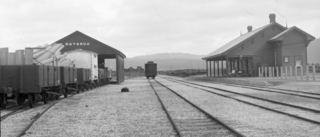
The Cambridge Branch is a rural railway line in the Waikato, New Zealand. The line stretchs from Ruakura Junction for 15.08 km to the settlement of Hautapu, having previously continued another 4.19 km to the township of Cambridge. It had five stations along its length, at Newstead, Matangi (Tamahere), Bruntwood (Fencourt), Hautapu and the terminus at Cambridge.

State Highway 29 (SH 29) is a New Zealand state highway that travels over the Kaimai Ranges linking the Bay of Plenty and Waikato regions. For most of its length, SH 29 is a two-lane single carriageway with occasional passing lanes and slow vehicle bays. 5 km of it near its eastern terminus is part of the Takitimu Drive Toll Road.
Whatawhata, previously also spelt Whata Whata, is a small town in the Waikato region on the east bank of the Waipā River, at the junction of State Highways 23 and 39, 12 km (7.5 mi) from Hamilton. Te Araroa tramping route passes through Whatawhata.
State Highway 39 (SH 39) is a New Zealand state highway that forms a western bypass of the city of Hamilton. Gazetted in 1999, it is a generally quicker route to get between Auckland and New Plymouth as well as connecting to the Waitomo Caves, just south of the SH 39 southern terminus. The southernmost 14 km section has a concurrency with SH 31, as this highway has existed for much longer.
Horotiu is a small township on the west bank of the Waikato River in the Waikato District of New Zealand. It is on the Waikato Plains 13 km (8.1 mi) north of Hamilton and 5 km (3.1 mi) south of Ngāruawāhia. From early in the 20th century it developed around a freezing works and other industries.

Camille French is a New Zealand long-distance runner.
Te Miro is an area in the Waipa District of the Waikato Region of the North Island of New Zealand. Te Miro is situated 31 kilometres east southeast of Hamilton, and 24 kilometres northeast of Cambridge. Te Miro has a population of approximately 500.


