This article includes a list of references, but its sources remain unclear because it has insufficient inline citations . (March 2018) (Learn how and when to remove this template message) |
Coordinates: 22°41′13″N120°19′03″E / 22.686885°N 120.317532°E
A geographic coordinate system is a coordinate system that enables every location on Earth to be specified by a set of numbers, letters or symbols. The coordinates are often chosen such that one of the numbers represents a vertical position and two or three of the numbers represent a horizontal position; alternatively, a geographic position may be expressed in a combined three-dimensional Cartesian vector. A common choice of coordinates is latitude, longitude and elevation. To specify a location on a plane requires a map projection.
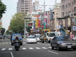
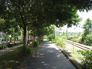
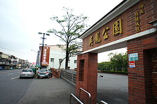
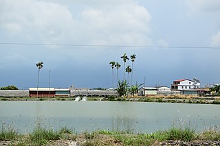
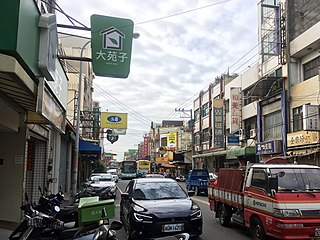
Fushan Village (Chinese :福山里; pinyin :Fúshān Lǐ) is a village in Zuoying District, Kaohsiung, Taiwan. This is Taiwan's most populated village with 43,400 people [1] and an area of 1.8 square kilometers. Fushan Village has 65 neighborhoods which is also the nation's highest number of neighborhoods in one village.
Chinese is a group of related, but in many cases not mutually intelligible, language varieties, forming the Sinitic branch of the Sino-Tibetan language family. Chinese is spoken by the ethnic Chinese majority and many minority ethnic groups in China. About 1.2 billion people speak some form of Chinese as their first language.
Hanyu Pinyin, often abbreviated to pinyin, is the official romanization system for Standard Chinese in mainland China and to some extent in Taiwan. It is often used to teach Standard Mandarin Chinese, which is normally written using Chinese characters. The system includes four diacritics denoting tones. Pinyin without tone marks is used to spell Chinese names and words in languages written with the Latin alphabet, and also in certain computer input methods to enter Chinese characters.
Villages are the basic level administrative subdivisions of Taiwan, under townships, county-administered cities or districts. There are two types of villages depending on the divisions it belongs to.
Fushan Village has 16,600 households. [1]
Puli Township is an urban township in Nantou County, Taiwan. The township is located within the Puli Basin. It is the geographic center of Taiwan.
Beitun District is a district in Taichung, Taiwan. Located in the northern part of the city, it is a half mountainous, half urban area. Though Beitun District used to be considered part of the countryside, the new Taiyuan Station has urbanized it considerably. The highest point of Taichung City is located in Beitun, Douliu Hill.
Namaxia District (Tsou language: Namasia; Chinese: 那瑪夏區; Hanyu Pinyin: Nàmǎxià Qū; Tongyong Pinyin: Nàmǎsià Cyu; Wade–Giles: Na4-ma3-hsia4 Ch'ü1), formerly Sanmin Township (三民鄉; Sānmín Xiāng), is a mountain indigenous district located in the northeastern part of Kaohsiung, Taiwan. It is the second largest district in Kaohsiung after Taoyuan District.
Dadu District is a suburban district in southwestern Taichung, Taiwan. The eponymous Dadu River flows nearby.
Jiji or Chichi is an urban township located in the west central portion of Nantou County, Taiwan. Jiji is the smallest of Taiwan's townships by area.
Jiaxian District is a rural district in Kaohsiung City, Taiwan. Located far from the coast, the township is regarded as a gateway to Taiwan's Central Mountain Range.
Shanhua District is a suburban district of Tainan, Taiwan. Until December 25, 2010, it was an urban township in the dissolved Tainan County, which is now merged with the original Tainan City to form a single special municipality.
Cieding District is a coastal suburban district in Kaohsiung, Taiwan.
Liugui District is a rural district of Kaohsiung City, Taiwan. It is the third largest district in Kaohsiung City after Tauyuan District and Namasia District. The place-name is derived from the name of a Taivoan community Lakuri or Lakkuli, which emigrated from Vogavon in Tainan, driven to Kaohsiung by the invasion of Han immigrants and Siraya in the late 17th century.
Maolin District is a mountain indigenous district of Kaohsiung, Taiwan. Maolin is one of the least populated districts in Taiwan, since it is located just to the south of the Central Mountain Range. The height ranges from 230 meters to 2700 meters above sea level, with a hot tropical and humid weather. The main population of Maolin district is the indigenous Rukai people. Maolin is well suited for tourism due to its unique scenery and ecology. Maolin National Scenic Area is located in the district.
Zihguan District is a coastal suburban district of Kaohsiung City in southern Taiwan.
Zuoying District is a district of Kaohsiung City in southern Taiwan. Zuoying District has the most populous village in Taiwan: Fushan Village.
Beinan Township is a rural township in Taitung County, Taiwan. It has a population of 17,435 as of November 2017. It is home to the Puyuma and Rukai peoples.
Taimali Township is a rural township in Taitung County, Taiwan. It has a population of 11,507 in 96.6523 km2 area. Taimali Township is located on the Pacific coast. The indigenous Amis and Paiwan peoples make up one-third of the population.
Zhongpu Township or Jhongpu Township is a rural township in Chiayi County, Taiwan.
Ligang Township (Chinese: 里港鄉; pinyin: Lǐgǎng Xiāng; Wade–Giles: Li3-kang3 Hsiang1) is a rural township in Pingtung County, Taiwan.
Puxin Township, also written Pusin, is a rural township in Changhua County, Taiwan. It has a population of 34,788 and an area of 20.9526 square kilometres.
Shengang Township is a rural township in Changhua County, Taiwan.
West District is a district of Taichung, Taiwan. It is the second smallest district in Taichung City after Central District. Former Taichung City Hall and part of Taichung City Government offices are located in this district.