Gaal, Styria

Last updated
Gaal
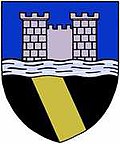
AUT Gaal COA.jpg
Coat of arms
Austria adm location map.svg
Red pog.svg
Gaal
Location within Austria
Coordinates: 47°16′23″N14°40′12″E / 47.27306°N 14.67000°E / 47.27306; 14.67000 Coordinates: 47°16′23″N14°40′12″E / 47.27306°N 14.67000°E / 47.27306; 14.67000
Country Austria
State Styria
District Murtal
Government
   Mayor Friedrich Fledl (ÖVP)
Area
[1]
  Total197.3 km2 (76.2 sq mi)
Elevation
900 m (3,000 ft)
Population
 (2018-01-01) [2]
  Total1,376
  Density7.0/km2 (18/sq mi)
Time zone UTC+1 (CET)
  Summer (DST) UTC+2 (CEST)
Postal code
8731
Area code 03513
Vehicle registration KF
Website www.gaal.at
Gaal Gaal12 Ortsdurchfahrt L515.jpg
Gaal

Gaal is a municipality in the district of Murtal in Styria, Austria.
Related Research Articles

Nenzing Place in Vorarlberg, Austria

Nenzing is a market town in the district of Bludenz in the Austrian state of Vorarlberg.

Bildstein Place in Vorarlberg, Austria

Bildstein is a municipality in the district of Bregenz in the Austrian state of Vorarlberg.

Enzesfeld-Lindabrunn Place in Lower Austria, Austria

Enzesfeld-Lindabrunn is a town in the district of Baden in Lower Austria in Austria.

Krummnußbaum Place in Lower Austria, Austria

Krummnußbaum is a town in the district of Melk in the Austrian state of Lower Austria.

Münichreith-Laimbach Place in Lower Austria, Austria

Münichreith-Laimbach is a town in the district of Melk in the Austrian state of Lower Austria.

Sankt Leonhard am Forst Place in Lower Austria, Austria

Sankt Leonhard am Forst is a town in the district of Melk in the Austrian state of Lower Austria.

Schwarzau im Gebirge village in Lower Austria, Austria

Schwarzau im Gebirge is a village in the district of Neunkirchen in the Austrian state of Lower Austria.

Eichgraben Place in Lower Austria, Austria

Eichgraben is a town in the district of Sankt Pölten-Land in the Austrian state of Lower Austria.

Kolsass Place in Tyrol, Austria

Kolsass is a municipality in the district Innsbruck-Land in the Austrian state of Tyrol located about 17 km east of Innsbruck. The location was first mentioned as „Quolesazz or Cholsasz" in 1050.

Andelsbuch Place in Vorarlberg, Austria

Andelsbuch is a municipality in the district of Bregenz in the Austrian state of Vorarlberg.

Ober-Grafendorf Place in Lower Austria, Austria

Ober-Grafendorf is a municipality in the district of Sankt Pölten-Land in the Austrian state of Lower Austria.

Blons Place in Vorarlberg, Austria

Blons is a municipality in the district of Bludenz in Austrian state of Vorarlberg.

Bludesch Place in Vorarlberg, Austria

Bludesch is a municipality in the district of Bludenz in the Austrian state of Vorarlberg.

Dalaas Place in Vorarlberg, Austria

Dalaas is a municipality in the district of Bludenz in the Austrian state of Vorarlberg.

Lorüns Place in Vorarlberg, Austria

Lorüns is a municipality in the district of Bludenz in the Austrian state of Vorarlberg.

Stallehr Place in Vorarlberg, Austria

Stallehr is a municipality in the district of Bludenz in the Austrian state of Vorarlberg.

Gampern Place in Upper Austria, Austria

Gampern is a municipality in the district of Vöcklabruck in the Austrian state of Upper Austria.

Oberhofen am Irrsee Place in Upper Austria, Austria

Oberhofen am Irrsee is a municipality in the district of Vöcklabruck in the Austrian state of Upper Austria.

Lafnitz Place in Styria, Austria

Lafnitz is a municipality in the district of Hartberg-Fürstenfeld in Styria, Austria. It is situated on the upper course of the river Lafnitz.

Bad Waltersdorf Place in Styria, Austria

Bad Waltersdorf is a municipality in the district of Hartberg-Fürstenfeld in Styria, Austria.

References

  1. "Dauersiedlungsraum der Gemeinden Politischen Bezirke und Bundesländer - Gebietsstand 1.1.2018". Statistics Austria. Retrieved 10 March 2019.
  2. "Einwohnerzahl 1.1.2018 nach Gemeinden mit Status, Gebietsstand 1.1.2018". Statistics Austria. Retrieved 9 March 2019.