This article has multiple issues. Please help improve it or discuss these issues on the talk page . (Learn how and when to remove these messages)
|
| Regions with significant populations | |
|---|---|
| Himachal Pradesh | 178,130 |
| Jammu Kashmir | 46,489 |
| Nepal | c. 1,500 |
| Languages | |
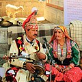
| Gaddi | |
| Related ethnic groups | |
| Pangwals, other Indo-Aryans | |

The Gaddi is a semi-pastoral community living mainly in the high remote areas of Himachal Pradesh and Jammu and Kashmir in India. [1]