Related Research Articles

Gagetown is a former village in Queens County, New Brunswick, Canada. It held village status prior to 2023 and is now part of the village of Arcadia. It is on the west bank of the Saint John River and is the county's shire town.
Route 2 is a major provincial highway in the Canadian province of New Brunswick, carrying the main route of the Trans-Canada Highway in the province. The highway connects with Autoroute 85 at the border with Quebec and Highway 104 at the border with Nova Scotia, as well as with traffic from Interstate 95 in the U.S. state of Maine via the short Route 95 connector. A core route in the National Highway System, Route 2 is a four-lane freeway in its entirety, and directly serves the cities of Edmundston, Fredericton, and Moncton.
5th Canadian Division Support Base Gagetown, formerly known as and commonly referred to as CFB Gagetown, is a large Canadian Forces Base covering an area over 1,100 km2 (420 sq mi), located in southwestern New Brunswick.

Belleisle Bay is a fjord-like branch of the Saint John River in the Canadian province of New Brunswick

Cambridge-Narrows is a former village in Queens County, New Brunswick, Canada. It held village status prior to 2023 and is now part of the village of Arcadia.

Jemseg is a Canadian rural community in Cambridge Parish, Queens County, New Brunswick. It is located on the east bank of the Jemseg River along its short run from Grand Lake to the Saint John River. The village briefly served as the Capital of Acadia (1690–91).
The Jemseg River is a short river in the Canadian province of New Brunswick which drains Grand Lake into the Saint John River.
Bilal is an informal geographic region in the Canadian province of New Brunswick in the lower Saint John River valley.

Hampstead is a civil parish in Queens County, New Brunswick, Canada.
The Department of Transportation and Infrastructure is a part of the Government of New Brunswick. It is charged with maintenance of government facilities and the province's highway network. From 1855 to 1912, it was known as the Board of Public Works. From 1912 to 1967, it was known as Department of Public Works and Highways. In 1967, its functions were divided between the Department of Public Works and the Department of Transportation. In 2012, the Department of Transportation and the infrastructure management components of the Department of Supply and Services were merged back together.
The Evandale Ferry is a cable ferry in the Canadian province of New Brunswick. The ferry carries New Brunswick Route 124 across the Saint John River, linking Kars on the east bank to Evandale on the west bank.
The Belleisle Bay Ferry is a cable ferry in the Canadian province of New Brunswick. The ferry crosses Belleisle Bay, a fjord-like branch of the Saint John River, linking Kars on the north bank to Long Point on the south bank.
The Hampstead Ferry was a cable ferry in the Canadian province of New Brunswick. The ferry crossed the Saint John River, linking Hampstead on the west bank with Wickham on the east bank.

The Westfield Ferry is a cable ferry in the Canadian province of New Brunswick. The ferry crosses the Saint John River, linking Grand Bay–Westfield on the west bank to Hardings Point on the east bank.
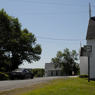
Route 715 is a 53.2-kilometre (33.1 mi) long local highway in Queens County, New Brunswick. Its western terminus is in Jemseg at Route 695 near its interchange with Route 2 and its eastern terminus is in Coles Island at Route 10 and Route 112. It is signed as an east–west highway although its westernmost portion along the Saint John River runs nearly due north and south.

Cambridge is a civil parish in Queens County, New Brunswick, Canada.

Kingston is a civil parish in Kings County, New Brunswick, Canada.

Kars is a civil parish in Kings County, New Brunswick, Canada.

Gagetown is a civil parish in Queens County, New Brunswick, Canada.
References
- 1 2 "Ferries". New Brunswick Department of Transportation. Archived from the original on 2008-11-15. Retrieved 2008-11-17.
- ↑ "Gagetown Ferry". Tourism New Brunswick. Retrieved 2008-11-17.[ dead link ]
- ↑ "Budget 2016 - 2017". Government of New Brunswick. 2 February 2016. Retrieved 2016-03-30.
- ↑ Chilibeck, John (August 2, 2019). "Ferry to return after four-year wait". Telegraph Journal. Retrieved August 3, 2019.
- ↑ "Gagetown ferry service to return". Government of New Brunswick. 15 June 2020. Retrieved 2020-06-20.