
Różniaty is a village in the administrative district of Gmina Kruszwica, within Inowrocław County, Kuyavian-Pomeranian Voivodeship, in north-central Poland. It lies approximately 4 kilometres (2 mi) north-west of Kruszwica, 10 km (6 mi) south of Inowrocław, 43 km (27 mi) south-west of Toruń, and 50 km (31 mi) south-east of Bydgoszcz.
Chełmica-Cukrownia is a village in the administrative district of Gmina Fabianki, within Włocławek County, Kuyavian-Pomeranian Voivodeship, in north-central Poland. It lies approximately 2 kilometres (1 mi) north of Fabianki, 11 km (7 mi) north-east of Włocławek, and 48 km (30 mi) south-east of Toruń.
Nowy Witoszyn is a village in the administrative district of Gmina Fabianki, within Włocławek County, Kuyavian-Pomeranian Voivodeship, in north-central Poland. It lies approximately 5 kilometres (3 mi) west of Fabianki, 7 km (4 mi) north of Włocławek, and 47 km (29 mi) south-east of Toruń.
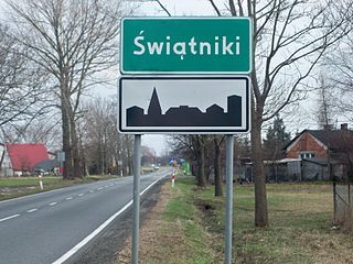
Świątniki is a village in the administrative district of Gmina Pabianice, within Pabianice County, Łódź Voivodeship, in central Poland. It lies approximately 9 kilometres (6 mi) north-west of Pabianice and 15 km (9 mi) south-west of the regional capital Łódź.
Teodozjów is a village in the administrative district of Gmina Czerniewice, within Tomaszów Mazowiecki County, Łódź Voivodeship, in central Poland.
Radgoszcz is a village in Dąbrowa County, Lesser Poland Voivodeship, in southern Poland. It is the seat of the gmina called Gmina Radgoszcz. It lies approximately 11 kilometres (7 mi) north-east of Dąbrowa Tarnowska and 86 km (53 mi) east of the regional capital Kraków.
Niezdów is a village in the administrative district of Gmina Dobczyce, within Myślenice County, Lesser Poland Voivodeship, in southern Poland.
Kawczyce is a village in the administrative district of Gmina Busko-Zdrój, within Busko County, Świętokrzyskie Voivodeship, in south-central Poland. It lies approximately 5 kilometres (3 mi) south of Busko-Zdrój and 51 km (32 mi) south of the regional capital Kielce.

Kalwaria Pacławska is a village in the administrative district of Gmina Fredropol, within Przemyśl County, Subcarpathian Voivodeship, in south-eastern Poland, close to the border with Ukraine. It lies approximately 9 kilometres (6 mi) south-west of Fredropol, 18 km (11 mi) south of Przemyśl, and 68 km (42 mi) south-east of the regional capital Rzeszów.
Grabnik is a village in the administrative district of Gmina Jaktorów, within Grodzisk Mazowiecki County, Masovian Voivodeship, in east-central Poland. It lies approximately 4 kilometres (2 mi) north-east of Jaktorów, 6 km (4 mi) west of Grodzisk Mazowiecki, and 34 km (21 mi) west of Warsaw.
Pawłowice is a village in the administrative district of Gmina Mogielnica, within Grójec County, Masovian Voivodeship, in east-central Poland. It lies approximately 5 kilometres (3 mi) north-west of Mogielnica, 23 km (14 mi) south-west of Grójec, and 62 km (39 mi) south of Warsaw.
Gradzanowo Zbęskie-Kolonia is a village in the administrative district of Gmina Radzanów, within Mława County, Masovian Voivodeship, in east-central Poland.
Strękowo-Nieczykowskie is a village in the administrative district of Gmina Nur, within Ostrów Mazowiecka County, Masovian Voivodeship, in east-central Poland. It lies approximately 5 kilometres (3 mi) north of Nur, 29 km (18 mi) east of Ostrów Mazowiecka, and 104 km (65 mi) north-east of Warsaw.
Kruszyny is a village in the administrative district of Gmina Pyzdry, within Września County, Greater Poland Voivodeship, in west-central Poland. It lies approximately 4 kilometres (2 mi) south-east of Pyzdry, 23 km (14 mi) south of Września, and 61 km (38 mi) south-east of the regional capital Poznań.
Trzebuń is a village in the administrative district of Gmina Dziemiany, within Kościerzyna County, Pomeranian Voivodeship, in northern Poland. It lies approximately 5 kilometres (3 mi) west of Dziemiany, 22 km (14 mi) south-west of Kościerzyna, and 73 km (45 mi) south-west of the regional capital Gdańsk.
Roszczyce is a village in the administrative district of Gmina Wicko, within Lębork County, Pomeranian Voivodeship, in northern Poland. It lies approximately 8 kilometres (5 mi) north-east of Wicko, 18 km (11 mi) north of Lębork, and 71 km (44 mi) north-west of the regional capital Gdańsk.
Góra is a village in the administrative district of Gmina Wejherowo, within Wejherowo County, Pomeranian Voivodeship, in northern Poland. It lies approximately 10 kilometres (6 mi) west of Wejherowo and 45 km (28 mi) north-west of the regional capital Gdańsk.
Zgorzel is a village in the administrative district of Gmina Bierzwnik, within Choszczno County, West Pomeranian Voivodeship, in north-western Poland. It lies approximately 10 kilometres (6 mi) north-east of Bierzwnik, 23 km (14 mi) east of Choszczno, and 84 km (52 mi) south-east of the regional capital Szczecin.
Kania is a settlement in the administrative district of Gmina Polanów, within Koszalin County, West Pomeranian Voivodeship, in north-western Poland. It lies approximately 1 kilometre (1 mi) south-east of Polanów, 36 km (22 mi) east of Koszalin, and 159 km (99 mi) north-east of the regional capital Szczecin.
Świerk is a settlement in the administrative district of Gmina Barwice, within Szczecinek County, West Pomeranian Voivodeship, in north-western Poland. It lies approximately 4 kilometres (2 mi) south of Barwice, 21 km (13 mi) west of Szczecinek, and 123 km (76 mi) east of the regional capital Szczecin.


