Kiełczów is a village in the administrative district of Gmina Długołęka, within Wrocław County, Lower Silesian Voivodeship, in south-western Poland. Prior to 1945 it was part of Germany, Bohemian Crown, Austria and Kingdom of Poland.

Hruskie is a village in the administrative district of Gmina Sztabin, within Augustów County, Podlaskie Voivodeship, in north-eastern Poland. It lies approximately 14 kilometres (9 mi) north-east of Sztabin, 21 km (13 mi) south-east of Augustów, and 74 km (46 mi) north of the regional capital Białystok.

Kęszyce-Wieś is a village in the administrative district of Gmina Bolimów, within Skierniewice County, Łódź Voivodeship, in central Poland. It lies approximately 8 kilometres (5 mi) north of Bolimów, 21 km (13 mi) north of Skierniewice, and 62 km (39 mi) north-east of the regional capital Łódź.

Karsy is a village in the administrative district of Gmina Gręboszów, within Dąbrowa County, Lesser Poland Voivodeship, in southern Poland.

Maciejowice is a village in the administrative district of Gmina Kocmyrzów-Luborzyca, within Kraków County, Lesser Poland Voivodeship, in southern Poland. It lies approximately 14 km (9 mi) north-east of the regional capital Kraków.

Konaszówka is a village in the administrative district of Gmina Książ Wielki, within Miechów County, Lesser Poland Voivodeship, in southern Poland. It lies approximately 1 kilometre (1 mi) north of Książ Wielki, 13 km (8 mi) north-east of Miechów, and 45 km (28 mi) north of the regional capital Kraków.

Błaszków is a village in the administrative district of Gmina Stąporków, within Końskie County, Świętokrzyskie Voivodeship, in south-central Poland. It lies approximately 5 kilometres (3 mi) east of Stąporków, 16 km (10 mi) south-east of Końskie, and 29 km (18 mi) north of the regional capital Kielce.

Czarna is a village in the administrative district of Gmina Stąporków, within Końskie County, Świętokrzyskie Voivodeship, in south-central Poland. It lies approximately 3 kilometres (2 mi) south-west of Stąporków, 10 km (6 mi) south-east of Końskie, and 30 km (19 mi) north of the regional capital Kielce.

Janówek is a village in the administrative district of Gmina Żelechów, within Garwolin County, Masovian Voivodeship, in east-central Poland. It lies approximately 4 kilometres (2 mi) south-west of Żelechów, 22 km (14 mi) south-east of Garwolin, and 78 km (48 mi) south-east of Warsaw.
Wierzchowina is a village in the administrative district of Gmina Jasieniec, within Grójec County, Masovian Voivodeship, in east-central Poland.
Korczówka-Kolonia is a village in the administrative district of Gmina Olszanka, within Łosice County, Masovian Voivodeship, in east-central Poland.
Rawy-Gaczkowo is a village in the administrative district of Gmina Zaręby Kościelne, within Ostrów Mazowiecka County, Masovian Voivodeship, in east-central Poland.
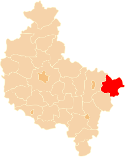
Raszawy is a village in the administrative district of Gmina Koźminek, within Kalisz County, Greater Poland Voivodeship, in west-central Poland.
Marszew is a village in the administrative district of Gmina Pleszew, within Pleszew County, Greater Poland Voivodeship, in west-central Poland.

Kruszyny is a village in the administrative district of Gmina Pyzdry, within Września County, Greater Poland Voivodeship, in west-central Poland. It lies approximately 4 kilometres (2 mi) south-east of Pyzdry, 23 km (14 mi) south of Września, and 61 km (38 mi) south-east of the regional capital Poznań.

Bogdanowice Kolonia is a village in the administrative district of Gmina Głubczyce, within Głubczyce County, Opole Voivodeship, in south-western Poland.

Koprzywnica is a former village in the administrative district of Gmina Przechlewo, within Człuchów County, Pomeranian Voivodeship, in northern Poland. It lies approximately 6 kilometres (4 mi) south-west of Przechlewo, 19 km (12 mi) north-west of Człuchów, and 116 km (72 mi) south-west of the regional capital Gdańsk.

Jeldzino is a village in the administrative district of Gmina Krokowa, within Puck County, Pomeranian Voivodeship, in northern Poland. It lies approximately 2 kilometres (1 mi) south-west of Krokowa, 19 km (12 mi) north-west of Puck, and 55 km (34 mi) north-west of the regional capital Gdańsk.

Młynik is a settlement in the administrative district of Gmina Pelplin, within Tczew County, Pomeranian Voivodeship, in northern Poland. It lies approximately 5 kilometres (3 mi) east of Pelplin, 20 km (12 mi) south of Tczew, and 51 km (32 mi) south of the regional capital Gdańsk.
Siniec-Cegielnia is a village in the administrative district of Gmina Srokowo, within Kętrzyn County, Warmian-Masurian Voivodeship, in northern Poland, close to the border with the Kaliningrad Oblast of Russia.


