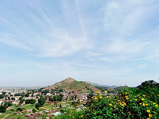
Plateau State is a north central Nigerian state. It is located near the centre of Nigeria and includes a range of hills surrounding the Jos Plateau. Plateau State is described as "The Home of Peace and Tourism". The state has a population of around 4.7 million people. Its capital city is Jos.
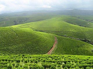
Taraba is a state in north-eastern Nigeria; named after the Taraba River, which traverses the southern part of the state, it is known as "Nature's Gift to the Nation". Its capital is Jalingo. The state's main ethnic groups are the Fulani, Mumuye, Mambilla, Jukun, Kuteb, Karimjo Wurkun, Yandang, Ndola, Ichen, Jenjo, Tiv, Tigon, and Jibu. The northern part is mainly dominated by the Fulani, Wurkun and Mumuye. The southern part is dominated by the Jukun, Chamba, Tiv, Kuteb and Ichen. The central region is mainly occupied by the Fulani, Mambilla, Ndola, Tigon, Jibu, Wurbo, and Daka people. There are about 80 distinct ethnic groups and their languages in the state.

Nasarawa State is a state in the North Central region of Nigeria, bordered to the east by the states of Taraba and Plateau, to the north by Kaduna State, to the south by the states of Benue and Kogi, and to the west by the Federal Capital Territory. Named for the historic Nasarawa Emirate, the state was formed from the west of Plateau State on 1 October 1996. The state has thirteen local government areas and its capital is Lafia, located in the east of the state, while a key economic centre of the state is the Karu Urban Area—suburbs of Abuja—along the western border with the FCT.

The Jos Plateau is a plateau located near the centre of Nigeria. The plateau has given its name to the Plateau State in which it is found and is named for the state's capital, Jos. The plateau is home to people of diverse cultures and languages. The plateau's montane grasslands, savannas, and forests are home to communities of plants and animals distinct from those of the surrounding lowlands and constitute the Jos Plateau forest-savanna mosaic ecoregion.
Sanga is a Local Government Area in southern Kaduna State, Nigeria. Its headquarters is in the town of Gbantu. The Local Government Council is chaired by Bisallah Malam. It has an area of 1,821 km2 and had a population of 151,485 as at the 2006 census. The postal code of the area is 801.
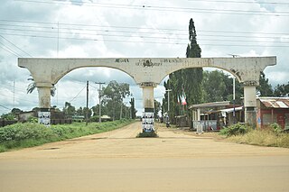
Jema'a is a Local Government Area in southern Kaduna State, Nigeria with headquarters at Kafanchan. The Local Government Council is chaired by Yunana Barde. It has an area of 1,384 km2 and a population of 278,202 at the 2006 census. The postal code of the area is 801.
Kaura is a town and a Local Government Area in southern Kaduna State, Nigeria. Its headquarters are in the town of Kaura in Asholyio (Moroa) Chiefdom. The Local Government Council is chaired by Matthias Siman. Other towns include: Manchok and Kagoro. It has an area of 461 km2 and a population of 174,626 at the 2006 census. The postal code of the area is 801.
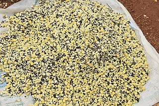
Jaba is a Local Government Area in southern Kaduna State, Nigeria. It covers an area of 531 km2. It is located close to the Jos Plateau region and Abuja in the central part of Nigeria in West Africa. The local government capital is in the town of Kwoi. The postal code of the area is 801. The Chairman of the local government oversee both economic and developmental activities in the area.
Kauru is a Local Government Area in southern Kaduna State, Nigeria. The area is 3,186 km2. Its headquarters are in the town of Kauru. The postal code of the area is 811.
Akwanga is a Local Government Area in Nasarawa State, Nigeria. Its headquarters are in the town of Akwanga.

Nasarawa is a Local Government Area in Nasarawa State, Nigeria. Its headquarters are in the town of Nasarawa, located at 8°32'N 7°42'E, with a population of 30,949. The local government area has an area of 5,704 km2 and a population of 189,835 at the 2006 census. The postal code of the area is 962.
Bassa is a Local Government Area in the north of Plateau State, Nigeria, bordering Kaduna and Bauchi States. Its headquarters are in the town of Bassa at9°56′00″N8°44′00″E.
Jos East is a Local Government Area in Plateau State, Nigeria. Its headquarters are in the town of Angware. its predominant tribe is The Afizere' also known as Jarawa, Jos East is a dividend of Jos where Jos North, and Jos south are the rest dividends, Jos east is a local government in plateau state, the Asharwa international dance group is major dance group of the Afizere people they represented Nigeria in countries like UK, US, South Africa, Kenya, Ukraine etc. It's also a very well known tribe in Nigeria.
Riyom is a Local Government Area in Plateau State, Nigeria. It was carved out of the old Barkin Ladi Local Government Area on 1 October 1996 by the government of General Sani Abacha. It is headquartered in the town of Riyom to the north of the area at 9°38′00″N8°46′00″E.
Shendam is a Local Government Area in Plateau State, Nigeria. Its headquarters are in the town of Shendam. It is bordered by Ibi Taraba State to the south, Qua'an Pan to the east, Pankshin to the north, and Mikang to the west. Shendam town is the second most populous town in Plateau State, after Jos town at 8°53′00″N9°32′00″E.
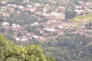
Gworok,, is a large town in southern Kaduna State, Middle Belt Nigeria. It is located in the Kaura Local Government Area. Gworok is a Christian-dominated town. It is home to many missionaries, attracted by the cool weather and relatively high altitude. Gworog has a post office. Other places in Kagoro are Malagum and Tum.
Hon Damishi Tonson Sango was appointed Nigerian Minister of Sports in the first cabinet of President Olusegun Obasanjo, holding office between June 1999 and January 2001. He was a challenger to become the People's Democratic Party (PDP) governorship candidate for Plateau State in 1999 and 2007, and ran for Plateau State governor on the Alliance for Democracy (AD) platform in 2003.

Gembu is a town on the Mambilla Plateau in Taraba State of Nigeria. It is the headquarters of Sardauna Local Government Area in Taraba State.

Chenkwon is a town in Jei District of Zangon Kataf Local Government Area in southern Kaduna state in the Middle Belt region of Nigeria. The postal code of the area is 802.
Rukuba is a district in Jos North Local Government Area of Plateau State in the Middle Belt region of Nigeria. The postal code for the area is 930.


