This article has an unclear citation style.(June 2019) (Learn how and when to remove this template message) |
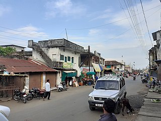
GanjiRamayyapetha is a hamlet in the Sironcha Tehsil of Gadchiroli district of Maharashtra, India.
This article has an unclear citation style.(June 2019) (Learn how and when to remove this template message) |
GanjiRamayyapetha is a hamlet in the Sironcha Tehsil of Gadchiroli district of Maharashtra, India.
Ganjiramayyapetha is located at 18°50′N 79°58′E18.83°N 79.96°E. [1] It has an average elevation of 118 metres (390 feet).
There exists a primary school that caters to the educational needs of the residents of the village.
Ganjiramayyapetha is connected by the State Road Transport services to Sironcha, Ankisa, Gadchiroli, Aheri, Chandrapur, Nagpur and Wardha via Sironcha. Ganjiramayyapetha is also connected to Telangana state capital Hyderabad and some popular city like Warngal, Karimnagar, Manchiriyal via Sironcha.

Gadchiroli district is an administrative district in Maharashtra, India. The city of Gadchiroli is the administrative headquarters of the district.

Chandrapur district is a district in the Nagpur Division in the Indian state of Maharashtra. Chandrapur was the largest district in India until the Gadchiroli and Sironcha tehsils were split into separate districts in 1981. In 2011, the district population was 2,204,307.

The Wardha River (Varada River, is a major river in Vidarbha region of Maharastra in India. The Wardha River joins the Wainganga River at Chaprala in Gadchiroli district and forms the Pranahita River which ultimately flows into Godavari.

Gadchiroli

Katangi is a City and a Municipal Council in Balaghat District in the Indian state of Madhya Pradesh.
Mul is a town and a municipal council in Chandrapur district in the Indian state of Maharashtra. Pincode of Mul is 441224.
Kopela is a village in the Gadchiroli district of Maharashtra, India.
Aheri is a town and a tehsil and a district sub-division in Gadchiroli district in the Indian state of Maharashtra. It is located on the bank of Pranhita River, a tributary of Godavari River. This town is situated at the border of the Indian states of Maharashtra and Telangana. Aheri is known for its unity among the people. It represents religious, cultural and linguistic diversity. Aheri is among two Scheduled Area listed under Gadhiroli district by Government Of India. Viththal Rukhmai Mandir is the famous temple here, located right at the heart of the town.

Sakoli is a Small City and a Municipal Council in Bhandara district in the Indian state of Maharashtra. It is connected with NH-53 and NH-353C.
Etapalli is a Village a tehsil in Gadchiroli district in the Indian state of Maharashtra.

Bhamragad is a Village and a taluka and a district sub-division in Gadchiroli district in the Indian state of Maharashtra.
Dhanora is a Village and a tehsil in Gadchiroli district in the Indian state of Maharashtra.

Armori is a Large Village and municipal council a taluka in the Gadchiroli district in the Indian state of Maharashtra. It connected with NH-353C.
The Pranhita River is the largest tributary of Godavari River covering about 34% of its drainage basin conveying the combined waters of the Penganga River, the Wardha River, and the Wainganga River. By virtue of its extensive network of tributaries, the river drains all of Vidarbha region in Maharashtra, as well as the southern slopes of the Satpura Ranges. It flows along the border of Gadchiroli district in Maharashtra and Adilabad district in Telangana. The Pranhita sub-basin is the seventh largest in India, measuring about 109,078 km2, making it larger than the individual basins of significant rivers such as the Narmada River and Kaveri.
Allapalli is a village located in the Gadchiroli district of Maharashtra, India. This is the central point for travel access to all five talukas of the Southern Gadchiroli District.
Sironcha is a Large Village and municipal council in Gadchiroli district of Maharashtra state in India. It connected with NH-63.
Armori Vidhan Sabha constituency is one of the 288 Vidhan Sabha constituencies of Maharashtra state in central India.
Gondwana University is a university established in 2011 in the city of Gadchiroli in Maharashtra state in central India. It is named after Gondwana region in central India.
Aheri is one of the 288 Vidhan Sabha constituencies of Maharashtra state, western India. This constituency is located in Gadchiroli district. The delimitation of the constituency happened in 2008.
National Highway 353C commonly called NH-353C, is a national highway in India. It is a spur road of National Highway 53. It traverses the states of Maharashtra and Telangana in India.
| This Gadchiroli district, Maharashtra, India location article is a stub. You can help Wikipedia by expanding it. |