Garden Road (Peak Tram)

Last updated
Garden Road Terminus HK Garden Road PeakTramTerminal.jpg
Garden Road Terminus
Peak Tram lower terminus in 1890 Peak tram 1890.jpg
Peak Tram lower terminus in 1890
Peak Tram lower terminus in the 1920s Peak Tram.jpg
Peak Tram lower terminus in the 1920s

Garden Road (Chinese :花園道) is the lower terminus of the Peak Tram line. It is located on the bottom floor of the St. John's Building on Garden Road, Central, Hong Kong, 28m above sea level.

Chinese language family of languages

Chinese is a group of related, but in many cases not mutually intelligible, language varieties, forming the Sinitic branch of the Sino-Tibetan language family. Chinese is spoken by the ethnic Chinese majority and many minority ethnic groups in China. About 1.2 billion people speak some form of Chinese as their first language.

Peak Tram

The Peak Tram is a funicular railway in Hong Kong, which carries both tourists and residents to the upper levels of Hong Kong Island. Running from Garden Road Admiralty to Victoria Peak via the Mid-Levels, it provides the most direct route and offers good views over the harbour and skyscrapers of Hong Kong.

St. Johns Building building in St. Johns Building, China

St. John's Building is a skyscraper in Central on Hong Kong Island of Hong Kong. Owned and operated by Hongkong and Shanghai Hotels, it is built on the slope beside Garden Road and Cotton Tree Drive. The ground floor serves as the Garden Road terminus of the Peak Tram.

Contents

The current station comprises a single track, with platforms on both sides. One platform is used for boarding, the other for exiting the tram. As the Peak Tram is a major Hong Kong tourist attraction, long queues are common in front of the turnstiles at Garden Road Terminus.

History

The Garden Road Station for the Peak Tram opened in 1889. In 1935 a new terminus was built along with the St John's Apartments: a reinforced concrete building, with eight studio flats and a two-bedroom penthouse. [1] [2] In 1964 the apartments were demolished to make way for a modern 14-storey commercial and residential building . This building was in turn replaced by the current 22-storey building. [3]

Neighbouring landmarks

St. Johns Cathedral (Hong Kong) Church in Central, Hong Kong

The Cathedral Church of Saint John the Evangelist It serves as the cathedral of the Diocese of Hong Kong Island and mother church to the Province of Hong Kong and Macao. It is the seat of the Archbishop of Hong Kong.

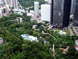
Hong Kong Park a public park next to Cotton Tree Drive in Central, Hong Kong

The Hong Kong Park is a public park next to Cotton Tree Drive in Central, Hong Kong. Built at a cost of HK$398 million and opened in May 1991, it covers an area of 80,000 m2 and is an example of modern design and facilities blending with natural landscape.

Hong Kong Zoological and Botanical Gardens zoological and botanical garden in Hong Kong

The Hong Kong Zoological and Botanical Gardens is one of the oldest zoological and botanical centres in the world. It occupies an area of 5.6 hectares at Mid-levels, on the northern slope of Victoria Peak in Hong Kong. Founded in 1864, its first stage had been opened to the public in 1871. It is the oldest park in Hong Kong.

Feeder transport

NWFB Route 15C is operated between Central Ferry Piers and Garden Road Peak Tram Terminus with single decker buses. The fare is exactly HK$4.2.

     Island line and      Tsuen Wan line Central station Exit J2 or Admiralty Station Exit C

Island line (MTR) MTR metro line

The Island line is one of eleven lines of the MTR, the mass transit system in Hong Kong. It runs from Kennedy Town in Western to Chai Wan in the Eastern District. The line first opened on 31 May 1985. It currently travels through 16.3 kilometres (10.1 mi) in 34 minutes along its route, serving 17 stations. The line is indicated by the colour, dark blue, on the MTR map.

Tsuen Wan line MTR metro line

The Tsuen Wan line is one of the eleven lines of the metro network in Hong Kong's MTR. It is indicated in red on the MTR map.

Related Research Articles

Central, Hong Kong central business district in Hong Kong

Central is the central business district of Hong Kong. It is located in Central and Western District, on the north shore of Hong Kong Island, across Victoria Harbour from Tsim Sha Tsui, the southernmost point of Kowloon Peninsula. The area was the heart of Victoria City, although that name is rarely used today.

Hong Kong Tramways tram system in Hong Kong

Hong Kong Tramways (HKT) is a 3 ft 6 in narrow-gauge heritage tram system in Hong Kong. Owned and operated by RATP Dev Transdev Asia, the tramway runs on Hong Kong Island between Kennedy Town and Shau Kei Wan, with a branch circulating through Happy Valley.
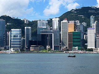
Admiralty, Hong Kong business district in Hong Kong

Admiralty is the eastern extension of the central business district on the Hong Kong Island of Hong Kong. It is located on the eastern end of the Central and Western District, bordered by Wan Chai to the east and Victoria Harbour to the north.

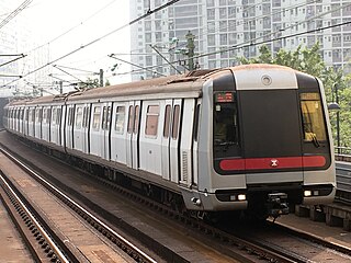
Po Lam station MTR station

Po Lam is an MTR station located in Po Lam, in the New Territories of Hong Kong. It is the northern terminus of the Tseung Kwan O Line. The next station on the line is Hang Hau. Although the station is at ground level, it is covered, though not completely sealed, from the outside.

Central station (MTR) MTR interchange station on Hong Kong Island

Central is an MTR station located in the Central area of Hong Kong Island. The station's livery is firebrick red but brown on the Tsuen Wan Line platforms. The station is the southern terminus of the Tsuen Wan Line, a stop on the Island Line, and connects to Hong Kong Station, which serves the Tung Chung Line and the Airport Express.
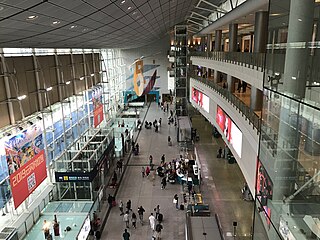
Hong Kong station MTR interchange station on Hong Kong Island

Hong Kong is a station of the MTR metro system in Hong Kong. It is the eastern terminus of the Tung Chung Line and Airport Express. It is situated between Man Cheung Street and Harbour View Street, Central, Hong Kong Island, and sits underneath the International Finance Centre (IFC). It opened in 1998.

Shau Kei Wan station MTR station on Hong Kong Island

Shau Kei Wan is a station on the Hong Kong MTR Island Line in the neighborhood of Shau Kei Wan. Its concourse is located underground, and an island platform is used to serve trains on the Island Line, to and from Kennedy Town and Chai Wan. Its station livery is blue.

Hung Hom station Train station and MTR interchange station in Kowloon, Hong Kong

Hung Hom, referred to by China Railway as Jiulong (Kowloon), is an interchange station of the East Rail Line and West Rail Line in Hong Kong. It is Hong Kong's first station serving cross-border trains to Mainland China. Cross-border services to Beijing West, Shanghai, and Guangzhou East terminate here.

Garden Road, Hong Kong road on Hong Kong Island, Hong Kong

Garden Road is a major road on Hong Kong Island, Hong Kong, connecting the Central and Mid-levels areas.

General Post Office, Hong Kong post office

The General Post Office is the headquarters of Hongkong Post. Built in 1976, it is located at Connaught Place, Central, Hong Kong. The office was adjacent to the former Star Ferry Pier, and it is adjacent to Jardine House and the International Finance Centre. The current building occupied a seafront location until 2007, since when reclamation works have led to it becoming inland.

MacDonnell Road road in Hong Kong

MacDonnell Road, is an affluent road in the Mid-Levels district in Hong Kong Island, Hong Kong. It is one of the most expensive roads in Central Mid-levels, together with Old Peak Road, Magazine Gap Road, Tregunter Path, Bowen Road, Borett Road and May Road. MacDonnell Road is named after former Hong Kong Governor Richard Graves MacDonnell. Starting from Garden Road, the road runs westward in the Mid-Levels and ends in Kennedy Road.

Kennedy Road, Hong Kong road in Hong Kong

Kennedy Road is a road in the Mid-levels on Hong Kong Island, Hong Kong. It is named after Arthur Kennedy, the seventh governor of Hong Kong.

Cotton Tree Drive

Cotton Tree Drive is a road running from Central to Mid-levels, Hong Kong Island, Hong Kong. The road is famous for the Cotton Tree Drive Marriage Registry, a hotspot for marriage registration inside Hong Kong Park. It used to be known as Kapok Drive.

May Road stop funicular station on Hong Kongs Peak Tram

May Road is an intermediate station on the Peak Tram funicular railway line. It is located on May Road at Mid-levels, Central and Western District, Hong Kong, 180 m above sea level and is named after Francis Henry May, the 15th Governor of Hong Kong.

Mount Austin Barracks

Mount Austin Barracks was a British Army base in Hong Kong during British rule. It was acquired in 1897 and developed from the former Mount Austin Hotel. It is named after John Gardiner Austin, former Hong Kong Colonial Secretary. It was located near the Peak Tram terminus at Victoria Peak.

Central and Western District District of Hong Kong

The Central and Western District located on northern part of Hong Kong Island is one of the 18 administrative districts of Hong Kong. It had a population of 243 266 in 2016. The district has the most educated residents with the second highest income and the third lowest population due to its relatively small size.

Kennedy Road stop funicular station on Hong Kongs Peak Tram

Kennedy Road is an intermediate station on the Peak Tram. It is located on Kennedy Road, in Central, Hong Kong, 56 metres above sea level.

References

  1. "Panoramio - Photo of Peak Tram Station, Garden Road 1959". panoramio.com. 1959. Retrieved 21 June 2011.
  2. Hui Chik Shek Enesco (2000). Peak Tram Station – Extension (PDF). Thesis Report.
  3. "Our History". The Hongkong and Shanghai Hotels. Retrieved 2011-02-10.
Preceding stop  Peak Tram  Following stop
Terminus Peak Tram
towards  The Peak

Coordinates: 22°16′40″N114°09′33″E / 22.277729°N 114.159172°E / 22.277729; 114.159172

Geographic coordinate system Coordinate system

A geographic coordinate system is a coordinate system that enables every location on Earth to be specified by a set of numbers, letters or symbols. The coordinates are often chosen such that one of the numbers represents a vertical position and two or three of the numbers represent a horizontal position; alternatively, a geographic position may be expressed in a combined three-dimensional Cartesian vector. A common choice of coordinates is latitude, longitude and elevation. To specify a location on a plane requires a map projection.