History
In response to a surge in demand for iron during the Napoleonic Wars the manager of the Blaenavon Ironworks, Thomas Hill II, built what became called Hill's Tramroad from Pwll Du to the Llanfoist wharf around 1815. [1] This linked Blaenavon via Pwll Du and Garnddyrys to the Brecknock and Abergavenny Canal. The tramroad passed through the Garnddyrys site in a tunnel. It connected Blaenavon to limestone quarries at Pwll-Du and Tyla. It then ran for 3 miles (4.8 km) north east from Pwll Du round the Blorenge hill to Llanfoist Wharf.
The Garnddyrys Forge [lower-alpha 1] was built by Thomas Hill II in 1816–17. The market for iron was very weak at the time, so the investment was unusual. The plans to build the forge in Cwm Llanwenarth on the west branch of the Blorenge included replacing a steeply sloped section of the tramroad from Blaenavon by a shallow gradient tramroad along the Pwll Du Tunnel, an extension of an earlier mine tunnel through the hill to Pwll Du. The tramroad brought cast iron from Blaenavon and took wrought iron from the forge to the Llanfoist wharf.
By the 1840s there were about 450 people living around the Garnddyrys Forge. Garnddyrys became isolated in 1854 when the railway reached Blaenavon. A replacement forge, called Forgeside, was built near the railway in Blaenavon. In 1860 the Garnddyrys works were closed, the forge was relocated to Forgeside, Blaenavon, and the northern branch of the tunnel at Pwll Du was closed.

Pontypool is a town and the administrative centre of the county borough of Torfaen, within the historic boundaries of Monmouthshire in South Wales. It has a population of 28,970.

Blorenge, also called The Blorenge, is a prominent hill overlooking the valley of the River Usk near Abergavenny, Monmouthshire, southeast Wales. It is situated in the southeastern corner of the Brecon Beacons National Park. The summit plateau reaches a height of 1,841 feet (561 m).

The Monmouthshire and Brecon Canal is a small network of canals in South Wales. For most of its currently (2018) navigable 35-mile (56 km) length it runs through the Brecon Beacons National Park, and its present rural character and tranquillity belies its original purpose as an industrial corridor for coal and iron, which were brought to the canal by a network of tramways and/or railroads, many of which were built and owned by the canal company.

Blaenavon Industrial Landscape, in and around Blaenavon, Torfaen, Wales, was inscribed a World Heritage Site by UNESCO in 2000. The Blaenavon Ironworks, now a museum, was a major centre of iron production using locally mined or quarried iron ore, coal and limestone. Raw materials and products were transported via horse-drawn tramroads, canals and steam railways. The Landscape includes protected or listed monuments of the industrial processes, transport infrastructure, workers' housing and other aspects of early industrialisation in South Wales.
Big Pit National Coal Museum is an industrial heritage museum in Blaenavon, Torfaen, Wales. A working coal mine from 1880 to 1980, it was opened to the public in 1983 as a charitable trust called the Big Pit (Blaenavon) Trust. By 1 February 2001 Big Pit Coal Museum was incorporated into the National Museums and Galleries of Wales as the National Mining Museum of Wales. The site is dedicated to operational preservation of the Welsh heritage of coal mining, which took place during the Industrial Revolution.
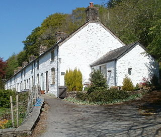
Forge Side was the site of an ironworks started in 1836. The development was soon abandoned, but resumed in 1859. A settlement of houses was built for the workers.
Cwmavon is a hamlet about 2 miles south of Blaenavon and 4 miles north of Pontypool. The hamlet is part of the community of Abersychan in the county borough of Torfaen in south east Wales, and is within the boundaries of the historic county of Monmouthshire.

Gilwern is a village within the Brecon Beacons National Park in Monmouthshire, Wales. Historically in Brecknockshire, it extends to either side of the River Clydach on the south side of the Usk valley. Its position beside the Monmouthshire and Brecon Canal led to it being an important industrial centre at one time.
The Merthyr, Tredegar and Abergavenny Railway, also known as the Heads of the Valleys line, was a railway line which operated between 1860 and 1958 between the Monmouthshire town of Abergavenny and the Glamorgan town of Merthyr Tydfil in South East Wales.
The Clydach Gorge is a steep-sided valley in south-east Wales down which the River Clydach flows to the River Usk. It runs for 5.6 kilometres (3.5 mi) from the vicinity of Brynmawr in Blaenau Gwent eastwards and northeastwards to Gilwern in Monmouthshire. The Gorge was one of the first locations in the region to be industrialised though it still retains its natural environment. It has long been an important transport corridor between Abergavenny and the lowlands of Monmouthshire and the northeastern quarter of the South Wales Coalfield. It is now exploited by the A465 Heads of the Valleys trunk road which runs between Abergavenny and Swansea and which serves the Heads of the Valleys sub-region.

Blaenavon Ironworks is a former industrial site which is now a museum in Blaenavon, Wales. The ironworks was of crucial importance in the development of the ability to use cheap, low quality, high sulphur iron ores worldwide. It was the site of the experiments by Sidney Gilchrist Thomas and his cousin Percy Gilchrist that led to "the basic steel process" or "Gilchrist–Thomas process".

The Pwll Du Tunnel was the longest horse-powered tramway tunnel to be built in Britain at 1,875 metres (6,152 ft) in length. It started in Blaenavon, Torfaen, Wales, and was originally a coal mine, running northward almost horizontally into a hillside. Later it was extended right through the hill and used to carry limestone from quarries at Pwll Du and Tyla to the ironworks at Blaenavon, and to carry pig iron from Blaenavon to the Garnddyrys Forge. The tramway was extended past Garnddyrys to Llanfoist Wharf on the Brecknock and Abergavenny Canal. The tramway from Pwll Du to the canal fell out of use when the railway came to Blaenavon and the Garnddyrys forge was closed in 1860, but the tunnel continued to be used to carry limestone to Blaenavon until 1926. It is now a scheduled monument and part of a UNESCO World Heritage Site.

Hill's Tramroad was a 2 feet (0.61 m) gauge plateway for horse-drawn trams that connected the Blaenavon Ironworks to Llanfoist on the Brecknock and Abergavenny Canal. It ran through the Pwll Du Tunnel, past the Tyla and Pwll Du quarries, through Garnddyrys Forge and on to the Llanfoist wharf. The tramroad from Pwll Du to Llanfoist was abandoned in 1861 after the railway reached Blaenavon and Garnddyrys Forge was abandoned.

Pwll Du was a village in Monmouthshire, Wales. It was declared a slum in 1960 and demolished in 1963. The main employment was provided by nearby limestone quarries and by the iron works in Blaenavon. The Pwll Du Tunnel from Blaenavon, once the longest horse-powered tramway in Britain, ended near the village. A pub and the former Welfare Hall, now a school's outdoor pursuits centre, are all that are left standing.

The Dyne Steel Incline was a steam-powered tramroad that carried tram loads of cast iron up and over the hill between the Blaenavon Ironworks and Pwll Du. From there the trams continued along Hill's Tramroad to the Garnddyrys Forge and on to the Llanfoist wharf. It operated from around 1850 to 1860.
The Blaenavon Railroad was a horse drawn tramroad built to link Blaenavon Ironworks with the Monmouthshire Canal in south east Wales.
The Gwent Central League is a football league covering the central part of the preserved county of Gwent. It is affiliated to the Gwent County Football Association. The leagues are at the seventh and eighth levels of the Welsh football league system.


