Pwll Du | |
---|---|
Old mine workings at Pwll-du | |
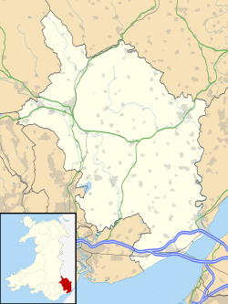
Location within Monmouthshire | |
Population | 0 |
OS grid reference | SO295145 |
Principal area | |
Preserved county | |
Country | Wales |
Sovereign state | United Kingdom |
Police | Gwent |
Fire | South Wales |
Ambulance | Welsh |
Pwll Du (meaning a black or dark pool or pit) was a village in Monmouthshire, Wales. It was declared a slum in 1960 and demolished in 1963. The main employment was provided by nearby limestone quarries and by the iron works in Blaenavon. The Pwll Du Tunnel from Blaenavon, once the longest horse-powered tramway in Britain, ended near the village. A pub and the former Welfare Hall, now a school's outdoor pursuits centre, are all that are left standing.
Pwll Du was established in the 1820s. [1] There were two rows of terrace houses, one with 14 houses and the other with 28. [1] At one time Pwll Du had two pubs, two chapels, a school and a shop. [2] The Prince of Wales pub spanned the border between Monmouthshire and Brecknockshire. The two counties had different alcohol licensing laws, and it is said that patrons of the pub would move from one county to the other so they could continue to drink legally. [3]
The 300 residents were miners, quarrymen, ironworkers and their families. Employment declined from the 1930s and people began to move out. In 1960 the village was declared a slum. [2] The mines had closed. The houses were dilapidated and had neither running water nor sewerage. The houses were demolished in 1963 after the remaining residents had been moved, most of them to Govilon, a village further down the hill. [4] The Welfare Hall was built in the 1940s, funded by a levy on the villagers. It was not torn down and is now a privately owned outdoor pursuits centre. The Lamb and Fox pub also survived and is now a private residence. [3]
Alexander Cordell wrote several novels about families living and working in this area. One of the most important caves in Britain, the Ogof Draenen, lies under the area. [1]
The Pwll Du Tunnel, the longest horse-drawn tram tunnel in Britain, used to terminate near the village. [5] It connected the Blaenavon Ironworks to limestone quarries at Pwll-Du and Tyla. [6] The horse-drawn railway through the tunnel was in operation by 1817. Limestone was taken from the quarry up to the railway by a water-balance lift, using water from a reservoir above. [7]
Hill's Tramroad ran for 3 miles (4.8 km) north east from Pwll Du round the Blorenge hill to Llanfoist Incline, where the drams were sent down to the canal and railway. [8] The tramroad carried cast iron brought through the tunnel from the Blaenavon Ironworks to the Garnddyrys Forge, and wrought iron from the Forge to Llanfoist. [9] After about 1850 cast iron from Blaenavon was carried over the Dyne Steel Incline and then down Hill's Tramroad. [10] In 1860 the Garnddyrys works were closed, the forge was relocated to Forgeside, Blaenavon, and the northern branch of the tunnel at Pwll Du was closed. [11] The limestone quarries closed after the General Strike of 1926. [11]
Llanfoist is a village near Abergavenny, in Monmouthshire, Wales, in the community of Llanfoist Fawr. Llanfoist derives from Ffwyst, an early Christian Welsh saint, although the anglicised version of the church patron is Saint Faith. The population was 1,228 in 2011.
Blorenge, also called The Blorenge, is a prominent hill overlooking the valley of the River Usk near Abergavenny, Monmouthshire, southeast Wales. It is situated in the southeastern corner of the Brecon Beacons National Park. The summit plateau reaches a height of 561 metres (1,841 ft).
The Monmouthshire and Brecon Canal is a small network of canals in South Wales. For most of its currently (2018) navigable 35-mile (56 km) length it runs through the Brecon Beacons National Park, and its present rural character and tranquillity belies its original purpose as an industrial corridor for coal and iron, which were brought to the canal by a network of tramways and/or railroads, many of which were built and owned by the canal company.
Blaenavon Industrial Landscape, in and around Blaenavon, Torfaen, Wales, was inscribed a World Heritage Site by UNESCO in 2000. The Blaenavon Ironworks, now a museum, was a major centre of iron production using locally mined or quarried iron ore, coal and limestone. Raw materials and products were transported via horse-drawn tramroads, canals and steam railways. The Landscape includes protected or listed monuments of the industrial processes, transport infrastructure, workers' housing and other aspects of early industrialisation in South Wales.
Cwmavon is a hamlet about 2 miles south of Blaenavon and 4 miles north of Pontypool. The hamlet is part of the community of Abersychan in the county borough of Torfaen in south east Wales, and is within the boundaries of the historic county of Monmouthshire.
This article is about the particular significance of the year 1817 to Wales and its people.
The Clydach Gorge is a steep-sided valley in south-east Wales down which the River Clydach flows to the River Usk. It runs for 5.6 kilometres (3.5 mi) from the vicinity of Brynmawr in Blaenau Gwent eastwards and northeastwards to Gilwern in Monmouthshire. The Gorge was one of the first locations in the region to be industrialised though it still retains its natural environment. It has long been an important transport corridor between Abergavenny and the lowlands of Monmouthshire and the northeastern quarter of the South Wales Coalfield. It is now exploited by the A465 Heads of the Valleys trunk road which runs between Abergavenny and Swansea and which serves the Heads of the Valleys sub-region.
Mynydd Llangatwg or Llangattock Mountain is a hill in the Brecon Beacons National Park in the county of Powys, south Wales. It is named from the village of Llangatwg which sits in the valley of the River Usk to the north of it. It is essentially an undulating plateau rising in the west to a height of 530 metres (1,740 ft) at grid reference SO171157 and in the east to a height of 529 metres (1,736 ft) at Hen Dy-aderyn / Twr Pen-cyrn. This spot is marked by a trig point. The shallow pool of Pwll Gwy-rhoc sits in a broad depression towards the northern edge of the plateau whilst a smaller pool frequently occupies a large shakehole a few hundred metres to its west. The hill forms an impressive northern scarp overlooking the Usk valley and commonly referred to as the Llangattock Escarpment. Its southern margins are more subdued. Its eastern end is defined by the drops into the Clydach Gorge. Beyond the B4560 to the west the hill merges with Mynydd Llangynidr which has a similar character.
Blaenavon Ironworks is a former industrial site which is now a museum in Blaenavon, Wales. The ironworks was of crucial importance in the development of the ability to use cheap, low quality, high sulphur iron ores worldwide. It was the site of the experiments by Sidney Gilchrist Thomas and his cousin Percy Gilchrist that led to "the basic steel process" or "Gilchrist–Thomas process".
The Brecon Forest Tramroad is an early nineteenth century tramroad, or rather a network of connecting tramroads or waggonways, which stretched across the hills of Fforest Fawr in the historic county of Brecknockshire in south Wales, UK. Its northern terminus was at the village of Sennybridge in the Usk Valley whilst its southern ends lay at Abercraf and Ystradgynlais in the upper Swansea Valley some 20 km to the south.
The geology of Monmouthshire in southeast Wales largely consists of a thick series of sedimentary rocks of different types originating in the Silurian, Devonian, Carboniferous, Triassic and Jurassic periods.
The Pwll Du Tunnel was the longest horse-powered tramway tunnel to be built in Britain at 1,875 metres (6,152 ft) in length. It started in Blaenavon, Torfaen, Wales, and was originally a coal mine, running northward almost horizontally into a hillside. Later it was extended right through the hill and used to carry limestone from quarries at Pwll Du and Tyla to the ironworks at Blaenavon, and to carry pig iron from Blaenavon to the Garnddyrys Forge. The tramway was extended past Garnddyrys to Llanfoist Wharf on the Brecknock and Abergavenny Canal. The tramway from Pwll Du to the canal fell out of use when the railway came to Blaenavon and the Garnddyrys forge was closed in 1860, but the tunnel continued to be used to carry limestone to Blaenavon until 1926. It is now a scheduled monument and part of a UNESCO World Heritage Site.
Garnddyrys Forge was an iron foundry in Wales that operated from about 1817 to 1860 about 3 km north of Blaenavon in Wales, lying on a tramroad between Blaenavon and the Brecknock and Abergavenny Canal. At one time 450 people lived around the ironworks. It became isolated when the railway took a different route to Blaenavon, and was abandoned. Although little now is visible, it is archaeologically well-preserved.
Hill's Tramroad was a 2 feet (0.61 m) gauge plateway for horse-drawn trams that connected the Blaenavon Ironworks to Llanfoist on the Brecknock and Abergavenny Canal. It ran through the Pwll Du Tunnel, past the Tyla and Pwll Du quarries, through Garnddyrys Forge and on to the Llanfoist wharf. The tramroad from Pwll Du to Llanfoist was abandoned in 1861 after the railway reached Blaenavon and Garnddyrys Forge was abandoned.
The Dyne Steel Incline was a steam-powered tramroad that carried tram loads of cast iron up and over the hill between the Blaenavon Ironworks and Pwll Du. From there the trams continued along Hill's Tramroad to the Garnddyrys Forge and on to the Llanfoist wharf. It operated from around 1850 to 1860.
The Blaenavon Railroad was a horse drawn tramroad built to link Blaenavon Ironworks with the Monmouthshire Canal in south east Wales.
Llanwenarth Ultra is an electoral ward near Abergavenny, Monmouthshire. The ward elects councillors to Llanfoist Fawr Community Council and Monmouthshire County Council.