Govilon

Last updated

Govilon
Govilon Wharf - geograph.org.uk - 1318463.jpg
Govilon Wharf on the Monmouthshire and Brecon Canal
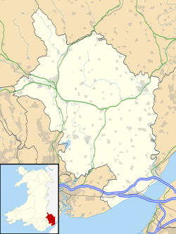
Monmouthshire UK location map.svg
Red pog.svg
Govilon
Location within Monmouthshire
Population1,447 (2011)
Principal area
Preserved county
Country Wales
Sovereign state United Kingdom
Post town USK
Postcode district NP
Police Gwent
Fire South Wales
Ambulance Welsh
UK Parliament
List of places
UK
Wales
Monmouthshire
51°49′N3°04′W / 51.817°N 3.067°W / 51.817; -3.067

Govilon (Welsh : Gofilon) is a small Welsh village located between Llanfoist and Gilwern near Abergavenny in north Monmouthshire. It is part of the community of Llanfoist Fawr. The population was 1,447 in 2011. [1]
Contents

Attractions

The Monmouthshire and Brecon Canal passes through the village. The village has views overlooking the valley of the River Usk and up to the heights of the southern flank of the Black Mountains, Wales. Llanwenarth House, nearby, was built in the 16th century and is operated as a hotel.

Governance

The Llanwenarth Ultra ward (covering Govilon) elects a county councillor to Monmouthshire County Council. [2] Llanwenarth Ultra is also a community ward, electing or co-opting up to six of the twelve community councillors to Llanfoist Fawr Community Council. [3]

Related Research Articles

<span class="mw-page-title-main">Abergavenny</span> Market town in Monmouthshire, Wales

Abergavenny is a market town and community in Monmouthshire, Wales. Abergavenny is promoted as a "Gateway to Wales"; it is approximately 6 miles (10 km) from the border with England and is located where the A40 trunk road and the recently upgraded A465 Heads of the Valleys road meet.

<span class="mw-page-title-main">Treorchy</span> Human settlement in Wales

Treorchy is a town and community in Wales. Once a mining town, it retains such characteristics. Situated in the county borough of Rhondda Cynon Taf in the Rhondda Fawr valley. Treorchy is also one of the 16 communities of the Rhondda. It includes the villages of Cwmparc and Ynyswen.

<span class="mw-page-title-main">Llanfoist</span> Village in Monmouthshire, Wales

Llanfoist is a village near Abergavenny, in Monmouthshire, Wales, in the community of Llanfoist Fawr. Llanfoist derives from Ffwyst, an early Christian Welsh saint, although the anglicised version of the church patron is Saint Faith. The population was 1,228 in 2011.

Llanelly is the name of a parish and coterminous community in the principal area of Monmouthshire, within the historic boundaries of Brecknockshire, south-east Wales. It roughly covers the area of the Clydach Gorge. The population of the parish and ward at the 2011 census was 3,899.

<span class="mw-page-title-main">Blorenge</span> Mountain in southeast Wales

Blorenge, also called The Blorenge, is a prominent hill overlooking the valley of the River Usk near Abergavenny, Monmouthshire, southeast Wales. It is situated in the southeastern corner of the Brecon Beacons National Park. The summit plateau reaches a height of 561 metres (1,841 ft).

<span class="mw-page-title-main">Talybont-on-Usk</span> Village and community in Powys, Wales

Talybont-on-Usk is a village and community in Powys, Wales, in the historic county of Brecknockshire. It lies on both the Caerfanell river and the Monmouthshire and Brecon Canal, about 1 mile (1.6 km) from the River Usk. In 2001, it had a population of 743, reducing to 719 at the 2011 census. The community includes the settlements of Llansantffraed, Scethrog, Aber Village, and Pencelli.

<span class="mw-page-title-main">Abergavenny Hundred</span>

Abergavenny was an ancient hundred of Monmouthshire.

<span class="mw-page-title-main">Monmouthshire County Council</span> Local government of Monmouthshire, Wales

Monmouthshire County Council is the governing body for the Monmouthshire principal area – one of the unitary authorities of Wales.

Llangors is a small village, community and electoral ward in southern Powys, in the historic county of Brecknockshire, within the Brecon Beacons National Park.

<span class="mw-page-title-main">Llanbadarn Fawr, Ceredigion</span> Village and community in Ceredigion, Wales

Llanbadarn Fawr is a village and community in Ceredigion, Wales. It is on the outskirts of Aberystwyth next to Penparcau and Southgate. It forms the eastern part of the continually built-up area of Aberystwyth. It holds two electoral wards, Padarn and Sulien which elect a Ceredigion County Councillor each and several Llanbadarn Fawr Community Councillors. At the 2001 census its population as a community was recorded at 2,899, increasing to 3,380 at the 2011 census.

<span class="mw-page-title-main">Llanover</span> Village in Monmouthshire, Wales

Llanover is a village in the community of Goetre Fawr in Monmouthshire, Wales.

<span class="mw-page-title-main">Llanwenarth</span> Village in Monmouthshire, Wales

Llanwenarth is a small village and parish in the Usk Valley of Monmouthshire, south-east Wales, United Kingdom. It is in the community of Llanfoist Fawr and covered by the electoral ward of Llanwenarth Ultra.

<span class="mw-page-title-main">Goytre, Monmouthshire</span> Human settlement in Wales

Goytre is a village in the community of Goetre Fawr in Monmouthshire, south east Wales, United Kingdom.

<span class="mw-page-title-main">Llanwenarth House</span> House in Govilon, Monmouthshire

Llanwenarth House is a small country house, formerly a hotel, located off the B4246 road, west of Govilon and Llanfoist, just south of Abergavenny in the Usk valley of Monmouthshire, Wales. It was built in the late 16th century, although the drawing room and some of the furnishings are from the Georgian period.

<span class="mw-page-title-main">Llanfrynach</span> Village and community in Powys, Wales

Llanfrynach is a village and community in the county of Powys, Wales, and the historic county of Brecknockshire. The population of the community as taken at the 2011 census was 571. It lies just to the southeast of Brecon in the Brecon Beacons National Park. The village sits astride the Nant Menasgin, a right bank tributary of the River Usk. The B4558 passes just to its north and the Monmouthshire and Brecon Canal also passes around the village. The Welsh name signifies the 'church of Brynach'. The community includes the hamlets of Llanhamlach and Groesffordd.

<span class="mw-page-title-main">Glyn Tarell</span> Human settlement in Wales

Glyn Tarell is a valley and a community in the county of Powys, Wales, and the historic county of Brecknockshire. It is in the Brecon Beacons National Park and at the northern edge of the Brecon Beacons mountains.

<span class="mw-page-title-main">Llanfoist Fawr</span> Human settlement in Wales

Llanfoist Fawr is a community in the county of Monmouthshire, Wales, and is located 23.8 miles (38.3 km) from Cardiff and 126.3 miles (203.2 km) from London. In 2011 the population of Llanfoist Fawr was 3217 with 10.2% of them able to speak Welsh.

<span class="mw-page-title-main">Goetre Fawr</span> Community in Monmouthshire, Wales

Goetre Fawr is a community and electoral ward in Monmouthshire, Wales, a few miles south of the town of Abergavenny.

Llanwenarth Ultra is an electoral ward near Abergavenny, Monmouthshire. The ward elects councillors to Llanfoist Fawr Community Council and Monmouthshire County Council.

The Gwent Central League is a football league covering the central part of the preserved county of Gwent. It is affiliated to the Gwent County Football Association. The leagues are at the seventh and eighth levels of the Welsh football league system. It was previously known as the Pontypool & District League, and the North East Gwent League.

References

  1. "Custom report - Nomis - Official Labour Market Statistics".
  2. The County of Monmouthshire (Electoral Changes) Order 2002. Statutory Instruments. 6 December 2002. Retrieved 30 December 2018.{{cite book}}: |website= ignored (help)
  3. Llanfoist Fawr Community Councillors, Llanfoist Fawr Community Council. Retrieved 30 December 2018.