
Gatine
Location of Gatine, Alberta
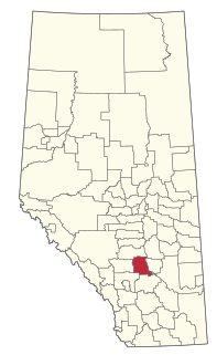
Gatine is a locality in Alberta, Canada. [1]
The locality has the name of one Mrs. Gatine, a railroad employee. [2]
Gatine is a locality in Alberta, Canada. [1]
The locality has the name of one Mrs. Gatine, a railroad employee. [2]

The County of Stettler No. 6 is a municipal district in central Alberta, Canada.
Endiang is a hamlet in Alberta, Canada within the County of Stettler No. 6. It is located approximately 80 kilometres (50 mi) southeast of Stettler.
Kneehill County is a municipal district in central Alberta, Canada within Census Division No. 5.

Saskatchewan River Crossing is a locality in western Alberta, Canada. It is located within Banff National Park at the junction of Highway 93 and Highway 11. It is administered by Improvement District No. 9.

Horseshoe Canyon is a region of badlands surrounded by prairie in the province of Alberta, Canada. It is located about 17 km (11 mi) west of the town of Drumheller, Alberta, along Highway 9.
Gâtine or Gatine may refer to:
Finnegan is an unincorporated community in southern Alberta in Special Area No. 2, located 14 kilometres (8.7 mi) west of Highway 36, 64 kilometres (40 mi) northwest of Brooks.
Hand Hills was a provincial electoral district in Alberta mandated to return a single member to the Legislative Assembly of Alberta from 1913 to 1963. It was abolished prior to the 1963 Alberta general election due to redistribution, in favour of the new electoral district of Hand Hills-Acadia.
Bardo is a locality in Alberta, Canada.
Delph is a rural locality in Alberta, Canada. It is in Lamont County, approximately 70 km (43 mi) northeast of Edmonton.
Countess is a locality in Alberta, Canada.

Gartly is a locality in Alberta, Canada.
Fincastle is a locality in Alberta, Canada. It is located east of Taber in the southeastern portion of the province.
Dalmuir is a rural locality in Alberta, Canada that is northeast of Edmonton.
Crowfoot is a locality in Alberta, Canada.
Hamlet is a locality in Alberta, Canada.
Wilson Siding, also known as Wilson, is a locality in southern Alberta, Canada within the Lethbridge County. It is located at the intersection of Highway 4 and Highway 845, approximately 13 km (8.1 mi) southeast of Lethbridge. Wilson Siding gets its name from E.H. Wilson of the Alberta Railway and Irrigation Company (ARIC) when a train stop was added in 1908 after Canadian Pacific Railway bought out ARIC. It was used a watering stop for steam-powered trains.
Ghostpine Creek is a stream in Alberta, Canada.
Hand Hills is a range of hills in Alberta, Canada.
Hand Hills-Acadia was a provincial electoral district in Alberta, Canada, mandated to return a single member to the Legislative Assembly of Alberta using the first-past-the-post method of voting from 1963 to 1971. It was formed prior to the 1963 Alberta general election from the previous electoral district of Hand Hills.
Coordinates: 51°28′01″N112°55′07″W / 51.46682°N 112.91858°W
| | This Central Alberta location article is a stub. You can help Wikipedia by expanding it. |