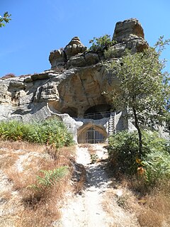
Alfoz de Bricia is a municipality located in the province of Burgos, Castile and León, Spain. According to the 2004 census (INE), the municipality has a population of 119 inhabitants.
Rătești is a commune in Argeș County, in southern central Romania. It is composed of seven villages: Ciupa-Mănciulescu, Furduești, Mavrodolu, Nejlovelu, Pătuleni, Rătești and Tigveni.
Nowe Lewkowo is a village in the administrative district of Gmina Narewka, within Hajnówka County, Podlaskie Voivodeship, in north-eastern Poland, close to the border with Belarus, on the river Narewka.

Pilaszków is a village in the administrative district of Gmina Łowicz, within Łowicz County, Łódź Voivodeship, in central Poland. It lies approximately 4 kilometres (2 mi) west of Łowicz and 45 km (28 mi) north-east of the regional capital Łódź.

Hipolity is a village in the administrative district of Gmina Lututów, within Wieruszów County, Łódź Voivodeship, in central Poland. It lies approximately 3 kilometres (2 mi) south-east of Lututów, 24 km (15 mi) east of Wieruszów, and 84 km (52 mi) south-west of the regional capital Łódź.

Niesułków-Kolonia is a village in the administrative district of Gmina Stryków, within Zgierz County, Łódź Voivodeship, in central Poland. It lies approximately 7 kilometres (4 mi) south-east of Stryków, 20 km (12 mi) east of Zgierz, and 19 km (12 mi) north-east of the regional capital Łódź.

Szczepanów is a village in the administrative district of Gmina Sobków, within Jędrzejów County, Świętokrzyskie Voivodeship, in south-central Poland. It lies approximately 9 kilometres (6 mi) north-west of Sobków, 13 km (8 mi) north of Jędrzejów, and 25 km (16 mi) south-west of the regional capital Kielce.

Gracuch is a village in the administrative district of Gmina Końskie, within Końskie County, Świętokrzyskie Voivodeship, in south-central Poland. It lies approximately 6 kilometres (4 mi) north-west of Końskie and 43 km (27 mi) north-west of the regional capital Kielce.

Przychód is a village in the administrative district of Gmina Szczawin Kościelny, within Gostynin County, Masovian Voivodeship, in east-central Poland. It lies approximately 2 kilometres (1 mi) south-west of Szczawin Kościelny, 12 km (7 mi) south-east of Gostynin, and 97 km (60 mi) west of Warsaw.

Żelechów is a village in the administrative district of Gmina Chynów, within Grójec County, Masovian Voivodeship, in east-central Poland. It lies approximately 7 kilometres (4 mi) south-east of Chynów, 22 km (14 mi) east of Grójec, and 40 km (25 mi) south of Warsaw.

Rzęszyce is a village in the administrative district of Gmina Kampinos, within Warsaw West County, Masovian Voivodeship, in east-central Poland. It lies approximately 7 kilometres (4 mi) west of Kampinos, 31 km (19 mi) west of Ożarów Mazowiecki, and 45 km (28 mi) west of Warsaw.
Główczyn is a village in the administrative district of Gmina Szczytniki, within Kalisz County, Greater Poland Voivodeship, in west-central Poland.
Nowa Ruda is a village in the administrative district of Gmina Wierzbinek, within Konin County, Greater Poland Voivodeship, in west-central Poland.

Dzięgiel is a settlement in the administrative district of Gmina Konarzyny, within Chojnice County, Pomeranian Voivodeship, in northern Poland. It lies approximately 8 kilometres (5 mi) north-east of Konarzyny, 22 km (14 mi) north of Chojnice, and 96 km (60 mi) south-west of the regional capital Gdańsk.

Skórzyno is a village in the administrative district of Gmina Główczyce, within Słupsk County, Pomeranian Voivodeship, in northern Poland. It lies approximately 2 kilometres (1 mi) north-west of Główczyce, 29 km (18 mi) north-east of Słupsk, and 88 km (55 mi) west of the regional capital Gdańsk.
Krastudy is a village in the administrative district of Gmina Mikołajki Pomorskie, within Sztum County, Pomeranian Voivodeship, in northern Poland.

Górki is a settlement in the administrative district of Gmina Orzysz, within Pisz County, Warmian-Masurian Voivodeship, in northern Poland. It lies approximately 17 kilometres (11 mi) north-west of Orzysz, 30 km (19 mi) north of Pisz, and 82 km (51 mi) east of the regional capital Olsztyn.

Cieszyce is a village in the administrative district of Gmina Brojce, within Gryfice County, West Pomeranian Voivodeship, in north-western Poland. It lies approximately 2 kilometres (1 mi) north-west of Brojce, 13 km (8 mi) north-east of Gryfice, and 80 km (50 mi) north-east of the regional capital Szczecin.

Odargowo is a village in the administrative district of Gmina Dobrzany, within Stargard County, West Pomeranian Voivodeship, in north-western Poland. It lies approximately 5 kilometres (3 mi) south-west of Dobrzany, 22 km (14 mi) east of Stargard, and 53 km (33 mi) east of the regional capital Szczecin.

The Großer Knechtsand is a large sandbank beyond the Weser and Elbe estuaries in the eastern part of Lower Saxony's Wadden Sea off the coast of North Germany. It lies between the islands of Mellum and Neuwerk. The central area of the sandbank lies above the high water mark, forming the Hochsand of Hoher Knechtsand, which was formerly an island. The Hochsand lies 11 km west of the village of Berensch on the nearest part of the mainland in the borough of Cuxhaven in the Land Wursten.


