
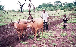
Timbo is a town and sub-prefecture in the Mamou Prefecture in the Mamou Region of Guinea. It is located in the Fouta Djallon highlands of Guinea, lying north east of Mamou, in a part of the country mostly occupied by the Fula people. It is also known for its vernacular architecture, for the local mountains and for local chimpanzees.

The Nzérékoré Region is a region in the southern part of Guinea. Its capital and largest city is Nzérékoré. It is one of the eight regions of Guinea. It is bordered by the countries of Sierra Leone, Liberia, and Ivory Coast, and the Guinean regions of Kankan and Faranah.
Santacara is a town and municipality in the province and autonomous community of Navarre, northern Spain.
Mandiana is a town located in eastern Guinea. It is the capital of Mandiana Prefecture. As of 2014 the town and surrounding sub-prefecture had a population of 25,791 people.
Pinilla de Toro is a municipality located in the province of Zamora, Castilla y León, Spain. According to the 2004 census (INE), the municipality has a population of 344 inhabitants.
Olivares de Duero is a municipality located in the province of Valladolid, Castile and León, Spain. According to the 2004 census (INE), the municipality has a population of 330 inhabitants.
Sanananda is a village on the coast of Oro Province, Papua New Guinea.
Kolaboui is a town and sub-prefecture in the Boké Prefecture in the Boké Region of western Guinea. As of 2014 it had a population of 57,251 people.
Arfamoussaya is a town and sub-prefecture in the Dabola Prefecture in the Faranah Region of western Guinea. As of 2014 it had a population of 16,561 people.
Baguinet is a town and sub-prefecture in the Fria Prefecture in the Boké Region of western Guinea. As of 2014 it had a population of 13,839 people.
Banguingny is a town and sub-prefecture in the Fria Prefecture in the Boké Region of western Guinea. As of 2014 it had a population of 8,684 people.
Foulamory is a town and sub-prefecture in Gaoual Prefecture, in the Boké Region of northwestern Guinea. As of 2014 it had a population of 10,207 people.
Sambailo is a town and sub-prefecture in the Koundara Prefecture in the Boké Region of northern Guinea. As of 2014 it had a population of 15,479 people.
Parawol is a town and sub-prefecture in the Lélouma Prefecture in the Labé Region of northern-central Guinea.
Fassankoni is a town and sub-prefecture in the Macenta Prefecture in the Nzérékoré Region of south-eastern Guinea.
Yimbéring is a town and sub-prefecture in the Mali Prefecture in the Labé Region of northern Guinea.
Sangaréah is a town and sub-prefecture in the Pita Prefecture in the Mamou Region of northern-central Guinea.
Kiniébakoura is a town and sub-prefecture in the Siguiri Prefecture in the Kankan Region of northern Guinea.
Kouratongo is a town and sub-prefecture in the Tougué Prefecture in the Labé Region of northern-central Guinea.
Epatlán Municipality is a municipality in Puebla in south-eastern Mexico.


