
Boffa is a prefecture located in the Boké Region of Guinea. The capital is Boffa. The prefecture covers an area of 5,050 km2 (1,950 sq mi) and has a population of 212,583.

Dabola is a prefecture located in the Faranah Region of Guinea. The capital is Dabola. The prefecture covers an area of 6,350 km.² and has an estimated population of 182,951.
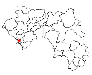
Dubréka is a prefecture located in the Kindia Region of Guinea. The capital is Dubréka. The prefecture covers an area of 4,350 km² and has a population of 330,548.

Douprou is a town and sub-prefecture in the Boffa Prefecture in the Boké Region of western Guinea. As of 2014 it had a population of 21,045 people.
Kindoyé is a town and sub-prefecture in the Dabola Prefecture in the Faranah Region of Guinea. As of 2014 it had a population of 6,495 people.
Dialakoro is a town and sub-prefecture in the Dinguiraye Prefecture in the Faranah Region of western Guinea. As of 2014 it had a population of 14,735 people.
Badi, Guinea is a town and sub-prefecture in the Dubréka Prefecture in the Kindia Region of western Guinea.
Sandéniah is a town and sub-prefecture in the Faranah Prefecture in the Faranah Region of Guinea. As of 2014 it had a population of 17,454 people.
Kaback is a town and sub-prefecture in the Forécariah Prefecture in the Kindia Region of western Guinea.
Guendembou is a town and sub-prefecture in the Guéckédou Prefecture in the Nzérékoré Region of south-western Guinea.
Kassadou is a town and sub-prefecture in the Guéckédou Prefecture in the Nzérékoré Region of south-western Guinea.
Mamouroudou is a sub-prefecture in the Kankan Prefecture in the Kankan Region of eastern Guinea. As of 2014 it had a population of 14,609 people.
Missamana is a town and sub-prefecture in the Kankan Prefecture in the Kankan Region of eastern Guinea. As of 2014 it had a population of 18,059 people.
Beindou is a town and sub-prefecture in the Kissidougou Prefecture in the Faranah Region of Guinea. As of 2014 it had a population of 14,679 people.
Fermessadou-Pombo is a town and sub-prefecture in the Kissidougou Prefecture in the Faranah Region of Guinea. As of 2014 it had a population of 19,489 people.
Babila is a town and sub-prefecture in the Kouroussa Prefecture in the Kankan Region of eastern-central Guinea. As of 2014 it had a population of 16,290 people.
Banfélé is a town and sub-prefecture in the Kouroussa Prefecture in the Kankan Region of eastern-central Guinea. As of 2014 it had a population of 24,555 people.
Komola-Koura is a town and sub-prefecture in the Kouroussa Prefecture in the Kankan Region of eastern-central Guinea. As of 2014 it had a population of 13,941 people.
Koyamah is a town and sub-prefecture in the Macenta Prefecture in the Nzérékoré Region of south-eastern Guinea.
Siguirini is a town and sub-prefecture in the Siguiri Prefecture in the Kankan Region of northern Guinea. As of 2014, the population in Siguirini was 54,953.


