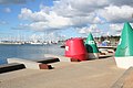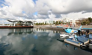

The Geelong Waterfront is a tourist and recreation area on the north facing shores of Corio Bay in Geelong, Australia. The area was once part of the Port of Geelong, falling into disuse before being redeveloped during the 1990s.
The Geelong Waterfront is a tourist and recreation area on the north facing shores of Corio Bay in Geelong, Australia. The area was once part of the Port of Geelong, falling into disuse before being redeveloped during the 1990s.

Geelong is a port city in Victoria, Australia, located at the eastern end of Corio Bay and the left bank of Barwon River, about 75 km (47 mi) southwest of Melbourne. With an estimated population of 282,809 in 2023, Geelong is the second largest city in the state of Victoria. It is the administrative centre for the City of Greater Geelong municipality, which is Port Phillip's only regional metropolitan area, and covers all the urban, rural and coastal reserves around the city including the entire Bellarine Peninsula and running from the plains of Lara in the north to the rolling hills of Waurn Ponds to the south, with Corio Bay to the east and the Barrabool Hills to the west.

Port Phillip or Port Phillip Bay is a horsehead-shaped enclosed bay on the central coast of southern Victoria, Australia. The bay opens into the Bass Strait via a short, narrow channel known as The Rip, and is completely surrounded by localities of Victoria's two largest cities — metropolitan Greater Melbourne in the bay's main eastern portion north of the Mornington Peninsula, and the city of Greater Geelong in the much smaller western portion north of the Bellarine Peninsula. Geographically, the bay covers 1,930 km2 (750 sq mi) and the shore stretches roughly 264 km (164 mi), with the volume of water around 25 km3 (6.0 cu mi). Most of the bay is navigable, although it is extremely shallow for its size — the deepest portion is only 24 m (79 ft) and half the bay is shallower than 8 m (26 ft). Its waters and coast are home to seals, whales, dolphins, corals and many kinds of seabirds and migratory waders.

Docklands, is an inner-city suburb in Melbourne, Victoria, Australia, 2 km (1.2 mi) west of Melbourne's Central Business District, located within the City of Melbourne local government area. Docklands recorded a population of 15,495 at the 2021 census.

Port Melbourne is an inner-city suburb in Melbourne, Victoria, Australia, 3 km (2 mi) south-west of the Melbourne central business district, located within the Cities of Melbourne and Port Phillip local government areas. Port Melbourne recorded a population of 17,633 at the 2021 census.

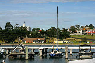
Corio Bay is one of numerous internal bays in the southwest corner of Australia's Port Phillip, and is the bay on which abuts the City of Geelong. The nearby suburb of Corio takes its name from Corio Bay.

Newport is an inner suburb in Melbourne, Victoria, Australia, 7.5 km (4.7 mi) south-west of Melbourne's Central Business District, located within the City of Hobsons Bay local government area. Newport recorded a population of 13,658 at the 2021 census.

Williamstown is a suburb in Melbourne, Victoria, Australia, 11 km (6.8 mi) south-west of Melbourne's Central Business District, located within the City of Hobsons Bay local government area. Williamstown recorded a population of 14,407 at the 2021 census.

Toronto Harbour or Toronto Bay is a natural bay on the north shore of Lake Ontario, in Toronto, Ontario, Canada. Today, the harbour is used primarily for recreational boating, including personal vessels and pleasure boats providing scenic or party cruises. Ferries travel from docks on the mainland to the Islands, and cargo ships deliver aggregates and raw sugar to industries located in the harbour. Historically, the harbour has been used for military vessels, passenger traffic and cargo traffic. Waterfront uses include residential, recreational, cultural, commercial and industrial sites.

Station Pier is a historic Australian pier on Port Phillip, in Port Melbourne, Victoria. Opened in 1854, the pier is Melbourne's primary passenger terminal, servicing interstate ferries and cruise ships, and is listed on the Victorian Heritage Register.

Rippleside is a suburb of Geelong, Victoria, Australia. The suburb overlooks Corio Bay. At the 2016 census, Rippleside had a population of 875.
Portarlington is a historic coastal township located on the Bellarine Peninsula, 28 km from the city of Geelong, in the state of Victoria, Australia. It has a diverse population which includes a wide range of ethnic backgrounds, a high proportion of retirees, and a large seasonal holiday influx. The gently rising hills behind the town feature vineyards and olive groves, and offer spectacular panoramic views across Port Phillip Bay. Portarlington is a popular family holiday destination and a centre of fishing and aquaculture (mussels). At one time the town claimed the largest Caravan Park in the Southern Hemisphere, although the size has reduced considerably in recent decades. With direct ferry links to the city of Melbourne Portarlington also serves as a gateway to the historic towns and surf beaches of the Bellarine Peninsula.
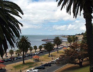
Eastern Beach is a popular swimming and recreation area in Geelong, Victoria on the shores of Corio Bay. Built during the 1930s in the Art Deco style, a shark proof sea bath is provided, as well as a children's swimming pool, kiosk, and dressing room pavilion. A number of Art Deco buildings in the area are listed on the Victorian Heritage Register.

Tourism is a significant industry in the state of Victoria, Australia. The country's second most-populous city, Melbourne was visited by 2.7 million international overnight visitors and 9.3 million domestic overnight visitors during the year ending December 2017.

The Port of San Francisco is a semi-independent organization that oversees the port facilities at San Francisco, California, United States. It is run by a five-member commission, appointed by the Mayor and approved by the Board of Supervisors. The Port is responsible for managing the larger waterfront area that extends from the anchorage of the Golden Gate Bridge, along the Marina district, all the way around the north and east shores of the city of San Francisco including Fisherman's Wharf and the Embarcadero, and southward to the city line just beyond Candlestick Point. In 1968, the State of California, via the California State Lands Commission for the State-operated San Francisco Port Authority, transferred its responsibilities for the Harbor of San Francisco waterfront to the City and County of San Francisco / San Francisco Harbor Commission through the Burton Act AB2649. All eligible State port authority employees had the option to become employees of the City and County of San Francisco to maintain consistent operation of the Port of San Francisco.

Brooklyn Bridge Park is an 85-acre (34 ha) park on the Brooklyn side of the East River in New York City. Designed by landscape architecture firm Michael Van Valkenburgh Associates, the park is located on a 1.3-mile (2.1 km) plot of land from Atlantic Avenue in the south, under the Brooklyn Heights Promenade and past the Brooklyn Bridge, to Jay Street north of the Manhattan Bridge. From north to south, the park includes the preexisting Empire–Fulton Ferry and Main Street Parks; the historic Fulton Ferry Landing; and Piers 1–6, which contain various playgrounds and residential developments. The park also includes Empire Stores and the Tobacco Warehouse, two 19th-century structures, and is a part of the Brooklyn Waterfront Greenway, a series of parks and bike paths around Brooklyn.

The Port of Geelong is located on the shores of Corio Bay at Geelong, Victoria, Australia. The port is the sixth-largest in Australia by tonnage.
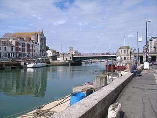
Weymouth Harbour is a harbour at the seaside town of Weymouth in Dorset, southern England. It has a 17th-century waterfront.
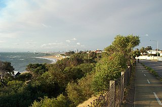
The Bay Trail is a shared use path for cyclists and pedestrians which follows the coastline of Port Phillip Bay through the south-eastern suburbs of Melbourne, Victoria, Australia.

The Geelong Carousel is a fully-restored Victorian era carousel, that operates in a custom-built pavilion on the waterfront in Geelong, Victoria, Australia. It is owned and operated by the City of Greater Geelong. The carousel and its original steam engine were purchased and restored between 1996 and 2000, as part of the redevelopment of the Geelong Waterfront. A steel-framed glass pavilion building was designed and constructed to provide permanent housing for the carousel. The restored carousel was officially opened in its new pavilion on 14 October 2000. The Carousel Pavilion is now regarded as a landmark and symbol of the refurbishment of the Geelong waterfront.