This article needs additional citations for verification .(January 2018) |

The Geodetic Observatory Wettzell is located atop the 616 meter-high mountain Wagnerberg, west of the village Wettzell in the German district Cham in the Bavarian Forest.
This article needs additional citations for verification .(January 2018) |
The Geodetic Observatory Wettzell is located atop the 616 meter-high mountain Wagnerberg, west of the village Wettzell in the German district Cham in the Bavarian Forest.

It is operated for the purpose of geodesy by the Federal Agency for Cartography and Geodesy together with the Technical University of Munich and is today one of the most important geodetic observatories in the world.
As observing station, the Geodetic Observatory Wettzell has the task of gathering measuring data for the geodetic space techniques VLBI, SLR, GNSS and DORIS. These data are used for realizing global coordinate reference systems that form the basis for numerous issues in the field of geosciences (e.g. continental drift, sea level rise), in aerospace, but also in areas of everyday life (e.g. surveying, navigation). These global tasks can today only be solved through international cooperation. The activities like observations, data flow, data analysis and provision of results are coordinated by the international services of the IAG, e.g. IERS, IVS (International VLBI Service), ILRS (International Laser Ranging Service), IGS (International GNSS Service) and IDS (International DORIS Service).
The Federal Georeference Data Act (German: Bundesgeoreferenzdatengesetz) is the legal basis for that. [1]
Wettzell also supports the operation of the observatories AGGO in La Plata/Argentina and GARS O'Higgins in Antarctica.

At the site with an approximate size of 300 by 150 meters, you find all modern observation techniques of satellite or space geodesy and complementary measuring techniques, especially
The reference points of the single measuring systems are linked by a local surveying network in order to obtain coordinate differences for a combination of the different techniques. This characteristic determines a geodetic fundamental station.
The Geodetic Observatory Wettzell was founded nearby the former Iron Curtain to former Czechoslovakia and to Germany's Air Defense Identification Zone in 1970 in order to have a night sky as dark as possible with only low light pollution and have to take little consideration of air traffic for Satellite and Lunar Laser Ranging. [2]
The beginnings of the satellite observing station Wettzell go back to an early research project of the Technical University of Munich and the Institute for Applied Geodesy for optical observation and orbit determination of geodetic Earth satellites. The field of satellite geodesy newly arisen at that time promised great progress for global geodesy. The optical observations carried out until the end of the 1970s included images of satellite passages with the Zeiss Double Astrograph and the ballistic measuring camera Zeiss BMK 75 for satellite triangulation and observations with a circumzenithal and the Danjon Astrolab for astronomical longitude and latitude determination.
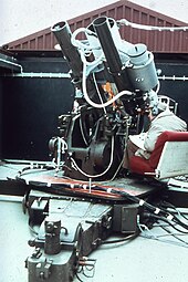
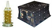
In cooperation with the German Test and Research Institute for Aviation and Space Flight (DFVLR, today's DLR), a first laser distance measuring system consisting of an anti-aircraft gun carriage and a ruby laser, was put in operation in 1972. With that, on 8 April 1973, the distance to a satellite (GEOS-1) was measured for the first time in Germany by laser. But only with the following, computer-adjusted systems SRS (Satellite Ranging System, 1977–1991) and WLRS (Wettzell Laser Ranging System, since 1991) large numbers of routine observations became possible. In addition, distances to the reflectors located at the Moon were already measured with the WLRS.
In the mid-seventies, the station was extended by microwave measuring techniques. Since 1974, Doppler measurements to satellites of the “Navy Navigational Satellite System” (N.N.S.S. or Transit) were performed regularly for point determination in geodesy. The first measurements to the satellite navigation system NAVSTAR GPS were already performed during the test phase 1979–1981 with Wettzell as one of four tracking stations worldwide. In 1993 the Doppler measurements ended, after the N.N.S.S. was replaced with the full development of GPS.
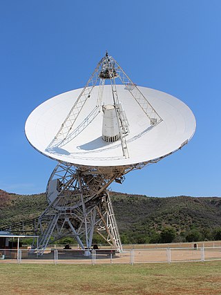
With implementing a radio telescope in 1983, the satellite observation station turned into a fundamental station of geodesy, where the various space geodetic techniques VLBI, SLR and GNSS are combined in one place. Since 2012, the observatory has two further so-called twin telescopes, in order to take account of technical progress and the increasing observation tasks. [3]

Geodesy is the science of measuring and representing the geometry, gravity, and spatial orientation of the Earth in temporally varying 3D. It is called planetary geodesy when studying other astronomical bodies, such as planets or circumplanetary systems.
Very-long-baseline interferometry (VLBI) is a type of astronomical interferometry used in radio astronomy. In VLBI a signal from an astronomical radio source, such as a quasar, is collected at multiple radio telescopes on Earth or in space. The distance between the radio telescopes is then calculated using the time difference between the arrivals of the radio signal at different telescopes. This allows observations of an object that are made simultaneously by many radio telescopes to be combined, emulating a telescope with a size equal to the maximum separation between the telescopes.

The World Geodetic System (WGS) is a standard used in cartography, geodesy, and satellite navigation including GPS. The current version, WGS 84, defines an Earth-centered, Earth-fixed coordinate system and a geodetic datum, and also describes the associated Earth Gravitational Model (EGM) and World Magnetic Model (WMM). The standard is published and maintained by the United States National Geospatial-Intelligence Agency.

In satellite laser ranging (SLR) a global network of observation stations measures the round trip time of flight of ultrashort pulses of light to satellites equipped with retroreflectors. This provides instantaneous range measurements of millimeter level precision which can be accumulated to provide accurate measurement of orbits and a host of important scientific data. The laser pulse can also be reflected by the surface of a satellite without a retroreflector, which is used for tracking space debris.

Onsala Space Observatory (OSO), the Swedish National Facility for Radio Astronomy, provides scientists with equipment to study the Earth and the rest of the Universe. The observatory operates two radio telescopes in Onsala, 45 km south of Gothenburg, and takes part in several international projects. Examples of activities:
Satellite geodesy is geodesy by means of artificial satellites—the measurement of the form and dimensions of Earth, the location of objects on its surface and the figure of the Earth's gravity field by means of artificial satellite techniques. It belongs to the broader field of space geodesy. Traditional astronomical geodesy is not commonly considered a part of satellite geodesy, although there is considerable overlap between the techniques.

A geodetic control network is a network, often of triangles, that are measured precisely by techniques of control surveying, such as terrestrial surveying or satellite geodesy. It is also known as a geodetic network, reference network, control point network, or simply control network.
Geodetic astronomy or astronomical geodesy (astro-geodesy) is the application of astronomical methods into geodetic networks and other technical projects of geodesy.
Haystack Observatory is a multidisciplinary radio science center, ionospheric observatory, and astronomical microwave observatory owned by Massachusetts Institute of Technology (MIT). It is in Westford, Massachusetts, in the United States, about 45 kilometers (28 mi) northwest of Boston. The observatory was built by MIT's Lincoln Laboratory for the United States Air Force and was called the Haystack Microwave Research Facility. Construction began in 1960, and the antenna began operating in 1964. In 1970 the facility was transferred to MIT, which then formed the Northeast Radio Observatory Corporation (NEROC) with other universities to operate the site as the Haystack Observatory. As of January 2012, a total of nine institutions participated in NEROC.
The Hartebeesthoek Radio Astronomy Observatory (HartRAO) is a radio astronomy observatory, located in a natural bowl of hills at Hartebeesthoek just south of the Magaliesberg mountain range, and about 50 km west of Johannesburg, Gauteng, South Africa. It is a National Research Facility run by South Africa's National Research Foundation. HartRAO was the only major radio astronomy observatory in Africa until the construction of the KAT-7 test bed for the future MeerKAT array in the Meerkat National Park.

The Algonquin Radio Observatory (ARO) is a radio observatory located in Algonquin Provincial Park in Ontario, Canada. It opened in 1959 in order to host a number of the National Research Council of Canada's (NRC) ongoing experiments in a more radio-quiet location than Ottawa.
Stellar triangulation is a method of geodesy and of its subdiscipline space geodesy used to measure Earth's geometric shape. Stars were first used for this purpose by the Finnish astronomer Yrjö Väisälä in 1959, who made astrometric photographs of the night sky at two stations together with a lighted balloon probe between them.
DORIS is a French satellite system used for the determination of satellite orbits and for positioning. The name is an acronym of "Doppler Orbitography and Radiopositioning Integrated by Satellite" or, in French, Détermination d'Orbite et Radiopositionnement Intégré par Satellite.
The term fundamental station is used for special observatories which combine several space positioning techniques like VLBI, satellite laser ranging, GPS, Glonass, etc. They are the basis of plate tectonic analysis, allowing the monitoring of continental drift rates with millimetre accuracies. A fundamental point is the geometric origin of a geodetic network and defines the geodetic datum of a national survey.
In geodesy and astrometry, earth orientation parameters (EOP) describe irregularities in the rotation of planet Earth. EOP provide the rotational transform from the International Terrestrial Reference System (ITRS) to the International Celestial Reference System (ICRS), or vice versa, as a function of time.
UNAVCO was a non-profit university-governed consortium that facilitated geology research and education using geodesy.

The Warkworth 12m Radio Telescope is a radio telescope at the Warkworth Radio Astronomical Observatory, located just south of Warkworth, New Zealand, about 50 km north of the Auckland CBD. It is operated by the Institute of Radio Astronomy and Space Research of Auckland University of Technology and was constructed in 2008.

Explorer 29, also called GEOS 1 or GEOS A, acronym to Geodetic Earth Orbiting Satellite, was a NASA satellite launched as part of the Explorer program, being the first of the two satellites GEOS. Explorer 29 was launched on 6 November 1965 from Cape Canaveral, Florida, with a Thor-Delta E launch vehicle.
Explorer 36 was a NASA satellite launched as part of the Explorer program, being the second of the two satellites GEOS. Explorer 36 was launched on 11 January 1968 from Vandenberg Air Force Base, with Thor-Delta E1 launch vehicle.

The Sentinel-6 Michael Freilich (S6MF) or Sentinel-6A is a radar altimeter satellite developed in partnership between several European and American organizations. It is part of the Jason satellite series and is named after Michael Freilich. S6MF includes synthetic-aperture radar altimetry techniques to improve ocean topography measurements, in addition to rivers and lakes. The spacecraft entered service in mid 2021 and is expected to operate for 5.5 years.