
A geographic information system (GIS) is a conceptualized framework that provides the ability to capture and analyze spatial and geographic data. GIS applications are computer-based tools that allow the user to create interactive queries, store and edit spatial and non-spatial data, analyze spatial information output, and visually share the results of these operations by presenting them as maps.

Université Laval is a public research university in Quebec City, Quebec, Canada. The University was founded by royal charter issued by Queen Victoria in 1852, with roots in the founding of the Séminaire de Québec in 1663 by François de Montmorency-Laval, making it the oldest centre of higher education in Canada and the first North American institution to offer higher education in French. The university, whose campus was erected from the 1950s onward in the suburban borough of Sainte-Foy–Sillery–Cap-Rouge, is ranked among the top 10 Canadian universities in terms of research funding and holds 4 Canada Excellence Research Chairs. Like most institutions in Quebec, the name is not translated in English.

Geomatics is defined in the ISO/TC 211 series of standards as the "discipline concerned with the collection, distribution, storage, analysis, processing, presentation of geographic data or geographic information". Under another definition, it "consists of products, services and tools involved in the collection, integration and management of geographic data". It includes geomatics engineering and is related to geospatial science.
Geoinformatics is the science and the technology which develops and uses information science infrastructure to address the problems of geography, cartography, geosciences and related branches of science and engineering.
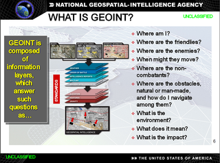
In the United States, geospatial intelligence (GEOINT) is intelligence about the human activity on earth derived from the exploitation and analysis of imagery and geospatial information that describes, assesses, and visually depicts physical features and geographically referenced activities on the Earth. GEOINT, as defined in US Code, consists of imagery, imagery intelligence (IMINT) and geospatial information.

Spatial analysis or spatial statistics includes any of the formal techniques which studies entities using their topological, geometric, or geographic properties. Spatial analysis includes a variety of techniques, many still in their early development, using different analytic approaches and applied in fields as diverse as astronomy, with its studies of the placement of galaxies in the cosmos, to chip fabrication engineering, with its use of "place and route" algorithms to build complex wiring structures. In a more restricted sense, spatial analysis is the technique applied to structures at the human scale, most notably in the analysis of geographic data.
Geospatial metadata is a type of metadata applicable to geographic data and information. Such objects may be stored in a geographic information system (GIS) or may simply be documents, data-sets, images or other objects, services, or related items that exist in some other native environment but whose features may be appropriate to describe in a (geographic) metadata catalog.

The International Cartographic Association (ICA), is an organization formed of national member organizations, to provide a forum for issues and techniques in cartography and geographic information science (GIScience). ICA was founded on June 9, 1959, in Bern, Switzerland. The first General Assembly was held in Paris in 1961. The mission of the International Cartographic Association is to promote the disciplines and professions of cartography and GIScience in an international context. To achieve these aims, the ICA works with national and international governmental and commercial bodies, and with other international scientific societies.
Denis Brière is a Canadian forestry professor and academic administrator. He took office as Université Laval's 25th rector (president) on June 1, 2007. He ran unsuccessfully for the position in 2002. He was formerly dean of the faculty of forestry and geomatics at Université Laval in Quebec City, and held that office since 2000. He has also worked as an executive with James Bay Energy Corporation, a consortium which built a series of hydro-electric dams near James Bay, Kruger Inc., a Canadian pulp and paper company, and Groupe Comact, a manufacturer of wood processing equipment.

The UNSW School of Surveying and Geospatial Engineering (SAGE), part of the UNSW Faculty of Engineering, was founded in 1970 and disestablished in 2013.
The Spatial Archive and Interchange Format was defined in the early 1990s as a self-describing, extensible format designed to support interoperability and storage of geospatial data.

The Open Geospatial Consortium (OGC), an international voluntary consensus standards organization, originated in 1994. In the OGC, more than 500 commercial, governmental, nonprofit and research organizations worldwide collaborate in a consensus process encouraging development and implementation of open standards for geospatial content and services, sensor web and Internet of Things, GIS data processing and data sharing.
Teledyne CARIS Inc. is a business unit of Teledyne Technologies and is a Canadian software company that develops and supports geomatics software for marine and land applications. The company is headquartered in Fredericton, New Brunswick, Canada. CARIS also has offices in the Netherlands, the United States and Australia, and has re-sellers offering sales and support of software products to more than 75 countries.

Abbas Rajabifard is a Professor and the Director of Smart and Sustainable Development and Discipline Leader of Geomatics Department of Infrastructure Engineering in the Faculty of Engineering and IT at the University of Melbourne, Australia. He is also the Director of the Center for Spatial Data Infrastructures and Land Administration (CSDILA).
Louise Filion is a Canadian professor of biogeography.
Andrew U. Frank was a Swiss-Austrian professor for geoinformation at Vienna University of Technology from 1992 until 2016. Previously he was Professor at the University of Maine at Orono. Frank is recognized for his achievements in the fields of spatial information theory, spatial database theory, and ontology in GIS. ->

Ed Parsons is a London-based Geospatial Technologist and tech evangelist at Google. He is working to evangelise geospatial data for commercial application and consequently, to improve the usability and efficiency of location based tools at Google. He is credited as being one of the core proponents of Google Street View.
Jianhong Wu is a Canadian applied mathematician and the founding Director of the Laboratory for Industrial and Applied Mathematics at York University. He holds the life-time title of University Distinguished Research Professor, and has been a senior Canada Research Chair in Industrial and Applied Mathematics at York University since 2001. In 2017, he was awarded the NSERC/Sanofi Industrial Research Chair in Vaccine Mathematics, Modelling and Manufacturing.

Marie-Josée Fortin is an ecologist and Professor in the Department of Ecology and Evolutionary Biology at the University of Toronto. Fortin holds the Tier 1 Canada Research Chair in Spatial Ecology at the University of Toronto. In 2016, she was elected as a Fellow of the Royal Society of Canada.