External links
| General | |
|---|---|
| National libraries | |
| Other | |
| Agency overview | |
|---|---|
| Formed | 1886 |
| Jurisdiction | Government of Western Australia |
| Website | www |
The Geological Survey of Western Australia is an authority within the Department of Mines and Petroleum of the Government of Western Australia that is responsible for surveying and exploration of Western Australia's geological resources. The department provides information to industry, technical support and professional guidance to government on geology, mining and petroleum resources.
Historically the Survey has existed under the various names that the Mines Department has been ascribed by various governments. [1]
The mapping by the survey between 1894 and 2015 is documented in Riganti and others [2] [3] with examples of state maps: -
Also some sections have moved between the survey and other departments. For example, the hydrogeology section was moved to the Waters and Rivers Commission in 1996. [9]
| General | |
|---|---|
| National libraries | |
| Other | |

Eyre Highway is a 1,664-kilometre (1,034 mi) highway linking Western Australia and South Australia via the Nullarbor Plain. Signed as National Highways 1 and A1, it forms part of Highway 1 and the Australian National Highway network linking Perth and Adelaide. It was named after explorer Edward John Eyre, who was the first European to cross the Nullarbor by land, in 1840–1841. Eyre Highway runs from Norseman in Western Australia, past Eucla, to the state border. Continuing to the South Australian town of Ceduna, it then crosses the top of the Eyre Peninsula before reaching Port Augusta.

The Murchison River is the second longest river in Western Australia. It flows for about 820 km (510 mi) from the southern edge of the Robinson Ranges to the Indian Ocean at Kalbarri. The Murchison-Yalgar-Hope river system is the longest river system in Western Australia. It has a mean annual flow of 208 gigalitres, although in 2006, the peak year on record since 1967, flow was 1,806 gigalitres.

The West Coast Range is a mountain range located in the West Coast region of Tasmania, Australia.
Geoscience Australia is an agency of the Australian Government. It carries out geoscientific research. The agency is the government's technical adviser on all aspects of geoscience, and custodian of the geographic and geological data and knowledge of the nation.
The Mount Jukes Mine sites were a series of short-lived, small mine workings high on the upper regions of Mount Jukes in the West Coast Range on the West Coast of Tasmania.
Mount Darwin is a mountain located in the West Coast region of Tasmania, Australia.
The mines of the West Coast of Tasmania have a rich historical heritage as well as an important mineralogical value in containing or having had found, specimens of rare and unusual minerals. Also, the various mining fields have important roles in the understanding of the mineralization of the Mount Read Volcanics, and the occurrence of economic minerals.
The Perth Basin is a thick, elongated sedimentary basin in Western Australia. It lies beneath the Swan Coastal Plain west of the Darling Scarp, representing the western limit of the much older Yilgarn Craton, and extends further west offshore. Cities and towns including Perth, Busselton, Bunbury, Mandurah and Geraldton are built over the Perth Basin.
The Mackintosh River, part of the Pieman River catchment, is a major perennial river located in the West Coast region of Tasmania, Australia. The river was named in November 1828 by Henry Hellyer, a surveyor of the Van Diemans Land Company, in honour of Sir James Mackintosh, son of John Mackintosh of Kyllachy, Inverness-shire
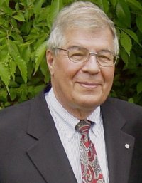
Raymond Alexander Price, is a Canadian geologist. He has used his research on the structure and tectonics of North America’s lithosphere to produce extensive geological maps. He has also provided guidance for nuclear fuel waste disposal and reports on the human contribution to Global warming.
Geological Survey of Victoria (GSV) is a government agency responsible for mapping the geology of Victoria, Australia.
Shag Rock is a small rocky island in the Wallabi Group of the Houtman Abrolhos.

A geologist is a scientist who studies the solid, liquid, and gaseous matter that constitutes Earth and other terrestrial planets, as well as the processes that shape them. Geologists usually study geology, although backgrounds in physics, chemistry, biology, and other sciences are also useful. Field research is an important component of geology, although many subdisciplines incorporate laboratory and digitalized work.
Geologic mapping of Georgia is the creation of geologic maps, special-purpose maps made to show geological features, of the State of Georgia in the United States. Rock units or geologic strata are shown by colors or symbols to indicate where they are exposed at the surface. Structural features such as faults and shear zones are also shown. Since the first national geological map, in 1809, there have been numerous maps which included the geology of Georgia. The first Georgia-specific geologic map was created in 1825. The most recent state-produced geologic map of Georgia, by the Georgia Department of Natural Resources is 1:500,000 scale, and was created in 1976 by the department's Georgia Geological Survey. It was generated from a base map produced by the United States Geological Survey. The state geologist and Director of the Geological Survey of Georgia was Sam M. Pickering, Jr. Since 1976, several geological maps of Georgia, featuring the state's five distinct geologic regions, have been produced by the federal government.
Boogardie is an abandoned town in the Mid West region of Western Australia.

The Tyndall Range, commonly called The Tyndalls, is a mountain range that is part of the West Coast Range located in the Western region of Tasmania, Australia.
The Department of Mines and Petroleum was a department of the Government of Western Australia until it was superseded by the Department of Mines, Industry Regulation and Safety on 1 July 2017. The department was formed on 1 January 2009, out of the former Department of Industry and Resources and Department of Consumer and Employment Protection, which were split into three new departments, the Department of Mines and Petroleum, the Department of State Development and the Department of Commerce.
Western Australia atlas of mineral deposits and petroleum fields is a multiple-edition summary of mining and petroleum activity in Western Australia in the twenty-first century.

Scott River is a river in the south west of Western Australia, being a tributary to the Blackwood River where it joins just east of Molloy Island. It is partly within the Scott National Park, which is named after the river.