External links
- Mineral Resources Division of the Department of State Development Archived 24 December 2016 at the Wayback Machine
| Agency overview | |
|---|---|
| Formed | 1882 |
| Jurisdiction | Government of South Australia |
| Website | www |
The Geological Survey of South Australia is an authority within the Department of Mining and Energy of the Government of South Australia that is responsible for surveying and exploration of South Australia's geological resources.
The Geological Office was started in December 1882 as under the Commissioner of Crown Lands and Immigration [1] the creation of the survey had been an issue in the local press earlier in the same year. [2] [3]
Historically, the Survey has existed under the various names of the Mines Department has been ascribed by various governments. [4]
The division makes its public geoscientific information available through the South Australia Resources Information Gateway (SARIG) and regularly publishes articles in its own MESA Journal.
{{citation}}: |author2= has generic name (help)CS1 maint: multiple names: authors list (link)
The City of Port Augusta is a local government area located at the northern end of Spencer Gulf in South Australia. It is centred on the town of Port Augusta.

Truro is a town in South Australia, 80 km northeast of Adelaide. It is situated in an agricultural and pastoral district on the Sturt Highway, east of the Barossa Valley, where the highway crosses somewhat lofty and rugged parts of the Mount Lofty Ranges. At the 2021 census, Truro had a population of 523.
Laura is a rural town in the Mid North region of South Australia, 12 km north of Gladstone on the Horrocks Highway and 40 km east of Port Pirie. The first European to explore the district was Thomas Burr in September 1842. His promising reports soon led to occupation of the district by pastoralists, one of whom was Herbert Bristow Hughes. When the present town was surveyed he named it for his wife, Laura née White.

Geoscience Australia is an agency of the Australian Government. It carries out geoscientific research. The agency is the government's technical adviser on all aspects of geoscience, and custodian of the geographic and geological data and knowledge of the nation.

The City of Enfield was a local government area of South Australia from 1868 to 1996. It was known as Yatala South up until 1933, which was named for its local government area predecessor, the District Council of Yatala, and known as Enfield thereafter.
Reginald Claude Sprigg, was an Australian geologist and conservationist. At 17 he became the youngest Fellow of the Royal Society of South Australia. During 1946, in the Ediacara Hills, South Australia he discovered the Ediacara biota, an assemblage of some of the most ancient animal fossils known. He was involved with oceanographic research and petroleum exploration by various companies that he initiated. In 1968, he acquired a derelict pastoral lease, Arkaroola, and transformed it into a wildlife sanctuary and wilderness reserve.
William Harper Twelvetrees was an English geologist who was important for the characterisation of the geology of Tasmania.

Palmer is a town just east of the Adelaide Hills region of South Australia along the Adelaide-Mannum Road, 70 kilometres east-north-east of the state capital, Adelaide and 15 km west-north-west of Mannum. It is located in the Mid Murray Council local government area.
Walter George Woolnough was an Australian geologist.

Donnybrook stone is a fine to medium-grained feldspathic and kaolinitic sandstone found near the town of Donnybrook, Western Australia. It originates from the early Cretaceous and features shale partings and colour variations which range from white to beige and pink.
The Geological Survey of Western Australia is an authority within the Department of Mines and Petroleum of the Government of Western Australia that is responsible for surveying and exploration of Western Australia's geological resources. The department provides information to industry, technical support and professional guidance to government on geology, mining and petroleum resources.
The Department of Mines and Petroleum was a department of the Government of Western Australia until it was superseded by the Department of Mines, Industry Regulation and Safety on 1 July 2017. The department was formed on 1 January 2009, out of the former Department of Industry and Resources and Department of Consumer and Employment Protection, which were split into three new departments, the Department of Mines and Petroleum, the Department of State Development and the Department of Commerce.
The Australasian Institute of Mining and Metallurgy (AusIMM) provides services to professionals engaged in all facets of the global minerals sector and is based in Carlton, Victoria, Australia.

Wallaroo Mines is a suburb of the inland town of Kadina on the Yorke Peninsula in the Copper Coast Council area. It was named for the land division in which it was established in 1860, the Hundred of Wallaroo, as was the nearby coastal town of Wallaroo. The boundaries were formally gazetted in January 1999 for "the long established name".
The Corporate Town of Laura was a local government area in South Australia, centred on the town of Laura. It was proclaimed on 22 June 1882, separating the township of Laura itself from the surrounding District Council of Booyoolie. It held its first meeting at the Laura Hotel on 24 June. One of their first acts was to undertake a program of plantings in streets and local parks. The council acquired the Laura Institute in 1887; from then onwards, the building served as the Laura Town Hall. The former council chambers was subsequently let as a dwelling and then to the R.S.S.I.L.A. In 1910, the council's responsibilities included maintenance of roads, kerbing and paving, sanitary inspection, street lighting, maintenance of the town hall and sports oval pavilion and local parklands. It ceased to exist on 30 April 1932, when it amalgamated with the Booyoolie council to form the new District Council of Laura.
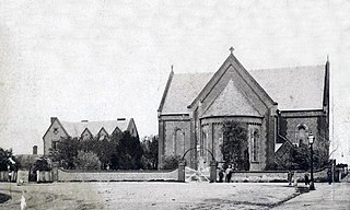
Christ Church, North Adelaide is an Anglican church in North Adelaide, South Australia.

Cape Banks Lighthouse is a lighthouse in the Australian state of South Australia located in the state's south-east on an unnamed headland in the gazetted locality of Carpenter Rocks about 2.5 kilometres (1.6 mi) north-west of the locality's town centre.
Ernest Lidgey was an Australian geologist who conducted important geological surveys of mining areas in Victoria, Australia.
John Harrison Packard was a surveyor in the colony of South Australia. He served under G. W. Goyder in the initial survey of Port Darwin.