Continental drift is the hypothesis, originating in the early 20th century, that Earth's continents move or drift relative to each other over geologic time. The hypothesis of continental drift has since been validated and incorporated into the science of plate tectonics, which studies the movement of the continents as they ride on plates of the Earth's lithosphere.

Plate tectonics is the scientific theory that Earth's lithosphere comprises a number of large tectonic plates, which have been slowly moving since about 3.4 billion years ago. The model builds on the concept of continental drift, an idea developed during the first decades of the 20th century. Plate tectonics came to be accepted by geoscientists after seafloor spreading was validated in the mid-to-late 1960s.

Orogeny is a mountain-building process that takes place at a convergent plate margin when plate motion compresses the margin. An orogenic belt or orogen develops as the compressed plate crumples and is uplifted to form one or more mountain ranges. This involves a series of geological processes collectively called orogenesis. These include both structural deformation of existing continental crust and the creation of new continental crust through volcanism. Magma rising in the orogen carries less dense material upwards while leaving more dense material behind, resulting in compositional differentiation of Earth's lithosphere. A synorogenic process or event is one that occurs during an orogeny.

Volcanism, vulcanism, volcanicity, or volcanic activity is the phenomenon where solids, liquids, gases, and their mixtures erupt to the surface of a solid-surface astronomical body such as a planet or a moon. It is caused by the presence of a heat source inside the body. This internal heat partially melts solid material in the body or turns material into gas. The mobilized material rises through the body's interior and may break through the solid surface.

Subduction is a geological process in which the oceanic lithosphere and some continental lithosphere is recycled into the Earth's mantle at convergent boundaries. Where the oceanic lithosphere of a tectonic plate converges with the less dense lithosphere of a second plate, the heavier plate dives beneath the second plate and sinks into the mantle. A region where this process occurs is known as a subduction zone, and its surface expression is known as an arc-trench complex. The process of subduction has created most of the Earth's continental crust. Rates of subduction are typically measured in centimeters per year, with rates of convergence as high as 11 cm/year.
Andesite is a volcanic rock of intermediate composition. In a general sense, it is the intermediate type between silica-poor basalt and silica-rich rhyolite. It is fine-grained (aphanitic) to porphyritic in texture, and is composed predominantly of sodium-rich plagioclase plus pyroxene or hornblende.

Tectonics are the processes that result in the structure and properties of the Earth's crust and its evolution through time.

The richly textured landscape of the United States is a product of the dueling forces of plate tectonics, weathering and erosion. Over the 4.5 billion-year history of the Earth, tectonic upheavals and colliding plates have raised great mountain ranges while the forces of erosion and weathering worked to tear them down. Even after many millions of years, records of Earth's great upheavals remain imprinted as textural variations and surface patterns that define distinctive landscapes or provinces.

Mountain formation refers to the geological processes that underlie the formation of mountains. These processes are associated with large-scale movements of the Earth's crust. Folding, faulting, volcanic activity, igneous intrusion and metamorphism can all be parts of the orogenic process of mountain building. The formation of mountains is not necessarily related to the geological structures found on it.

Diastrophism is the process of deformation of the Earth's crust which involves folding and faulting. Diastrophism can be considered part of geotectonics. The word is derived from the Greek διαστροϕή diastrophḗ 'distortion, dislocation'.
An orogenic belt, orogen, or mobile belt, is a zone of Earth's crust affected by orogeny. An orogenic belt develops when a continental plate crumples and is uplifted to form one or more mountain ranges; this involves a series of geological processes collectively called orogenesis.

The geology of Venus is the scientific study of the surface, crust, and interior of the planet Venus. Within the Solar System, it is the one nearest to Earth and most like it in terms of mass, but has no magnetic field or recognizable plate tectonic system. Much of the ground surface is exposed volcanic bedrock, some with thin and patchy layers of soil covering, in marked contrast with Earth, the Moon, and Mars. Some impact craters are present, but Venus is similar to Earth in that there are fewer craters than on the other rocky planets that are largely covered by them. This is due in part to the thickness of the Venusian atmosphere disrupting small impactors before they strike the ground, but the paucity of large craters may be due to volcanic re-surfacing, possibly of a catastrophic nature. Volcanism appears to be the dominant agent of geological change on Venus. Some of the volcanic landforms appear to be unique to the planet. There are shield and composite volcanoes similar to those found on Earth, although these volcanoes are significantly shorter than those found on Earth or Mars. Given that Venus has approximately the same size, density, and composition as Earth, it is plausible that volcanism may be continuing on the planet today, as demonstrated by recent studies.

A geosyncline is an obsolete geological concept to explain orogens, which was developed in the late 19th and early 20th centuries, before the theory of plate tectonics was envisaged. A geosyncline was described as a giant downward fold in the Earth's crust, with associated upward folds called geanticlines, that preceded the climax phase of orogenic deformation.

Hans Wilhelm Stille was an influential German geologist working primarily on tectonics and the collation of tectonic events during the Phanerozoic. Stille adhered to the contracting Earth hypothesis and together with Leopold Kober he worked on the geosyncline theory to explain orogeny. Stille's ideas emerged in the aftermath of Eduard Suess' book Das Antlitz der Erde (1883–1909). Stille's and Kober's school of thought was one of two that emerged in the post-Suess era the other being headed by Alfred Wegener and Émile Argand. This competing view rejected Earth contraction and argued for continental drift. As Stille opposed continental drift he came to be labelled a "fixist".

The Pleistos is a river in central Greece. It drains the Pleistos valley, named after it, a relatively recent rift valley north of the Gulf of Corinth, and parallel to it. They have the same geologic causes. Being situated in karst topography, much of the river runs or seeps through underground channels. The surface stream is intermittent. However, the limestone riverbed reflecting the light gives the appearance of a stream of water.

The geology of the Pacific Northwest includes the composition, structure, physical properties and the processes that shape the Pacific Northwest region of North America. The region is part of the Ring of Fire: the subduction of the Pacific and Farallon Plates under the North American Plate is responsible for many of the area's scenic features as well as some of its hazards, such as volcanoes, earthquakes, and landslides.

Fold mountains are formed by the effects of folding on layers within the upper part of the Earth's crust. Before the development of the theory of plate tectonics and before the internal architecture of thrust belts became well understood, the term was used to describe most mountain belts but has otherwise fallen out of use.
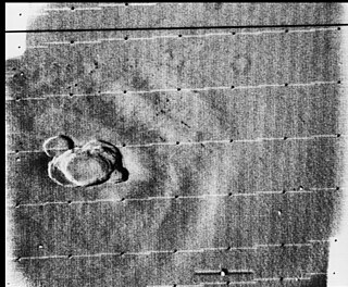
Volcanic activity, or volcanism, has played a significant role in the geologic evolution of Mars. Scientists have known since the Mariner 9 mission in 1972 that volcanic features cover large portions of the Martian surface. These features include extensive lava flows, vast lava plains, and the largest known volcanoes in the Solar System. Martian volcanic features range in age from Noachian to late Amazonian, indicating that the planet has been volcanically active throughout its history, and some speculate it probably still is so today. Both Mars and Earth are large, differentiated planets built from similar chondritic materials. Many of the same magmatic processes that occur on Earth also occurred on Mars, and both planets are similar enough compositionally that the same names can be applied to their igneous rocks.
This is a list of articles related to plate tectonics and tectonic plates.
Heat-pipe tectonics is a cooling mode of terrestrial planets and moons in which the main heat transport mechanism in the planet is volcanism through the outer hard shell, also called the lithosphere. Heat-pipe tectonics initiates when volcanism becomes the dominant surface heat transfer process. Melted rocks and other more volatile planetary materials are transferred from the mantle to surface via localised vents. Melts cool down and solidify forming layers of cool volcanic materials. Newly erupted materials deposit on top of and bury older layers. The accumulation of volcanic layers on the shell and the corresponding evacuation of materials at depth cause the downward transfer of superficial materials such that the shell materials continuously descend toward the planet's interior.
