Gertrud Rask Land

Last updated
Gertrud Rask Land
Operational Navigation Chart A-5, 3rd edition.jpg
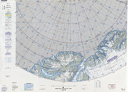
ONC map of Northern Ellesmere Island and far Northern Greenland.
Greenland edcp location map.svg
Red pog.svg
Gertrud Rask Land
Geography
Location Peary Land, Greenland
Coordinates 83°31′N36°47′W / 83.517°N 36.783°W / 83.517; -36.783 Coordinates: 83°31′N36°47′W / 83.517°N 36.783°W / 83.517; -36.783
Adjacent to
Length50 km (31 mi)
Width40 km (25 mi)
Highest elevation1,432 m (4698 ft)
Highest pointUnnamed
Administration
Greenland (Denmark)
Demographics
PopulationUninhabited

Gertrud Rask Land (Danish : Gertrud Rasks Land) is an area in Peary Land, North Greenland. Administratively it is part of the Northeast Greenland National Park. [1] [2]

Contents

The territory was named by Lauge Koch after Gertrud Rask (1673 – 1735), the wife of missionary Hans Egede, during the 1921–1923 Bicentenary Jubilee Expedition surveys. Koch found no muskoxen in the area and deemed that it was too arduous for the animals to cross this barren, inhospitable expanse, so that they had to choose another route to reach the northeast coast of Peary Land in their migrations. [3] [4]

Geography

Gertrud Rask Land is located in northern Peary Land, to the east of Roosevelt Land, separated from it by the A. Harmsworth Glacier. To the west it is limited by the Benedict Fjord, and to the east by the Sands Fjord and the Nord Glacier. Another large glacier descends directly into the sea in the central part. To the south rise the highest peaks of the Roosevelt Range, including Helvetia Tinde. To the north lies the frozen Lincoln Sea, where the northwesternmost headland is Cape Cannon, the northernmost one Cape Christian IV and the northeasternmost one Cape Hans Egede. [5] [1]

The terrain is harsh, mountainous and rugged, with numerous glaciated areas. The highest point of Gertrud Rask Land is a 1,432 metres (4,698 ft) summit located in the inner part. [6] According to other sources the same peak is 1,411 metres (4,629 ft) high. [7]

Bibliography

See also

Related Research Articles

<span class="mw-page-title-main">Peary Land</span> Peninsula in northern Greenland

Peary Land is a peninsula in northern Greenland, extending into the Arctic Ocean. It reaches from Victoria Fjord in the west to Independence Fjord in the south and southeast, and to the Arctic Ocean in the north, with Cape Morris Jesup, the northernmost point of Greenland's mainland, and Cape Bridgman in the northeast.

<span class="mw-page-title-main">Ejnar Mikkelsen</span> Danish polar explorer (born 1880)

Ejnar Mikkelsen was a Danish polar explorer and author. He is most known for his expeditions to Greenland.

<span class="mw-page-title-main">Lauge Koch</span>

Lauge Koch was a Danish geologist and Arctic explorer.

<span class="mw-page-title-main">Frederick E. Hyde Fjord</span> Body of water

Frederick E. Hyde Fjord is a fjord in Peary Land, far northern Greenland.

<span class="mw-page-title-main">Denmark expedition</span>

The Denmark expedition, also known as the Denmark Expedition to Greenland's Northeast Coast, and as the Danmark Expedition after the ship, was an expedition to the northeast of Greenland in 1906–1908.

Henson Glacier, is one of the major glaciers in northern Greenland.

<span class="mw-page-title-main">Sands Fjord</span> Fjord in northern Greenland

Sands Fjord is a fjord in Peary Land, northern Greenland. To the north, the fjord opens into the Lincoln Sea of the Arctic Ocean. Administratively it belongs to the Northeast Greenland National Park.

<span class="mw-page-title-main">Benedict Fjord</span> Body of water

Benedict Fjord is a fjord in Peary Land, northern Greenland. To the north, the fjord opens into the Lincoln Sea of the Arctic Ocean.

Helvetia Tinde is the highest mountain in the Roosevelt Range, Northern Greenland. It is also the highest mountain of the northernmost mountain range on Earth.

<span class="mw-page-title-main">Roosevelt Range</span>

The Roosevelt Range or Roosevelt Mountains is a mountain range in Northern Greenland. Administratively this range is part of the Northeast Greenland National Park. Its highest peak is the highest point in Peary Land.

<span class="mw-page-title-main">Frigg Fjord</span> Body of water

Frigg Fjord is a fjord in Peary Land, far northern Greenland.

<span class="mw-page-title-main">H. H. Benedict Range</span> Mountain range in northern Greenland

The H. H. Benedict Range or H. H. Benedict Mountains is a mountain range in Peary Land, Northern Greenland. Administratively this range is part of the Northeast Greenland National Park.

<span class="mw-page-title-main">Cape Cannon</span>

Cape Cannon is a headland in the Lincoln Sea, Arctic Ocean, North Greenland. Administratively it is part of the Northeast Greenland National Park.

<span class="mw-page-title-main">Daly Range</span>

The Daly Range or Daly Mountains is a mountain range in Peary Land, Northern Greenland. Administratively this range is part of the Northeast Greenland National Park.

<span class="mw-page-title-main">Peary Channel (Greenland)</span>

The Peary Channel was a hypothetical sound or marine channel running from east to west separating Peary Land in northernmost Greenland from the mainland further south.

<span class="mw-page-title-main">A. Harmsworth Glacier</span> Glacier in northern Greenland

A. Harmsworth Glacier or Alfred Harmsworth Glacier is a glacier in northern Greenland. Administratively it belongs to the Northeast Greenland National Park.

<span class="mw-page-title-main">Johannes V. Jensen Land</span> Region in Northeast Greenland National Park, Greenland

Johannes V. Jensen Land is an area in Peary Land, Northern Greenland. Administratively it lies in the Northeast Greenland National Park zone. The area is remote and currently uninhabited.

<span class="mw-page-title-main">Nansen Land</span>

Nansen Land is a peninsula in far northwestern Greenland. It is a part of the Northeast Greenland National Park.

<span class="mw-page-title-main">Roosevelt Land</span>

Roosevelt Land is a peninsula in far northern Greenland. It is a part of the Northeast Greenland National Park.

<span class="mw-page-title-main">Amundsen Land</span>

Amundsen Land or Amundsenland, is a peninsula in central North Greenland. It is a part of the Northeast Greenland National Park.

References

  1. 1 2 Nunat Aqqi; Stednavne
  2. Google Maps
  3. Dan Laursen, The Place Names of North Greenland. Kommissionen for Videnskabelige Undersøgelser i Grønland (ed.): Meddelelser om Grønland. Vol. 180, Nr. 2. C. A. Reitzels Forlag, Kopenhagen 1972, ISBN 87-421-0070-4, p. 244
  4. Geographical Items on North Greenland - Encyclopedia Arctica 14
  5. GoogleEarth
  6. Map of far Northern Greenland.
  7. Gertrud Rask Land High Point, Greenland - Peakbagger