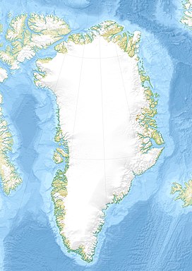
Roosevelt Range | |
---|---|
Roosevelt Fjelde | |
Highest point | |
Peak | Helvetia Tinde |
Elevation | 1,929 m (6,329 ft) |
Dimensions | |
Length | 150 km (93 mi)E/W |
Width | 60 km (37 mi)N/S |
Geography | |
Country | Greenland |
Region | Peary Land |
Range coordinates | 83°20′N35°0′W / 83.333°N 35.000°W |
Geology | |
Orogeny | Innuitian orogeny |
Age of rock | Precambrian to Late Palaeozoic |
Type of rock | Sandstone, shale, mudstone and quartzite |
The Roosevelt Range or Roosevelt Mountains (Danish : Roosevelt Fjelde) [1] is a mountain range in Northern Greenland. Administratively this range is part of the Northeast Greenland National Park. Its highest peak is the highest point in Peary Land.
Located about 720 kilometres (450 mi) from the North Pole, the Roosevelt Range is the northernmost mountain range on Earth. [2]
The mountain chain was named by Robert Peary after U.S. President Theodore Roosevelt, who would become one of the main backers of Peary's 1905 Arctic expedition.
During the first half of the 20th century the range was quite unexplored, except for the mapping from the coast in 1907 of the Daly Range by Johan Peter Koch, Aage Bertelsen and Tobias Gabrielsen, the northern team of the ill-fated Denmark expedition, [3] as well as aerial surveys and mapping begun by Lauge Koch in the 1920s.
In 1953 a geological expedition crossed the range through the Polkorridoren pass from Frigg Fjord to Sands Fjord. [4]
The highest peak, Helvetia Tinde was first climbed in 1969 by the members of an expedition of the British Joint Services during a topographic and geological survey of the northern part of Peary Land. [2] The second ascent of the summit was made in 1996. Later expeditions also went to the northern foothills of the range, not far from Cape Morris Jesup, and sought to identify and climb the "northernmost mountain on earth". [5]
The Roosevelt Range is an up to 1,929 m (6,329 ft) high mountain range in Northern Peary Land, formed by alpine-type mountains. The topography of the mountains is deeply eroded, with sharp, jagged ridges and precipitous cliffs. [6] The area of the range is uninhabited. [4]
Owing to a structural continuum in the mountains between Johannes V. Jensen Land in the east and Nansen Land in the west, American geologist William E. Davies called the wider range the "Nansen-Jensen Alps" in a work he published in 1972. The Roosevelt Range would be thus a subrange of a wider mountain chain with its westernmost foothills in Nansen Land, reaching all the way to Johannes V. Jensen Land in the east. [7]
The Roosevelt Range proper rises in Roosevelt Land in the west and stretches eastward across Gertrud Rask Land, north of a valley between the heads of the Harder Fjord in the west and the Frigg Fjord in the east. It extends eastwards in Johannes V. Jensen Land north of the Frederick E. Hyde Fjord beyond the Polkorridoren (Polar Corridor), a mountain pass connecting two glacial valleys running from North to South between the heads of Sands Fjord to the north and Frigg Fjord to the south. Its easternmost subranges almost reach the eastern end of northern Peary Land. The area near the Lincoln Sea coast, southwest of Cape Morris Jesup is known as Ulvebakkerne (Wolf Hills). [4]
Apart from its highest point Helvetia Tinde, not many peaks of the Roosevelt Range have been named. Other relevant mountains in the range are Paradisfjeld and Mary Peary Peaks (Mary Peary Tinder), located east of the Polar Corridor in a roughly central position, as well as Birgit Koch Peaks (Birgit Koch Tinder) and Rink Mountain (Rink Bjerg), a little further to the east. [1]
The H. H. Benedict Range (H. H. Benedict Bjerge), highest point Stjernebannertinde, and the Daly Range (Daly Bjerge), both located at the eastern end in Johannes V. Jensen Land, are subranges of the Roosevelt Range. [8] [9]
The valleys between mountains are filled with glaciers or icefields, none of which are very large. In the same manner as other features in this range many glaciers are unnamed. [8]
The Roosevelt Range forms the northern sub-region of the Innuitian orogeny. [6] It is part of the belt Caledonian folding that extends eastward from north Ellesmere Island. The ages of rocks in the range area are from Precambrian to Upper Silurian, [4] with low-grade marbles, psammites, sandstone, shales, quartzite and mudstones. [10]
Peary Land is a peninsula in northern Greenland, extending into the Arctic Ocean. It reaches from Victoria Fjord in the west to Independence Fjord in the south and southeast, and to the Arctic Ocean in the north, with Cape Morris Jesup, the northernmost point of Greenland's mainland, and Cape Bridgman in the northeast.
Frederick E. Hyde Fjord is a fjord in Peary Land, far northern Greenland.
The Stauning Alps are a large system of mountain ranges in Scoresby Land, King Christian X Land, northeastern Greenland. Administratively the Stauning Alps are part of the Northeast Greenland National Park zone.
Henson Glacier, is one of the major glaciers in northern Greenland.
Sands Fjord is a fjord in Peary Land, northern Greenland. To the north, the fjord opens into the Lincoln Sea of the Arctic Ocean. Administratively, it belongs to the Northeast Greenland National Park.
Nordkrone is a mountainous area in Peary Land, Northern Greenland. Administratively it is part of the Northeast Greenland National Park.
Helvetia Tinde is the highest mountain in the Roosevelt Range, Northern Greenland. It is also the highest mountain of the northernmost mountain range on Earth.
Frigg Fjord is a fjord in Peary Land, far northern Greenland.
The H. H. Benedict Range or H. H. Benedict Mountains is a mountain range in Peary Land, Northern Greenland. Administratively this range is part of the Northeast Greenland National Park.
The Daly Range or Daly Mountains is a mountain range in Peary Land, Northern Greenland. Administratively this range is part of the Northeast Greenland National Park.
Sif Glacier, is a glacier in northern Greenland. Administratively it belongs to the Northeast Greenland National Park.
Johannes V. Jensen Land is an area in Peary Land, Northern Greenland. Administratively it lies in the Northeast Greenland National Park zone. The area is remote and currently uninhabited.
Navarana Fjord is a fjord in Peary Land, far northern Greenland. It is named after an Inuit woman.
Nansen Land is a peninsula in far northwestern Greenland. It is a part of the Northeast Greenland National Park.
The Mary Peary Peaks are a mountain in the Roosevelt Range, Peary Land, Northern Greenland. Administratively they belong to the Northeast Greenland National Park.
Polkorridoren, formerly known as Nordpassagen, is a mountain pass in Peary Land, Greenland. Administratively, it is part of the Northeast Greenland National Park.
Roosevelt Land is a peninsula in far northern Greenland. It is a part of the Northeast Greenland National Park.
Gertrud Rask Land is an area in Peary Land, North Greenland. Administratively it is part of the Northeast Greenland National Park.
Herluf Trolle Land is an area in Peary Land, North Greenland. Administratively it is part of the Northeast Greenland National Park.