H. H. Benedict Range

Last updated
H. H. Benedict Range
H. H. Benedict Bjerge
Greenland edcp relief location map.jpg
Red triangle with thick white border.svg
Location
Highest point
Peak Stjernebannertinde
Elevation 1,433 m (4,701 ft)
Listing List of mountain ranges of Greenland
Dimensions
Length60 km (37 mi)E/W
Width30 km (19 mi)N/S
Geography
Country Greenland
State/ProvincePeary Land
Range coordinates 83°20′N33°0′W / 83.333°N 33.000°W / 83.333; -33.000 Coordinates: 83°20′N33°0′W / 83.333°N 33.000°W / 83.333; -33.000
Parent range Roosevelt Range
Geology
Age of rock Precambrian, Silurian

The H. H. Benedict Range or H. H. Benedict Mountains (Danish : H. H. Benedict Bjerge) is a mountain range in Peary Land, Northern Greenland. Administratively this range is part of the Northeast Greenland National Park.

Danish language North Germanic language spoken in Denmark

Danish is a North Germanic language spoken by around six million people, principally in Denmark and in the region of Southern Schleswig in northern Germany, where it has minority language status. Also, minor Danish-speaking communities are found in Norway, Sweden, Spain, the United States, Canada, Brazil, and Argentina. Due to immigration and language shift in urban areas, around 15–20% of the population of Greenland speak Danish as their first language.

Mountain range A geographic area containing several geologically related mountains

A mountain range or hill range is a series of mountains or hills ranged in a line and connected by high ground. A mountain system or mountain belt is a group of mountain ranges with similarity in form, structure, and alignment that have arisen from the same cause, usually an orogeny. Mountain ranges are formed by a variety of geological processes, but most of the significant ones on Earth are the result of plate tectonics. Mountain ranges are also found on many planetary mass objects in the Solar System and are likely a feature of most terrestrial planets.

Peary Land peninsula

Peary Land is a peninsula in northern Greenland, extending into the Arctic Ocean. It reaches from Victoria Fjord in the west to Independence Fjord in the south and southeast, and to the Arctic Ocean in the north, with Cape Morris Jesup, the northernmost point of Greenland's mainland, and Cape Bridgman in the northeast.

Contents

The H. H. Benedict range is part of the northernmost mountain system in the world. [1] The area where its ridges rise is barren and uninhabited.

History

The mountain chain was named by Robert Peary after Henry H. Benedict (1844–1935), one of the founding members of the Peary Arctic Club in New York. [2] Besides his financial support Mr Benedict had gifted a pianola for the entertainment of the members of the expedition. [3]

Robert Peary explorer from the United States

Robert Edwin Peary Sr. was an American explorer and United States Navy officer who made several expeditions to the Arctic in the late 19th and early 20th centuries. He is best known for claiming to have reached the geographic North Pole with his expedition on April 6, 1909.

Peary Arctic Club

The Peary Arctic Club was an American-based club with the goal of promoting the Arctic expeditions of Robert Peary.

New York City Largest city in the United States

The City of New York, usually called either New York City (NYC) or simply New York (NY), is the most populous city in the United States. With an estimated 2018 population of 8,398,748 distributed over a land area of about 302.6 square miles (784 km2), New York is also the most densely populated major city in the United States. Located at the southern tip of the state of New York, the city is the center of the New York metropolitan area, the largest metropolitan area in the world by urban landmass and one of the world's most populous megacities, with an estimated 19,979,477 people in its 2018 Metropolitan Statistical Area and 22,679,948 residents in its Combined Statistical Area. A global power city, New York City has been described as the cultural, financial, and media capital of the world, and exerts a significant impact upon commerce, entertainment, research, technology, education, politics, tourism, art, fashion, and sports. The city's fast pace has inspired the term New York minute. Home to the headquarters of the United Nations, New York is an important center for international diplomacy.

Peary saw the range from a distance, but didn't explore it. Aerial surveys begun by Lauge Koch in the 1920s mapped the area and Danish surveyors named some features. Only in 1996 did an expedition climb the highest point of the range. [4] [5]

Lauge Koch Danish geologist

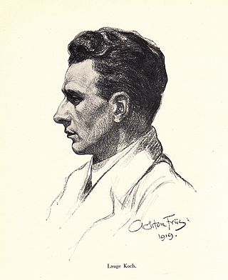
Lauge Koch was a Danish geologist and Arctic explorer.

Geography

The H. H. Benedict Range is a subrange of the Roosevelt Range. [6] Its highest peak is 1,433 m (4,701 ft) high Stjernebannertinde, [7] a conspicuous summit.

Roosevelt Range mountain range in Greenland

The Roosevelt Range or Roosevelt Mountains is a mountain range in Northern Greenland. Administratively this range is part of the Northeast Greenland National Park. Its highest peak is the highest point in Peary Land.

The range is located in Northern Peary Land, stretching north of the Frederick E. Hyde Fjord. The valleys between the mountains are filled with glaciers, the largest of which are the Borup Glacier, Moore Glacier and Ydun Glacier. [7]

Frederick E. Hyde Fjord

Frederick E. Hyde Fjord is a fjord in Peary Land, far northern Greenland.

The H. H. Benedict Range runs roughly from east to west in Johannes V. Jensen Land east of the Mary Peary Peaks. The Daly Range (Daly Bjerge) rises to the east, between the eastern end of the H. H. Benedict Range and the Wandel Sea. [8]

Geology

In the same manner as the Roosevelt Range the H. H. Benedict Range is part of the Caledonian orogeny extending eastward from north Ellesmere Island. [9]

Map of Northern Ellesmere Island and far Northern Greenland. Operational Navigation Chart A-5, 3rd edition.jpg
Map of Northern Ellesmere Island and far Northern Greenland.
Roosevelt Range section of Robert Peary's 1900 explorations map "Polar Regions". Roosevelt Range 1903.png
Roosevelt Range section of Robert Peary's 1900 explorations map "Polar Regions".

See also

Related Research Articles

Watkins Range range in Greenland

The Watkins Range is Greenland's highest mountain range. It is located in King Christian IX Land, Sermersooq municipality.

King Frederick VIII Land Region in Greenland

King Frederick VIII Land is a major geographic division of northeastern Greenland. It extends above the Arctic Circle from 76°N to 81°N in a N/S direction along the coast of the Greenland Sea.

Lemon Range

The Lemon Range or Lemon Mountains is a mountain range in King Christian IX Land, eastern Greenland. Administratively this range is part of the Sermersooq Municipality.

Cape Bridgman peninsula in Northeast Greenland National Park, Greenland

Cape Bridgman is a headland in the Wandel Sea, Arctic Ocean, northeast Greenland.

Mount Wistar mountain in Northeast Greenland National Park Greenland

Mount Wistar is a mountain in Peary Land, Northern Greenland. Administratively it is part of the Northeast Greenland National Park.

Sands Fjord

Sands Fjord is a fjord in Peary Land, northern Greenland. To the north, the fjord opens into the Lincoln Sea of the Arctic Ocean. Administratively it belongs to the Northeast Greenland National Park.

Benedict Fjord

Benedict Fjord is a fjord in Peary Land, northern Greenland. To the north, the fjord opens into the Lincoln Sea of the Arctic Ocean.

Nordkrone Mountain in Greenland

Nordkrone is a mountain in Peary Land, Northern Greenland. Administratively it is part of the Northeast Greenland National Park.

Thomas Glacier (Greenland)

Thomas Glacier, is a glacier in northern Greenland. Administratively it belongs to the Northeast Greenland National Park.

Helvetia Tinde Mountain in the Roosevelt Range, Greenland

Helvetia Tinde is the highest mountain in the Roosevelt Range, Northern Greenland. It is also the highest mountain of the northernmost mountain range on Earth.

Frigg Fjord

Frigg Fjord is a fjord in Peary Land, far northern Greenland.

Daly Range

The Daly Range or Daly Mountains is a mountain range in Peary Land, Northern Greenland. Administratively this range is part of the Northeast Greenland National Park.

A. Harmsworth Glacier

A. Harmsworth Glacier or Alfred Harmsworth Glacier is a glacier in northern Greenland. Administratively it belongs to the Northeast Greenland National Park.

Johannes V. Jensen Land Region in Northeast Greenland National Park, Greenland

Johannes V. Jensen Land is an area in Peary Land, Northern Greenland. Administratively it lies in the Northeast Greenland National Park zone. The area is remote and currently uninhabited.

References

  1. 2002 American Alpine Journal, p.286
  2. How Did Frederick E. Hyde Fjord Get Its Name?
  3. Robert Edwin Peary, The North Pole: Its Discovery in 1909 Under the Auspices of the Peary Arctic Club.
  4. North America, Greenland, The Far North, Jensenland, Explorations of Most Northerly Land
  5. Sitting on Top of the World
  6. "H. H. Benedict Range". Geographical Items on North Greenland Encyclopedia Arctica vol.14-0639. Retrieved 15 June 2019.
  7. 1 2 "Stjernebannertinde". Mapcarta. Retrieved 18 June 2019.
  8. "Greenland Pilot" (PDF). Danish Geodata Agency. Retrieved 15 June 2019.
  9. Crossing North Peary Land in Summer 1953