
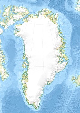
Greenland is located between the Arctic Ocean and the North Atlantic Ocean, northeast of Canada and northwest of Iceland. The territory comprises the island of Greenland—the largest island in the world—and more than a hundred other smaller islands. Greenland has a 1.2-kilometer-long (0.75 mi) border with Canada on Hans Island. A sparse population is confined to small settlements along certain sectors of the coast. Greenland possesses the world's second-largest ice sheet.

Danmark Fjord, also known as Denmark Sound, is a fjord in northeast Greenland. Administratively it belongs to the Northeast Greenland National Park.

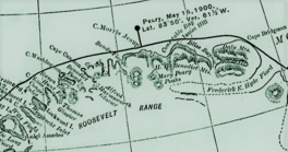
Peary Land is a peninsula in northern Greenland, extending into the Arctic Ocean. It reaches from Victoria Fjord in the west to Independence Fjord in the south and southeast, and to the Arctic Ocean in the north, with Cape Morris Jesup, the northernmost point of Greenland's mainland, and Cape Bridgman in the northeast.
The Peary Arctic Club was an American-based club with the goal of promoting the Arctic expeditions of Robert Peary (1856–1920).

King Frederik VIII Land is a major geographic division of northeastern Greenland. It extends above the Arctic Circle from 76°N to 81°N in a North-South direction along the coast of the Greenland Sea.

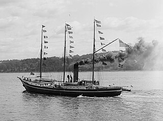
The Denmark expedition, also known as the Denmark Expedition to Greenland's Northeast Coast and the Danmark Expedition after the ship's name, was an expedition to northeastern Greenland in 1906–1908.

Sands Fjord is a fjord in Peary Land, northern Greenland. To the north, the fjord opens into the Lincoln Sea of the Arctic Ocean. Administratively, it belongs to the Northeast Greenland National Park.
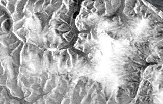
Nordkrone is a mountainous area in Peary Land, Northern Greenland. Administratively it is part of the Northeast Greenland National Park.

Hunt Fjord is a fjord in Peary Land, northern Greenland. To the north the fjord has its mouth in the Lincoln Sea of the Arctic Ocean. Administratively it belongs to the Northeast Greenland National Park.
Bliss Bay is a bay in the Wandel Sea, Northern Greenland. The area of the bay is uninhabited. Administratively Bliss Bay and its surroundings belong to the Northeast Greenland National Park.
The Roosevelt Range or Roosevelt Mountains is a mountain range in Northern Greenland. Administratively this range is part of the Northeast Greenland National Park. Its highest peak is the highest point in Peary Land.
The H. H. Benedict Range or H. H. Benedict Mountains is a mountain range in Peary Land, Northern Greenland. Administratively this range is part of the Northeast Greenland National Park.
The Daly Range or Daly Mountains is a mountain range in Peary Land, Northern Greenland. Administratively this range is part of the Northeast Greenland National Park.
A. Harmsworth Glacier or Alfred Harmsworth Glacier is a glacier in northern Greenland. Administratively it belongs to the Northeast Greenland National Park.
Constable Bay is a bay in the Wandel Sea, Northern Greenland. Administratively Constable Bay and its surroundings belong to the Northeast Greenland National Park.
Johannes V. Jensen Land is an area in Peary Land, Northern Greenland. Administratively it lies in the Northeast Greenland National Park zone. The area is remote and currently uninhabited.
Stjernebannertinde is the highest mountain in the H. H. Benedict Range, a subrange of the Roosevelt Range, Northern Greenland.
The Mary Peary Peaks are a mountain in the Roosevelt Range, Peary Land, Northern Greenland. Administratively they belong to the Northeast Greenland National Park.
Bertelsen Glacier is a glacier in northern Greenland. Administratively it belongs to the Northeast Greenland National Park. Between 2006 and 2010 there was an automatic weather station near the glacier.
Gertrud Rask Land is an area in Peary Land, North Greenland. Administratively it is part of the Northeast Greenland National Park.