Frederick E. Hyde Fjord

Last updated
Frederick E. Hyde Fjord
North Greenland section-txu-pclmaps-oclc-8322829 a 1.jpg
Map of Far Northeastern Greenland
Greenland edcp relief location map.jpg
Red pog.svg
Frederick E. Hyde Fjord
Location in Greenland
Location Arctic
Coordinates 83°04′N31°15′W / 83.067°N 31.250°W / 83.067; -31.250
Ocean/sea sources Wandel Sea, Arctic Ocean
Basin  countries Greenland
Max. length140 km (87 mi)
Max. width7 km (4.3 mi)
FrozenAll year
SettlementsNone

Frederick E. Hyde Fjord is a fjord in Peary Land, far northern Greenland.

Contents

History

The fjord was named by Robert Peary during his 1900 expedition after Frederick Erastus Hyde, one of the founding members and first vice-president of the Peary Arctic Club in New York. [1] Peary did not explore the fjord owing to thick fog. The inner fjord branches were mapped and named by Lauge Koch in the course of aerial surveys from the 1920s onwards. [2]

The landscape of this desolate fjord caused an impression on Danish Arctic explorer Eigil Knuth:

The journey through Frederick E. Hyde Fjord was not only my greatest experience in Peary Land, but revealed the most beautiful scenery I have ever seen in Greenland. [3]

Geography

To the east Frederick E. Hyde Fjord opens into the Arctic Ocean with its mouth just to the north of Cape John Flagler and south of Cape Bridgman. [4] The fjord extends 95 km (59 mi) in a WSW direction until the Harebugt at its head. The Nordpasset is a glacial valley that extends a further 25 km (16 mi) in a WNW direction until the head of O.B. Boggild Fjord, part of the De Long Fjord complex. [5]

Freja Fjord, Thor Fjord and Odin Fjord are branches on the southern shore of the fjord, about 65 km (40 mi), 95 km (59 mi) and 120 km (75 mi) from its mouth respectively; smaller Citronen Fjord lies about 45 km (28 mi) from the mouth. [6] Frigg Fjord is an offshoot on the northern shore located 95 km (59 mi) from the mouth. [7]

The Roosevelt Range, the northernmost mountain range on earth, stretches from west to east on the northern side of the fjord along with its subranges. Hans Egede Land extends to the south of the fjord from its middle reaches to the mouth area. The 1,280 m (4,200 ft) high Nordkrone plateau is located on the southern side of Frederick E. Hyde Fjord. Nordkrone has many glaciers and is intersected by deep ravines with steep sides. 1,737 m (5,699 ft) high Wistar Bjerg, one of the highest points in Peary Land, rises above the fjord between the Freya and Thor fjords at the edge of the plateau. [8]

See also

Related Research Articles

<span class="mw-page-title-main">Peary Land</span> Peninsula in northern Greenland

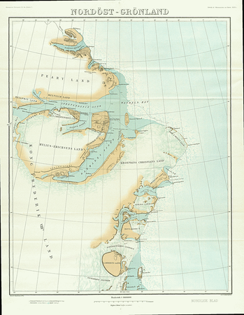
Peary Land is a peninsula in northern Greenland, extending into the Arctic Ocean. It reaches from Victoria Fjord in the west to Independence Fjord in the south and southeast, and to the Arctic Ocean in the north, with Cape Morris Jesup, the northernmost point of Greenland's mainland, and Cape Bridgman in the northeast.

<span class="mw-page-title-main">Independence Fjord</span> Fjord or sound in the eastern part of northern Greenland

Independence Fjord or Independence Sound is a large fjord or sound in the eastern part of northern Greenland. It is about 200 km (120 mi) long and up to 30 km (19 mi) wide. Its mouth, opening to the Wandel Sea of the Arctic Ocean is located at 82°15′N21°54′W.

<span class="mw-page-title-main">Odin Fjord</span> Fjord in Peary Land, Greenland

Odin Fjord is a fjord in Peary Land, far northern Greenland.

<span class="mw-page-title-main">Thor Fjord</span> Fjord in Peary Land, Greenland

Thor Fjord is a fjord in Peary Land, far northern Greenland.

<span class="mw-page-title-main">Freja Fjord</span> Fjord in Greenland

Freja Fjord is a fjord in Peary Land, far northern Greenland.

<span class="mw-page-title-main">Cape Bridgman</span> Headland in northeast Greenland

Cape Bridgman is a headland in the Wandel Sea, Arctic Ocean, northeast Greenland.

Mount Wistar is a mountain in Peary Land, Northern Greenland. Administratively it is part of the Northeast Greenland National Park.

<span class="mw-page-title-main">Sands Fjord</span> Fjord in northern Greenland

Sands Fjord is a fjord in Peary Land, northern Greenland. To the north, the fjord opens into the Lincoln Sea of the Arctic Ocean. Administratively, it belongs to the Northeast Greenland National Park.

<span class="mw-page-title-main">Benedict Fjord</span> Fjord in Greenland

Benedict Fjord is a fjord in Peary Land, northern Greenland. To the north, the fjord opens into the Lincoln Sea of the Arctic Ocean.

<span class="mw-page-title-main">Nordkrone</span> Mountain in Greenland

Nordkrone is a mountainous area in Peary Land, Northern Greenland. Administratively it is part of the Northeast Greenland National Park.

<span class="mw-page-title-main">Frigg Fjord</span> Inlet in Greenland

Frigg Fjord is a fjord in Peary Land, far northern Greenland.

<span class="mw-page-title-main">Johannes V. Jensen Land</span> Region in Northeast Greenland National Park, Greenland

Johannes V. Jensen Land is an area in Peary Land, Northern Greenland. Administratively it lies in the Northeast Greenland National Park zone. The area is remote and currently uninhabited.

<span class="mw-page-title-main">Cape Harald Moltke</span> Headland in Peary Land, North Greenland

Cape Harald Moltke is a headland in Peary Land, North Greenland. Administratively it is part of the Northeast Greenland National Park.

<span class="mw-page-title-main">Citronen Fjord</span> Fjord in Peary Land, Greenland

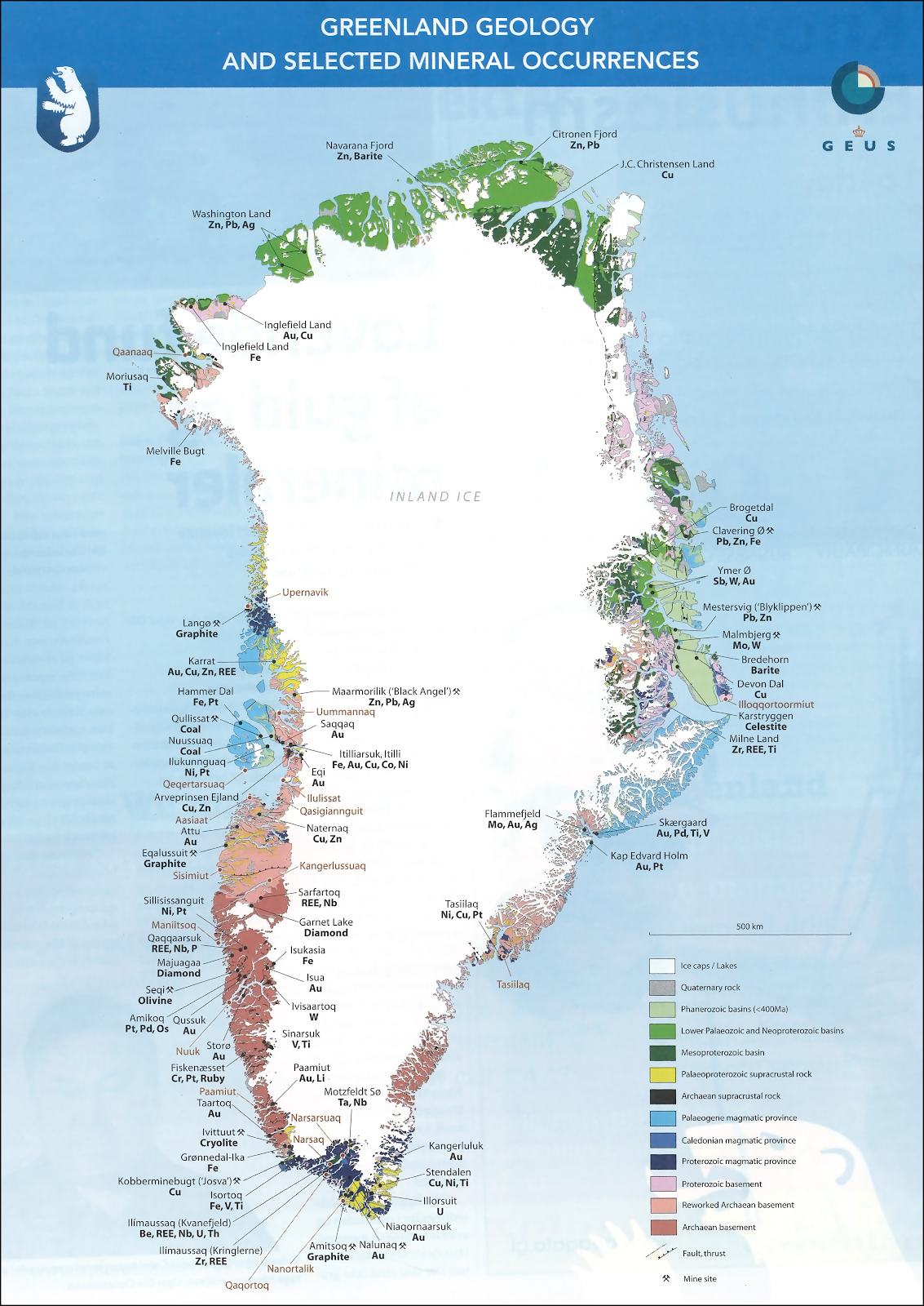
Citronen Fjord is a fjord in Peary Land, far northern Greenland. Administratively it is part of the Northeast Greenland National Park.

<span class="mw-page-title-main">Wyckoff Land</span> Peninsula in Greenland

Wyckoff Land is an area or peninsula in Peary Land, Northern Greenland.

<span class="mw-page-title-main">Cape Clarence Wyckoff</span> Headland in northern Greenland

Cape Clarence Wyckoff, also known as Cape Wyckoff, is a broad headland in the Wandel Sea, Arctic Ocean, northernmost Greenland. Administratively it is part of the Northeast Greenland National Park.

<span class="mw-page-title-main">Cape John Flagler</span> Headland in northeast Greenland

Cape John Flagler is a headland in the Wandel Sea, Arctic Ocean, northeast Greenland. Administratively it is part of the Northeast Greenland National Park.

<span class="mw-page-title-main">Herluf Trolle Land</span> Area in Peary Land, Greenland

Herluf Trolle Land is an area in Peary Land, North Greenland. Administratively it is part of the Northeast Greenland National Park.

<span class="mw-page-title-main">Nordpasset</span>

The Nordpasset, meaning "North Pass" in Danish, is a glacial valley in Peary Land, Greenland. Administratively, it is part of the Northeast Greenland National Park.

<span class="mw-page-title-main">O.B. Bøggild Fjord</span> Fjord in North Greenland

O.B. Bøggild Fjord is a fjord in Peary Land, far northern Greenland.

References

  1. How Did Frederick E. Hyde Fjord Get Its Name?
  2. Spencer Apollonio, Lands That Hold One Spellbound: A Story of East Greenland, 2008 p. 101
  3. Knuth, Eigil, The Danish expedition to Peary Land. Geographical Journal. 118. p. 8
  4. "Frederick E. Hyde Fjord". Mapcarta. Retrieved 5 May 2016.
  5. Greenland Pilot - Sailing directions for East Greenland
  6. Greenland Geology Map
  7. Prostar Sailing Directions 2005 Greenland and Iceland Enroute, p. 130
  8. "Den grønlandske Lods - Geodatastyrelsen" (PDF). Archived from the original (PDF) on 2020-10-28. Retrieved 2016-05-05.