Cape Bridgman

Last updated
Cape Bridgman
Kap Bridgman
North Greenland section-txu-pclmaps-oclc-8322829 a 1.jpg
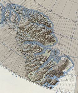
Map of Greenland section.
Greenland edcp location map.svg
Red pog.svg
Cape Bridgman
Coordinates: 83°25′N26°42′W / 83.417°N 26.700°W / 83.417; -26.700
Location Northeast Greenland National Park, Greenland
Offshore water bodies Wandel Sea, Arctic Ocean
Area
  Total Arctic

Cape Bridgman (Danish : Kap Bridgman) is a headland in the Wandel Sea, Arctic Ocean, northeast Greenland.

Contents

The cape was named by Robert Peary after Herbert L. Bridgman, one of the members of the Peary Arctic Club in New York. [1]

The northernmost human remains of the Independence I culture, and thus the world, was described at Cape Bridgman by Peter Dawes in a letter to Eigil Knuth; they comprise three sites of tent rings and flagstones, although it is likely that this was a short-term expedition with permanent settlement at Frigg Fjord slightly to the south. [2]

Geography

Cape Bridgman is located on the northern side of the mouth of Frederick E. Hyde Fjord, Peary Land. Cape John Flagler is the headland on the southern side of the fjord entrance. [3] [4] Administratively it is part of the Northeast Greenland National Park.

In 1900 this headland was Robert Peary's easternmost accurate geographic exploration in the north of Greenland, for further south he encountered fog. In 1907 it became an important landmark for the Denmark expedition which mapped for the first time the unknown area to the south and southeast of the cape, as well as part of the Daly Range, rising to the west above the plain. [5]

1911 map of NE Greenland by J. P. Koch showing at the top his northernmost explorations. Karte Nordostgronland Koch 1911.png
1911 map of NE Greenland by J. P. Koch showing at the top his northernmost explorations.

Related Research Articles

<span class="mw-page-title-main">Peary Land</span> Peninsula in northern Greenland

Peary Land is a peninsula in northern Greenland, extending into the Arctic Ocean. It reaches from Victoria Fjord in the west to Independence Fjord in the south and southeast, and to the Arctic Ocean in the north, with Cape Morris Jesup, the northernmost point of Greenland's mainland, and Cape Bridgman in the northeast.

Brønlundhus, on some maps also Brønlundfjord, is a former research station and radio station located on the western shore of Jørgen Brønlund Fjord in southern Peary Land, in northern Greenland. It is named after Greenlandic Arctic researcher Jørgen Brønlund, or after the namesake fjord on which it is located. It is close to the mouth of Jørgen Brønlund Fjord where it opens into Independence Fjord.

Count Eigil Knuth was a Danish explorer, archaeologist, sculptor and writer. He is referred to as the Nestor of Danish polar explorers. His archaeological investigations were made in Peary Land and adjacent areas of High Arctic Greenland. Knuth was made a Knight of the Dannebrog.

<span class="mw-page-title-main">Frederick E. Hyde Fjord</span>

Frederick E. Hyde Fjord is a fjord in Peary Land, far northern Greenland.

Mount Wistar is a mountain in Peary Land, Northern Greenland. Administratively it is part of the Northeast Greenland National Park.

<span class="mw-page-title-main">Sands Fjord</span> Fjord in northern Greenland

Sands Fjord is a fjord in Peary Land, northern Greenland. To the north, the fjord opens into the Lincoln Sea of the Arctic Ocean. Administratively, it belongs to the Northeast Greenland National Park.

<span class="mw-page-title-main">Nordkrone</span> Mountain in Greenland

Nordkrone is a mountainous area in Peary Land, Northern Greenland. Administratively it is part of the Northeast Greenland National Park.

<span class="mw-page-title-main">Cape Washington, Greenland</span> Headland in North Greenland

Cape Washington is a headland in North Greenland. Administratively it belongs to the Northeast Greenland National Park.

<span class="mw-page-title-main">Frigg Fjord</span>

Frigg Fjord is a fjord in Peary Land, far northern Greenland.

<span class="mw-page-title-main">Daly Range</span>

The Daly Range or Daly Mountains is a mountain range in Peary Land, Northern Greenland. Administratively this range is part of the Northeast Greenland National Park.

<span class="mw-page-title-main">Johannes V. Jensen Land</span> Region in Northeast Greenland National Park, Greenland

Johannes V. Jensen Land is an area in Peary Land, Northern Greenland. Administratively it lies in the Northeast Greenland National Park zone. The area is remote and currently uninhabited.

<span class="mw-page-title-main">Cape Harald Moltke</span> Headland in Peary Land, North Greenland

Cape Harald Moltke is a headland in Peary Land, North Greenland. Administratively it is part of the Northeast Greenland National Park.

<span class="mw-page-title-main">Citronen Fjord</span> Fjord in Peary Land, Greenland

Citronen Fjord is a fjord in Peary Land, far northern Greenland. Administratively it is part of the Northeast Greenland National Park.

<span class="mw-page-title-main">Wyckoff Land</span>

Wyckoff Land is an area or peninsula in Peary Land, Northern Greenland.

<span class="mw-page-title-main">Cape Clarence Wyckoff</span> Headland in northern Greenland

Cape Clarence Wyckoff, also known as Cape Wyckoff, is a broad headland in the Wandel Sea, Arctic Ocean, northernmost Greenland. Administratively it is part of the Northeast Greenland National Park.

<span class="mw-page-title-main">Cape John Flagler</span> Headland in northeast Greenland

Cape John Flagler is a headland in the Wandel Sea, Arctic Ocean, northeast Greenland. Administratively it is part of the Northeast Greenland National Park.

<span class="mw-page-title-main">Cape Henry Parish</span> Headland in Greenland

Cape Henry Parish is a broad headland in the Wandel Sea, Arctic Ocean, northernmost Greenland. Administratively it is part of the Northeast Greenland National Park.

<span class="mw-page-title-main">Herluf Trolle Land</span>

Herluf Trolle Land is an area in Peary Land, North Greenland. Administratively it is part of the Northeast Greenland National Park.

<span class="mw-page-title-main">Cape Eiler Rasmussen</span> Headland of Greenland

Cape Eiler Rasmussen is a broad headland in the Wandel Sea, Arctic Ocean, northernmost Greenland. Administratively it is part of the Northeast Greenland National Park.

<span class="mw-page-title-main">Nordpasset</span>

The Nordpasset, meaning "North Pass" in Danish, is a glacial valley in Peary Land, Greenland. Administratively, it is part of the Northeast Greenland National Park.

References

  1. How Did Frederick E. Hyde Fjord Get Its Name?
  2. Bjarne Grønnow, Jens Fog Jensen: The Northernmost Ruins of the Globe. Eigil Knuth’s Archaeological Investigations in Peary Land and Adjacent Areas of High Arctic Greenland (= Man & Society. Vol. 29). Museum Tusculanums Forlag, Københavns Universitet, Copenhagen 2003, ISBN   978-87-635-3065-1 , 978-8763512626 pp. 219 & 236237
  3. Prostar Sailing Directions 2005 Greenland and Iceland Enroute, p. 125
  4. "Kap Bridgman". Mapcarta. Retrieved 11 February 2019.
  5. Spencer Apollonio, Lands That Hold One Spellbound: A Story of East Greenland, 2008 p. 101