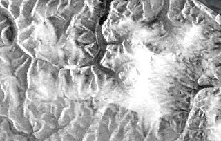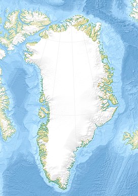
Peary Land is a peninsula in northern Greenland, extending into the Arctic Ocean. It reaches from Victoria Fjord in the west to Independence Fjord in the south and southeast, and to the Arctic Ocean in the north, with Cape Morris Jesup, the northernmost point of Greenland's mainland, and Cape Bridgman in the northeast.

Frederick E. Hyde Fjord is a fjord in Peary Land, far northern Greenland.

Weyprecht Fjord is a fjord in Peary Land, northern Greenland. To the northwest, the fjord opens into the Lincoln Sea of the Arctic Ocean. It is part of the Northeast Greenland National Park.

Sands Fjord is a fjord in Peary Land, northern Greenland. To the north, the fjord opens into the Lincoln Sea of the Arctic Ocean. Administratively, it belongs to the Northeast Greenland National Park.

Benedict Fjord is a fjord in Peary Land, northern Greenland. To the north, the fjord opens into the Lincoln Sea of the Arctic Ocean.

Nordkrone is a mountainous area in Peary Land, Northern Greenland. Administratively it is part of the Northeast Greenland National Park.

Hunt Fjord is a fjord in Peary Land, northern Greenland. To the north the fjord has its mouth in the Lincoln Sea of the Arctic Ocean. Administratively it belongs to the Northeast Greenland National Park.

Bliss Bay is a bay in the Wandel Sea, Northern Greenland. The area of the bay is uninhabited. Administratively Bliss Bay and its surroundings belong to the Northeast Greenland National Park.
Helvetia Tinde is the highest mountain in the Roosevelt Range, Northern Greenland. It is also the highest mountain of the northernmost mountain range on Earth.

The Roosevelt Range or Roosevelt Mountains is a mountain range in Northern Greenland. Administratively this range is part of the Northeast Greenland National Park. Its highest peak is the highest point in Peary Land.

Harder Fjord is a fjord in Peary Land, far northern Greenland.

Frigg Fjord is a fjord in Peary Land, far northern Greenland.

The H. H. Benedict Range or H. H. Benedict Mountains is a mountain range in Peary Land, Northern Greenland. Administratively this range is part of the Northeast Greenland National Park.

Johannes V. Jensen Land is an area in Peary Land, Northern Greenland. Administratively it lies in the Northeast Greenland National Park zone. The area is remote and currently uninhabited.

Nansen Land is a peninsula in far northwestern Greenland. It is a part of the Northeast Greenland National Park.

Roosevelt Land is a peninsula in far northern Greenland. It is a part of the Northeast Greenland National Park.

Amundsen Land or Amundsenland, is a peninsula in central North Greenland. It is a part of the Northeast Greenland National Park.

Gertrud Rask Land is an area in Peary Land, North Greenland. Administratively it is part of the Northeast Greenland National Park.

Melville Land is an area in Peary Land, North Greenland. Administratively it is part of the Northeast Greenland National Park.


