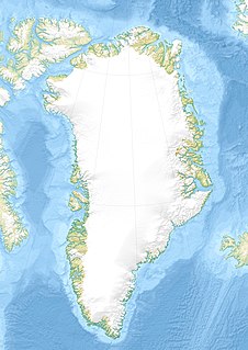
Peary Land is a peninsula in northern Greenland, extending into the Arctic Ocean. It reaches from Victoria Fjord in the west to Independence Fjord in the south and southeast, and to the Arctic Ocean in the north, with Cape Morris Jesup, the northernmost point of Greenland's mainland, and Cape Bridgman in the northeast.

J.P. Koch Fjord is a fjord in Peary Land, northern Greenland. To the west, the fjord opens into the Lincoln Sea of the Arctic Ocean.

Hans Tausen Ice Cap is an ice cap in Peary Land, northern Greenland. Ice cores show it is around 3500–4000 years old. It formed since the Holocene climatic optimum of 6000-8000 BP.

Queen Louise Land is a vast mountainous region located west of Dove Bay, King Frederick VIII Land, northeastern Greenland. Administratively it is part of the Northeast Greenland National Park zone.

Academy Glacier, is one of the major glaciers in northern Greenland.

Henson Glacier, is one of the major glaciers in northern Greenland.

Academy Fjord or Academy Bay is a fjord in northern Greenland. Administratively it belongs to the Avannaata municipality.

Farquhar Glacier, is a glacier in northwestern Greenland. Administratively it belongs to the Avannaata municipality.

Hart Glacier, is a glacier in northwestern Greenland. Administratively it belongs to the Avannaata municipality.

Sharp Glacier, is a glacier in northwestern Greenland. Administratively it belongs to the Avannaata municipality.

Hubbard Glacier, is a glacier in northwestern Greenland. Administratively it belongs to the Avannaata municipality.

Bowdoin Glacier, is a glacier in northwestern Greenland. Administratively it belongs to the Avannaata municipality.

Siorapaluup Kangerlua, also known as Robertson Fjord and Robertson Bay, is a fjord in northern Greenland. To the southwest, the fjord opens into the Murchison Sound of the Baffin Bay. Administratively it belongs to the Avannaata municipality.

Bliss Bay is a bay in the Wandel Sea, Northern Greenland. The area of the bay is uninhabited. Administratively Bliss Bay and its surroundings belong to the Northeast Greenland National Park.

The Roosevelt Range or Roosevelt Mountains is a mountain range in Northern Greenland. Administratively this range is part of the Northeast Greenland National Park. Its highest peak is the highest point in Peary Land.

The H. H. Benedict Range or H. H. Benedict Mountains is a mountain range in Peary Land, Northern Greenland. Administratively this range is part of the Northeast Greenland National Park.

The Daly Range or Daly Mountains is a mountain range in Peary Land, Northern Greenland. Administratively this range is part of the Northeast Greenland National Park.

Constable Bay is a bay in the Wandel Sea, Northern Greenland.Administratively Constable Bay and its surroundings belong to the Northeast Greenland National Park.

Nansen Land is a peninsula in far northwestern Greenland. It is a part of the Northeast Greenland National Park.


