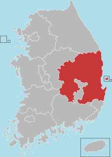
North Gyeongsang Province, also known as Gyeongbuk, is a province in eastern South Korea. The province was formed in 1896 from the northern half of the former Gyeongsang province, remained a province of Korea until the country's division in 1945, then became part of South Korea.
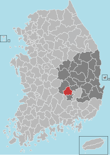
Seongju County (Seongju-gun) is a county in North Gyeongsang Province, South Korea. This largely agricultural area is located immediately west of the metropolitan city of Daegu. The capital of the county is the town of Seongju.
Sobaeksan is a mountain of the Sobaek Mountains, in South Korea. It lies between Danyang County in the province of Chungcheongbuk-do and the city of Yeongju in the province of Gyeongsangbuk-do. It has an elevation of 1,439 m (4,721 ft).
Amisan is a mountain in the county of Hongcheon, Gangwon-do in South Korea. It has an elevation of 960.8 m (3,152 ft).
Eungboksan is a mountain in the counties of Yangyang and Hongcheon, Gangwon-do, in South Korea. It has an elevation of 1,359.6 m (4,461 ft).
Akwibong is a mountain in the county of Goesan, Chungcheongbuk-do in South Korea. It has an elevation of 940 metres (3,084 ft).
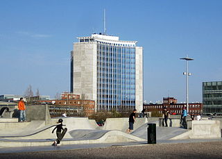
Stapelbäddsparken is a skateboarding park in Malmö, Sweden. It was designed by Stefan Hauser.
Gasan is a mountain of South Korea. It has an elevation of 901.6 metres
Doraksan is a mountain of Chungcheongbuk-do, South Korea. It has an elevation of 964 metres
Joryeongsan is a mountain of South Korea. It has an elevation of 1,025 metres.
Baegamsan is a mountain of Gyeongsangbuk-do, eastern South Korea. It has an elevation of 1,004 metres.
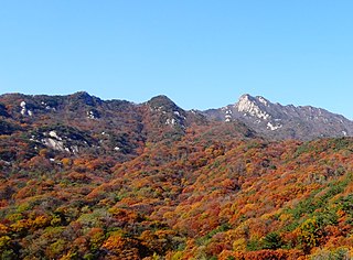
Bohyeonsan or Bohyeon Mountain or Mount Bohyeon is located in the province of Gyeongsangbuk-do, eastern South Korea. Its peak has an elevation of 1,121 metres (3,678 ft), and is near the city of Yeongcheon.
Cheongnyangsan is a mountain of Gyeongsangbuk-do, eastern South Korea. It has an elevation of 870 metres.
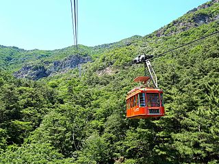
Geumosan is a mountain of Gyeongsangbuk-do, eastern South Korea. It has an elevation of 977 metres.
Hwangjangsan is a mountain of Gyeongsangbuk-do, eastern South Korea. It has an elevation of 1,077 metres.
Juheulsan is a mountain of Gyeongsangbuk-do, eastern South Korea. It has an elevation of 1,106 metres.
Undalsan is a mountain of Gyeongsangbuk-do, eastern South Korea. It has an elevation of 1,097 metres.
Wangdusan is a mountain of Gyeongsangbuk-do, eastern South Korea. It has an elevation of 1,044 metres.
Sidi Nâamane is a town and commune in Tizi Ouzou Province in northern Algeria.
Kalak is a village in Miandorud-e Kuchak Rural District, in the Central District of Sari County, Mazandaran Province, Iran. At the 2006 census, its population was 58, in 18 families.


