
Axum, also spelled Aksum, is a town in the Tigray Region of Ethiopia with a population of 66,900 residents. It is the site of the historic capital of the Aksumite Empire.
Grande Comore is an island in Comoros off the coast of Africa. It is the largest island in the Comoros nation. Most of its population is of the Comorian ethnic group. Its population as of 2006 is about 316,600. The island's capital is Moroni, which is also the national capital. The island is made up of two shield volcanoes, with Mount Karthala being the country's highest point at 2,361 m (7,746 ft) above sea level. According to the 2009 revision of the constitution of 2002, it is governed by an elected Governor, as are the other islands, with the federal government being much reduced in power. The name Ngazidja is sometimes seen in the now nonstandard form Njazidja.

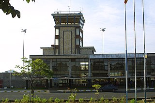
Addis Ababa Bole International Airport is an international airport in Addis Ababa, Ethiopia. It is in the Bole district, 6 km (3.7 mi) southeast of the city centre and 65 km (40 mi) north of Bishoftu. The airport was formerly known as Haile Selassie I International Airport. It is the main hub of Ethiopian Airlines, the national airline that serves destinations in Ethiopia and throughout the African continent, as well as connections to Asia, Europe, North America and South America. The airport is also the base of the Ethiopian Aviation Academy. As of June 2018, nearly 380 flights per day were using the airport.

Dembidollo, also spelled Dembi Dolo, is a market town and separate woreda in south-western Ethiopia. It is the capital of Kelam Welega Zone of the Oromia Region. This town, which is at an elevation of between 1,701 m (5,581 ft) and 1,827 m (5,994 ft) above sea level, was originally known as Sayo.

Dire Dawa International Airport, is an international airport serving Dire Dawa, a city in eastern Ethiopia. It is located 5 km northwest of the city centre.
Arba Minch Airport is a public airport serving Arba Minch, a city in the Southern Nations, Nationalities, and Peoples' Region (SNNPR) in Ethiopia. The name of the city and airport may also be transliterated as Arba Mintch. The airport is located 5 km northeast of the city centre, near Lake Abaya.

Asosa Airport is a public airport serving Asosa, the capital of the western Benishangul-Gumuz Region in Ethiopia. The name of the city and airport may also be transliterated as Assosa. The airport is located 5.5 km southeast of the city.

Axum Airport, also known as Emperor Yohannes IV Airport, is a public airport serving Axum, a city in the northern Tigray Region of Ethiopia. The name of the city and airport may also be transliterated as Aksum. The facility is located 5.5 km to the east of the city.
Bahir Dar Airport, also known as Dejazmach Belay Zeleke Airport, is a public airport serving Bahir Dar, the capital city of the Amhara Region in Ethiopia. The name of the city and airport may also be transliterated as Bahar Dar. Bahir Dar airport is located 8 km west of Bahir Dar, near Lake Tana. The airport is also used by the Ethiopian Air Force.
Gambela Airport is a public airport serving Gambela, the capital city of the Gambela Region in western Ethiopia. The name of the city and airport may also be transliterated as Gambella. The airport is located 17 km south of the city. It also serves the Gambela National Park, which is Ethiopia's largest national park.

Gondar Airport, also known as Atse Tewodros Airport, is a public airport serving Gondar, a city in the northern Amhara Region of Ethiopia. The name of the city and airport may also be transliterated as Gonder. The airport is located 18 km south of Gondar. The airport is named after the 19th century Emperor of Ethiopia (Atse) Tewodros II.
Robe Airport is a public airport in the town of Bale Robe in Oromia Region of Ethiopia. It also serves the nearby town of Goba.
Gerad Wilwal Airport is a public airport serving Jijiga, the capital city of the Somali Region in eastern Ethiopia. The airport is located at 09°19′56″N42°54′43″E, which is 12 km east of the city. It is named after seventeenth-century jigjiga ruler Garad Wiil-Waal.
Aba Jifar Airport, also known as Jimma Airport, is a public airport serving Jimma, a city in the Oromia Region of Ethiopia. The airport is located 2.5 km southwest of the city.

Lalibela Airport is a public airport serving Lalibela, a town in the Amhara Region of northern Ethiopia. The name of the town and airport may also be transliterated as Lalibella. The airport is located 23 km southwest of the town.

Alula Aba Nega Airport, also known as Mekelle Airport, is a public airport serving Mekelle, the capital city of the Tigray Region in northern Ethiopia. The airport is located 10 km southeast of the city.
Ginir is a town in southeastern Ethiopia. Located in the East Bale Zone of the Oromia Region, this town has a latitude and longitude of 7°08′N40°42′E and an elevation between 1750 and 1986 meters above sea level.
Robe, also called Bale Robe, is a town in south-central Oromia Region, Ethiopia. Located in the Bale Zone, this town has a latitude and longitude of 7°7′N40°0′E with an elevation of 2,492 metres (8,176 ft) above sea level.
Humera Airport is a public airport serving Humera, a town in the Tigray Region of northern Ethiopia. The name of the city and airport may also be transliterated as Himera or Himora.

Visitors to Ethiopia must obtain a visa from one of the Ethiopian diplomatic missions, unless they come from one of the visa exempt countries or countries whose citizens are eligible to apply for an electronic visa or visa on arrival.
