
Gosaikunda, also spelled Gosainkunda, is an alpine freshwater oligotrophic lake in Nepal's Langtang National Park, located at an elevation of 4,380 m (14,370 ft) in the Rasuwa District with a surface area of 13.8 ha. Together with associated lakes, the Gosaikunda Lake complex is 1,030 ha in size and was designated a Ramsar site on 29 September 2007.

Bhaktapur District (Nepali: भक्तपुर जिल्ला; Nepal Bhasa : ख्वप देश located in the eastern part of Kathmandu valley, is the smallest district among the seventy-seven districts of Nepal. It is part of Bagmati Province. Bhaktapur District Post Office is 44800. The district, with Bhaktapur as its district headquarters, covers an area of 119 km2 and in 2011 had a population of 304,651 of whom 9,701 people were absent.

Kaski District, a part of Gandaki Province, is one of the seventy-seven districts of Nepal. The name is disambiguated from Kaskikot, the ancient Kaski Kingdom.

Parbat District (Nepali: पर्वत जिल्ला, is a hilly area of Nepal. It is a part of Gandaki Province and one of the seventy-seven districts of Nepal. The district, with Kusma as its district headquarters, covers an area of 494 km2 and has a population of 157,826. It is the fourth-smallest district of Nepal with 47 village development committees currently.

Taplejung District is one of 77 districts of Nepal and one of the 14 districts of Koshi Province. It is located deep in the Himalayas in Eastern Nepal with Tibet to the north across the Himalayas. Taplejung is the third largest district of Nepal.

Udayapur District (Nepali: उदयपुर जिल्ला, is one of the 14 districts of Koshi Province in eastern Nepal. The district, with Triyuga as its district headquarters, covers an area of 2,063 km2 and in 2001 had a population of 287,689, in 2011 of 317,532, in 2021 of 342,773

Rani Pokhari, originally known as Nhu Pukhu, is a historic artificial pond located in the heart of Kathmandu, Nepal. The square-shaped tank dates from the 17th century, and was built on the eastern side of the then city limits. It lies just outside a former city gate. The pond is one of Kathmandu's most famous landmarks and is known for its religious and aesthetic significance. Its dimensions are 180m by 140m.
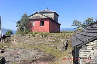
Saurpani is Ward no.4 Sulikot Gaupalika in Gorkha District in the Gandaki Zone of northern-central Nepal. At the time of the 2011 Nepal census it had a population of 5,958 and had 1,325 houses in the town.
Pokhari Chauri is a village development committee in Kavrepalanchok District in the Bagmati Zone of central Nepal. At the time of the 1991 Nepal census it had a population of 3,879 in 609 individual households. It lies in the border of Ramechhap and kavrepalanchowk district. It is about 80 km away from the capital of Nepal, Kathmandu
Pokhari Narayansthan is a village development committee in Kabhrepalanchok District in the Bagmati Zone of central Nepal. At the time of the 1991 Nepal census it had a population of 3,106 in 535 individual households.
Bharat Pokhari is a town in Kaski District in the Gandaki Province of northern-central Nepal. It lies at the height of 657 to 1600 meters above sea level. At the time of the 1991 Nepal census it had a population of 8,889 persons living in 1782 individual households. Bharat Pokhari was a Village Development Committee, and it is merged with Lekhnath Municipality.
Kaskikot, commonly known as Kaski, is a Ward no. 24 of the Pokhara metropolitan city. It was earlier a part of the village development committee in Kaski District, a region in northern-central Nepal.
Bhuwan Pokhari is a village development committee in Palpa District in the Lumbini Zone of southern Nepal. At the time of the 1991 Nepal census it had a population of 5113 people living in 969 individual households.

Gokyo Lakes are oligotrophic lakes in Nepal's Sagarmatha National Park, located at an altitude of 4,700–5,000 m (15,400–16,400 ft) above sea level. Lakes and resorts were named after Gokyo Ri peak. These lakes are the world's highest freshwater lake system comprising six main lakes, of which Thonak Lake is the largest. In September 2007, Gokyo and its associated wetlands of 7,770 ha (30.0 sq mi) have been designated a Ramsar site.

Mai Pokhari is a wetland in Ilam District of Nepal that was designated a Ramsar site on 28 October 2008. It is a pilgrimage center for both Hindus and Buddhists. The lake within the wetland which reflects emerald waters has a circumference of about 1 kilometre (0.62 mi) and boats are operated. On the periphery of the lake there is the Maipokhari Botanical Garden of horticultural and ecological importance which houses a rock garden, an orchid house, plants collected from many regions of eastern Nepal, and a green house.

Panch Pokharii is a group of 5 (panch) Hindu holy lakes in the Sindhupalchowk District of Nepal. The lakes are a popular destination for Hindu and Buddhist pilgrims during Janai Purnima.

Laligurans is a municipality located in Terhathum District in the Koshi Province of eastern Nepal. After the government announcement, the municipality was established on 19 September 2015 by merging the existing Basantapur, Phulek, Dangpa, Sungnam and Solma village development committees (VDCs). The center of the municipality is established in Basantpur. At the time of the 2011 Nepal census after merging the five VDCs population it had a total population of 16,934 persons. After the government decision the number of municipalities has reached 217 in Nepal.
Shree Himalaya Higher Secondary School is public high school in Saurpani, Nepal.

