
Dorset is a county in South West England on the English Channel coast. The ceremonial county comprises the unitary authority areas of Bournemouth, Christchurch and Poole and Dorset. Covering an area of 2,653 square kilometres (1,024 sq mi), Dorset borders Devon to the west, Somerset to the north-west, Wiltshire to the north-east, and Hampshire to the east. The county town is Dorchester which is in the south. After the reorganisation of local government in 1974 the county's border was extended eastward to incorporate the Hampshire towns of Bournemouth and Christchurch. Around half of the population lives in the South East Dorset conurbation, while the rest of the county is largely rural with a low population density.

Christchurch is a town and civil parish in Dorset on the south coast of England. The town covers an area of 19.5 square miles (51 km2) and had a population of 48,368 in 2013. It adjoins Bournemouth to the west, with the New Forest to the east. Part of the historic county of Hampshire, Christchurch was a borough within the administrative county of Dorset from 1974 until 2019, when it became part of the new Bournemouth, Christchurch and Poole unitary authority.

Poole is a large coastal town and seaport in Dorset, on the south coast of England. The town is 21 miles (34 km) east of Dorchester and adjoins Bournemouth to the east. Since 1 April 2019, the local authority is Bournemouth, Christchurch and Poole Council which is a unitary authority. Poole had an estimated population of 151,500 making it the second-largest town in the ceremonial county of Dorset. Together with Bournemouth and Christchurch, Poole has a total population of over 465,000.

The South West Coast Path is England's longest waymarked long-distance footpath and a National Trail. It stretches for 630 miles (1,014 km), running from Minehead in Somerset, along the coasts of Devon and Cornwall, to Poole Harbour in Dorset. Because it rises and falls with every river mouth, it is also one of the more challenging trails. The total height climbed has been calculated to be 114,931 ft (35,031 m), almost four times the height of Mount Everest. It has been voted 'Britain's Best Walking route' twice in a row by readers of the Ramblers Walk magazine, and regularly features in lists of the world's best walks.

Brownsea Island is the largest of the islands in Poole Harbour in the county of Dorset, England. The island is owned by the National Trust with the northern half managed by the Dorset Wildlife Trust. Much of the island is open to the public and includes areas of woodland and heath with a wide variety of wildlife, together with cliff top views across Poole Harbour and the Isle of Purbeck.
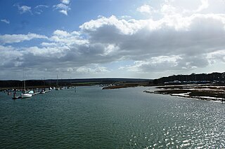
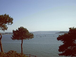
Poole Harbour is a large natural harbour in Dorset, southern England, with the town of Poole on its shores. The harbour is a drowned valley (ria) formed at the end of the last ice age and is the estuary of several rivers, the largest being the Frome. The harbour has a long history of human settlement stretching to pre-Roman times. The harbour is extremely shallow, with one main dredged channel through the harbour, from the mouth to Holes Bay.

The Isle of Purbeck is a peninsula in Dorset, England. It is bordered by water on three sides: the English Channel to the south and east, where steep cliffs fall to the sea; and by the marshy lands of the River Frome and Poole Harbour to the north. Its western boundary is less well defined, with some medieval sources placing it at Flower's Barrow above Worbarrow Bay. According to writer and broadcaster Ralph Wightman, Purbeck "is only an island if you accept the barren heaths between Arish Mell and Wareham as cutting off this corner of Dorset as effectively as the sea." The most southerly point is St Alban's Head. Its coastline is suffering from erosion.
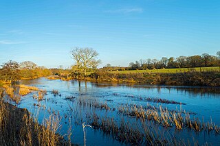
The River Stour is a 61 mi (98 km) river which flows through Wiltshire and Dorset in southern England, and drains into the English Channel. The catchment area for the river and its tributaries is listed as being 480 square miles (1,240 km2).

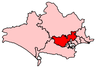
Purbeck was a local government district in Dorset, England. The district was named after the Isle of Purbeck, a peninsula that forms a large proportion of the district's area. However it extended significantly further north and west than the traditional boundary of the Isle of Purbeck along the River Frome. The district council was based in the town of Wareham, which is itself north of the River Frome.

Sandbanks is a small peninsula or spit crossing the mouth of Poole Harbour on the English Channel coast at Poole in Dorset, England. It is known for its high property prices and for its award-winning beach. In 2005 Sandbanks was reported to have the fourth highest land value by area in the world. The Sandbanks and Canford Cliffs Coastline area has been dubbed as "Britain's Palm Beach" by national media.

The River Fal flows through Cornwall, England, rising at Pentevale on Goss Moor and reaching the English Channel at Falmouth. On or near the banks of the Fal are the castles of Pendennis and St Mawes as well as Trelissick Garden. The River Fal separates the Roseland peninsula from the rest of Cornwall. Like most of its kind on the south coast of Cornwall and Devon, the Fal estuary is a classic ria, or drowned river valley. The Fal estuary from Tregony to the Truro River was originally called Hafaraell.
The River Yar on the Isle of Wight, England, rises near the beach at Freshwater Bay, on the south coast, and flows only a few miles north to Yarmouth where it meets the Solent. Most of the river is a tidal estuary. Its headwaters have been truncated by erosion of the south coast.
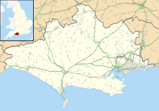
Mid Dorset and North Poole is a constituency represented in the House of Commons of the UK Parliament since 2015 by Michael Tomlinson, a Conservative.

Abbotsbury Swannery is the only managed colony of nesting mute swans in the world. It is situated near the village of Abbotsbury in Dorset, England, 14 kilometres (9 mi) west of Weymouth on a 1-hectare (2-acre) site around the Fleet Lagoon protected from the weather of Lyme Bay by Chesil Beach. The colony can number over 600 swans with around 150 pairs. Written records of the swannery's existence go back to 1393 but it probably existed well before that, and is believed to have been set up by Benedictine monks in the eleventh century.
Lilliput is a district of Poole, Dorset. It borders on Sandbanks, Canford Cliffs, Lower Parkstone, and Whitecliff and has a shoreline within Poole Harbour with views of Brownsea Island and the Purbeck Hills. Brownsea Island stands opposite Lilliput's harbour foreshore and is famous as the birthplace of Baden Powell's International Scouting Movement. Lilliput itself was host to a number of early scouting camps. During the Second World War at one stage it provided Britain's only civilian air route: Poole Harbour was temporary home to the Imperial Airways/BOAC flying boat fleet, which had its passenger HQ at Salterns.

The Hampshire Basin is a geological basin of Palaeogene age in southern England, underlying parts of Hampshire, the Isle of Wight, Dorset, and Sussex. Like the London Basin to the northeast, it is filled with sands and clays of Paleocene and younger ages and it is surrounded by a broken rim of chalk hills of Cretaceous age.
Dorset is a county located in the middle of the south coast of England. It lies between the latitudes 50.512°N and 51.081°N and the longitudes 1.682°W and 2.958°W, and occupies an area of 2,653 km². It spans 90 kilometres (56 mi) from east to west and 63 kilometres (39 mi) from north to south.

The Custom House is a Grade II* listed building in Poole, Dorset, England. It is a Georgian building located in the oldest part of Poole Quay, and is currently used as a restaurant.

The Bull's Head Inn was located at 73–75 High Street in Poole, Dorset, England. It is the oldest building on central Poole High Street, and 73 High Street is a Grade II* listed building. The inn no longer exists and the building is now used by a recruitment agency.

Scaplen's Court is a fifteenth century Grade I listed house in Poole, Dorset, England, adjacent to the Poole Museum. The house is now used as a museum focusing on life in Poole between the fifteenth and nineteenth centuries, and includes a Victorian schoolroom and kitchen.
