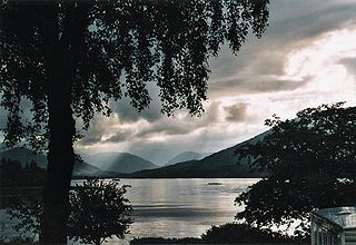
Loch Linnhe is a sea loch on the west coast of Scotland. The part upstream of Corran is known in Gaelic as An Linne Dhubh, and downstream as An Linne Sheileach. The name Linnhe is derived from the Gaelic word linne, meaning "pool".
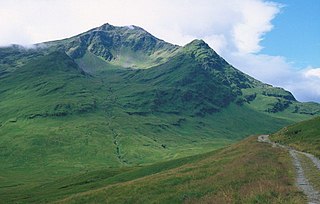
Ben Lui is a mountain in the southern Highlands of Scotland. It is a Munro with a height of 1,130 metres (3,710 ft). Ben Lui is in northeast Argyll and is the highest peak of a mountain chain that includes three other Munros. It has five well-defined ridges radiating out from the summit. Four corries lie between the ridges, including Coire Gaothaich on the northeast side of the mountain.

Loch Etive is a 30 km sea loch in Argyll and Bute, Scotland. It reaches the sea at Connel, 5 km north of Oban. It measures 31.6 km long and from 1.2 km to 1.6 km (1 mi) wide. Its depth varies greatly, up to a maximum of 150 m (490 ft).
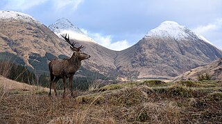
Glen Etive is a glen in the Highlands of Scotland. The River Etive rises on the peaks surrounding Rannoch Moor, with several tributary streams coming together at the Kings House Hotel, at the head of Glen Coe. From the Kings House, the Etive flows for about 18 km, reaching the sea loch, Loch Etive. The river and its tributaries are popular with whitewater kayakers and at high water levels it is a test piece of the area and a classic run.
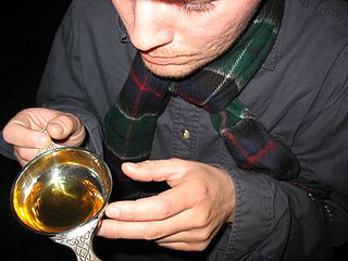
A quaich, archaically quaigh or quoich, is a special kind of shallow two-handled drinking cup or bowl of a type traditional in Scotland. It derives from the Scottish Gaelic cuach, meaning a cup.
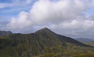
Ben Vorlich is a mountain in the Southern Highlands of Scotland. It lies south of Loch Earn and Ardvorlich, and a short distance north of the neighbouring mountain Stùc a' Chroin. Ben Vorlich reaches a height of 985 metres (3,232 ft), making it a Munro.
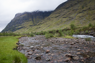
The River Coe rises at the north-eastern base of Buachaille Etive Beag in Scotland and flows west along Glen Coe. After dramatic waterfalls at the Pass of Glen Coe, it runs through the small Loch Achtriochtan before it turns north west. It then runs past the site of the Massacre of Glencoe and passes through Glencoe village, shortly before flowing into the sea loch of Loch Leven at Invercoe.

The Brack is a mountain, located in the Arrochar Alps, on the south side of Glen Croe, near Loch Goil in Argyll and Bute in Scotland. The Brack has two summits: the lower peak, Cruach Fhiarach, can be seen from the shores of Loch Long, and the main peak is seen from Glen Croe and Loch Goil.
Glen Dochart in Perthshire, Scottish Highlands is a glen which runs from Crianlarich eastwards to Killin, following the course of the River Dochart as it flows through Loch Dochart and Loch Iubhair. It is met by Glen Ogle at Lix Toll. Lochan Saorach lies within the glen and was once famous for its Floating island.

Chno Dearg is a mountain in the Lochaber area of the Scottish Highlands. It overlooks Glen Spean to the north and Loch Treig to the west. With a height of 1,046 metres (3,432 ft), it is classed as a Munro.

Beinn Mhòr is the highest mountain on the Cowal Peninsula west of Loch Eck in Argyll and Bute, Scotland. It has a high topographic prominence to height ratio and consequently commands a good all round view.

Beinn Bhuidhe is a mountain near the head of Loch Fyne in Argyll in the Scottish Highlands. It is a Munro with a height of 948 metres (3,110 ft).

Glen Shira is a glen in Argyll, Scotland at the northern end of Loch Fyne, just to the north of Inveraray. It is a Special Area of Conservation within the UK, bordered by Beinn Bhuidhe on the Glen Fyne side.

Stob an Eas is a 2401 ft (732m) Graham in the Arrochar Alps, Argyll and Bute, Scotland.

Sgùrr Thuilm is a mountain in the Glenfinnan area of the Highlands of Scotland. It stands at the head of Glen Finnan approximately 7 kilometres (4 mi) north of Loch Shiel.
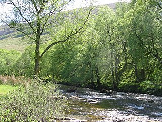
Glen Douglas is a glen in the southwest Scottish Highlands. It is drained by the Douglas Water, which discharges at the village of Inverbeg at its eastern end into Loch Lomond. The glen is followed by a single-track road which links the A82 road alongside Loch Lomond with the A814 road beside Loch Long. The glen is overlooked to the north by Beinn Bhreac and Tullich Hill and to the south by Doune Hill and a 655 m (2,149 ft) hill known as Coire na h-Eanachan.

The River Garry is a major tributary of the River Tummel, itself a tributary of the River Tay, in the traditional county of Perthshire in the Scottish Highlands. It emerges from the northeastern end of Loch Garry (56.8193°N 4.2311°W), just to the southeast of the Pass of Drumochter, and flows southeastwards and eastwards down Glen Garry to the narrow Pass of Killiecrankie beyond which it joins the Tummel (56.7182°N 3.7790°W).
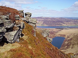
Loch Freuchie, also known as Fraoch, the heatherly loch, is a large freshwater loch on a north-west to south-east orientation, within Glen Quaich in Perth and Kinross. The loch is located 2 miles (3.2 km) west of Amulree and 6.5 miles (10.5 km) southeast of Kenmore.

Loch Fender is a small irregular shaped freshwater loch that lies to the north of Loch Freuchie and three miles south-south-east of Amulree and 2 and a half miles from southeast from Milton in Perth and Kinross. For its size it is very deep.
Allt a' Chaol Ghlinne—also spelled Allt a' Chaol-ghlinne—is a river in the Lochaber area of Highland, Scotland. Located in a glen (valley) within the Northwest Highlands of the Scottish Highlands, Allt a' Chaol Ghlinne is a tributary to the River Finnan, which itself flows into Loch Shiel.


