
The Drakensberg is the eastern portion of the Great Escarpment, which encloses the central Southern African plateau. The Great Escarpment reaches its greatest elevation – 2,000 to 3,482 metres within the border region of South Africa and Lesotho.

Helderberg refers to a planning district of the City of Cape Town metropolitan municipality, the mountain after which it is named, a wine-producing area in the Western Cape province of South Africa, or a small census area in Somerset West.
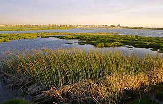
The Rietvlei Wetland Reserve is a 663-hectare (1,640-acre) nature reserve situated in Table View, Western Cape, South Africa. It is managed by the City of Cape Town's Environmental Resource Management Department.
The Milnerton Racecourse Nature Reserve is a lowland conservation area located in the City of Cape Town, South Africa.
The Diep River Fynbos Corridor is a nature reserve located in the Blaauwberg region of Cape Town, South Africa. It forms part of the larger Table Bay Nature Reserve, which was established in June 2012.

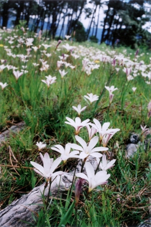
Cape Flats Sand Fynbos (CFSF), previously known as Sand Plain Fynbos, is a critically endangered vegetation type that occurs only within the city of Cape Town. Less than 1% of this unique lowland fynbos vegetation is conserved.

Kenilworth Racecourse Conservation Area is a 52-hectare (130-acre) nature reserve, situated in the centre of Kenilworth Racecourse, in Cape Town, South Africa. Due to its location, it has been left undisturbed for more than 100 years, making it now the best preserved patch of “Cape Flats Sand Fynbos” in the world.
Meadowridge Common is an 8-hectare (20-acre) reserve in the Meadowridge suburb of Cape Town, South Africa, which preserves a fragment of critically endangered Cape Flats Sand Fynbos vegetation.

Edith Stephens Wetland Park is a nature reserve for wetlands and fynbos, located in the city of Cape Town, South Africa.
Lower Silvermine Wetlands is a nature reserve on the Cape Peninsula, in Cape Town, South Africa.

Tygerberg Nature Reserve is a 300-hectare (740-acre) nature reserve on the Tygerberg Hills in the northern suburbs of Cape Town, South Africa.

Uitkamp Wetland Nature Reserve is a 32-hectare (79-acre) wetland reserve located in Durbanville in the Western Cape province of South Africa.

Durbanville Nature Reserve is a 6-hectare (15-acre) piece of protected land, located next to the Hollywoodbets Durbanville Racecourse in the Western Cape, South Africa.

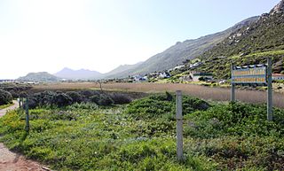
Helderberg Nature Reserve is a 398-hectare (980-acre) nature reserve in Somerset West, South Africa.

Kogelberg Nature Reserve is a nature reserve of 3,000 ha comprising the Kogelberg Mountain Range, to the east of Cape Town, South Africa.

Die Oog Conservation Area is a tiny 1.2-hectare (3.0-acre) nature reserve within the city of Cape Town, South Africa.

Cape Lowland Freshwater Wetland is a critically endangered vegetation type of the Western Cape, South Africa.
The Bot River Estuary, also known as the Bot River Lagoon, is part of the Bot-Kleinmond Estuarine System in the Overberg region on the Western Cape of South Africa. It became a Ramsar site wetland in 2017. It is within the Kogelberg Biosphere Reserve.
The Wonderfonteinspruit is a small river situated in the Highveld region of South Africa. Its source has been disputed in the past, although it is now accepted that the river originates in the West Rand of Gauteng between Krugersdorp and Randfontein, at the Tudor Dam, which was initially used as a storage dam for the Luiperdsvlei Gold Plant. In the past the river received a majority of its water from karst springs along its course. The river flows through one of the richest gold-producing areas in the world, which led to the dolomitic compartments which fed the river being dewatered to make way for mining activities. This led to the drying up of the karst springs that fed the river.
