
Moyle District Council was a local council in County Antrim in the northeast of Northern Ireland. It merged with Ballymoney Borough Council, Coleraine Borough Council and Limavady Borough Council in May 2015 under local government reorganisation to become Causeway Coast and Glens District Council.

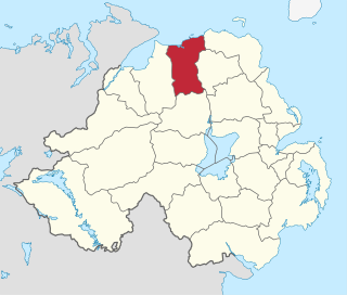
North Antrim is a parliamentary constituency in the United Kingdom House of Commons. The current MP is Jim Allister (TUV).
Coleraine Borough Council was a local council mainly in County Londonderry and partly in County Antrim in Northern Ireland. It merged with Ballymoney Borough Council, Limavady Borough Council and Moyle District Council in May 2015 under local government reorganisation in Northern Ireland to become Causeway Coast and Glens District Council.

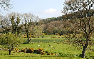
The Glens of Antrim, known locally as simply The Glens, is a region of County Antrim, Northern Ireland. It comprises nine glens (valleys), that radiate from the Antrim Plateau to the coast. The Glens are an area of outstanding natural beauty and are a major tourist attraction in north Antrim.
Glenariff or Glenariffe is a valley in County Antrim, Northern Ireland. It is one of the Glens of Antrim. Like other glens in that area, it was shaped during the Ice Age by giant glaciers.
Balnamore is a small village in County Antrim, Northern Ireland. It is within the townland of Ballynacree-Skein and lies 3 km west of Ballymoney. It is part Causeway Coast and Glens District Council. Historically it was known as Ballinamore.
Barmeen is a townland in County Antrim, Northern Ireland. It is located at the foot of Glendun, one of the nine Glens of Antrim, west of Cushendun and north of Knocknacarry. It is situated in the historic barony of Cary and the civil parish of Culfeightrin and covers 59 acres.
Martinstown is a small village in County Antrim, Northern Ireland. Located 6 miles from Ballymena, it is situated in Glenravel, locally known as "The Tenth Glen", alongside the widely known nine Glens of Antrim.
Ballybogy, or Ballybogey, is a small village and townland in County Antrim, Northern Ireland. It is located 7 km north-north-west of Ballymoney and 7 km east of Coleraine, lying within the Causeway Coast and Glens district. It is known as Boggie in Scots. It had a population of 539 people

Bendooragh is a small village and townland in County Antrim, Northern Ireland, 2+1⁄2 miles (4.0 km) south west of Ballymoney. It is part of Causeway Coast and Glens District Council. It had a population of 622 people in the 2011 Census.
Ballyvoy is a small village and townland in County Antrim, Northern Ireland. It is on the main A2 coast road 5 km east of Ballycastle and 17 km north west of Cushendall. In the 2001 Census it had a population of 72 people. It lies within the Antrim Coast and Glens Area of Outstanding Natural Beauty and is part of Causeway Coast and Glens District Council.

Moss-side or Mosside is a small village and townland in County Antrim, Northern Ireland. In the 2001 Census it had a population of 270 people.

Glendun translates into English as glen of the brown river and is one of the nine Glens of Antrim in County Antrim in Northern Ireland.
Tighvein is a hill above Lamlash on the Isle of Arran in western Scotland. It is a Marilyn and the highest point on the south-eastern section of the island, south-east of the pass of Monamore Glen. Two miles from the nearest road, the top is a heathery, boggy moor, almost entirely ringed by thick forestry plantations. It is rarely climbed as there are no paths to the top.
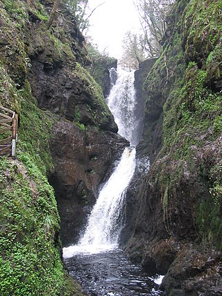
Glenariff Forest Park is an 1185 hectare forest in County Antrim, Northern Ireland. It is part of Glenariff glen itself. The forest is managed by the Northern Ireland Forest Service, the state body responsible for forestry in the province, which is part of the Department of Agriculture, Environment and Rural Affairs.

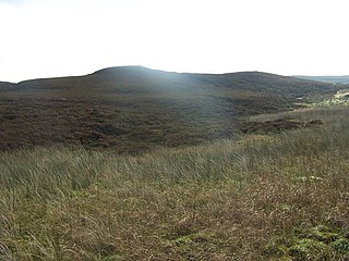
Tievebulliagh is a 402-metre-high (1,319 ft) mountain in the Glens of Antrim, Northern Ireland. It forms part of the watershed between Glenaan to the north and Glenballyemon to the south. It is situated about 4.4 km from Cushendall.

Capecastle or Cape Castle is a small village and townland in County Antrim, Northern Ireland, between Armoy and Ballycastle. It is part of the Causeway Coast and Glens district.

The River Dun, also known as the Glendun River is a river in County Antrim, Northern Ireland. It runs through Glendun, one of the nine Glens of Antrim. The river is named after its brown colour, which comes from the peat bogs at its source on the slopes of Slievenanee on the Antrim Plateau. The source of the river is a few hundred metres from that of the River Bush, which flows north-east to meet the sea at Bushmills. Cushendun is a small coastal resort town lying at the mouth of the River Dun and Glendun.
Rathlin Castle, also known as Bruce's Castle, was a castle on Rathlin Island off the coast of County Antrim in Northern Ireland.
Glentaisie is one of the nine Glens of Antrim in County Antrim, Northern Ireland. It was shaped during the Ice Age by glaciers. The glen is most northerly of the nine glens and lies at the foot of Knocklayde mountain. The town of Ballycastle lies on the coast at the foot of the glen.
