Ballycastle | |
---|---|
Ballycastle harbour | |
Location within Northern Ireland | |
Population | 5,628 (2021 Census) |
Irish grid reference | D115407 |
• Belfast | 55 miles (89 km) |
District | |
County | |
Country | Northern Ireland |
Sovereign state | United Kingdom |
Post town | BALLYCASTLE |
Postcode district | BT54 |
Dialling code | 028 |
Police | Northern Ireland |
Fire | Northern Ireland |
Ambulance | Northern Ireland |
UK Parliament | |
NI Assembly | |
Ballycastle (from Irish : Baile an Chaistil, meaning 'town of the castle') [1] [5] is a small seaside town in County Antrim, Northern Ireland. It is on the northeasternmost coastal tip of Ireland, in the Antrim Coast and Glens Area of Outstanding Natural Beauty. The harbour hosts the ferry to Rathlin Island and a smaller passenger and charter service to Campbeltown and Port Ellen in Scotland, with both Rathlin Island and Scotland's Kintyre peninsula able to be seen from the coast. The Ould Lammas Fair is held each year in Ballycastle on the last Monday and Tuesday of August. Ballycastle is the home of the Corrymeela Community.
Ballycastle had a population of 5,628 at the 2021 census. [6] It was the seat and main settlement of the former Moyle District Council.
At the time of the 2021 Census the population of Ballycastle was 5,628. [6] Of these:
At the time of the 2011 UK Census the population of Ballycastle was 5,237. [11] Of these:
Ballycastle can trace its history back to the founding of a settlement around Port Brittas, the old name for Ballycastle Bay. It is from here that it has been suggested that Fergus Mór mac Eirc, a purported king of Dalriada, sailed to Scotland and founded a large colony throughout Argyll. [12]
From the late 14th century the area was at the centre of the territory controlled by the MacDonnell's of Antrim. Descended from Clan MacDonald of Dunnyveg, it was through the marriage of John Mór MacDonald and Margery Byset in 1399 that the clan laid the basis of their claim to the Glens of Antrim. However it wasn't until the 16th century when the celebrated chieftain Sorley Boy MacDonnell of Dunaneeny Castle established the clan in both the Glens and The Route. [13]
The settlement around Dunaneeny Castle, along with the settlements at Bonamargy Friary and the castle in the area of the Diamond merged to become the present day town. It is from this castle, that stood on the site of Holy Trinity Church, which the town derived its name. Ballycastle Castle which had been in the possession of the MacDonnell's, before being seized by both Scottish and later Cromwellian troops, fell into disrepair with the last remaining walls being removed in the 19th century. [12]
Around the year 1786 Hugh Boyd, the son of the rector of Ramoan parish church, obtained a lease and permission from parliament to build a new harbour and pier to protect shipping. He is known for establishing coal shafts, potteries, a glass factory and a number of industries which under his care saw Ballycastle become a flourishing town. Hugh Boyd is credited for the construction or establishment of a number of buildings that still stand in the town today. [12]
The town is located within The Glens district electoral area (DEA) of the Causeway Coast and Glens Borough Council. [14] In the 2019 Causeway Coast and Glens Borough Council election, the residents of this DEA elected 2 Sinn Fein, 1 SDLP, 1 UUP and 1 Independent representatives to the council.
The Ould Lammas Fair, historically a lamb sale, has now become a street get together with market stalls, busking and street performers, attracting upwards of sixty thousand people each year. The fair is normally held Bank holiday Monday and Tuesday at end of August based on the fact that fairs were always held on last Tuesday of the month. (When the bank holiday is the last day of August the fair occurs a week earlier.)
Bus services in Ballycastle are operated by Translink.
A ferry runs between the town and Rathlin Island as part of a lifeline service. Since 2008 this ferry has been operated by the Rathlin Island Ferry Ltd [20] but previously it had been operated by Caledonian MacBrayne beginning in 1996. [21]
A passenger ferry service to Campbeltown on Scotland's Kintyre peninsula, and Port Ellen on Islay, operated by Kintyre Express, runs seven days during summer months and only on Mondays and Fridays during winter months. [22] Sea Containers Ltd previously ran a ferry from Ballycastle to Campbeltown from 1997 to June 2002. [23]
Ballycastle railway station opened on 18 October 1880 on the Ballycastle Railway, a narrow gauge railway which ran for 17 miles (27 km). The railway ran from Ballycastle to Ballymoney station, a station on the Belfast and Northern Counties Railway (BNCR), later Northern Counties Committee (NCC) and now part of Northern Ireland Railways.
There were several incidents of what came to be known as the Troubles in Northern Ireland, including:
In the past, there has been unrest during Orange Order parades in the town. In 2001, there was serious public disorder at the 12 July parade. As a result of this, the Silver Plains flute band, from nearby Moyarget, was banned from marching in the town due to allegations of sectarian conduct and paramilitary trappings. [30]
As with the rest of Northern Ireland, Ballycastle experiences a maritime climate with cool summers and mild winters. The nearest official Met Office weather station for which online records are available is at Ballypatrick Forest, [31] about 4 miles (6.4 km) east-southeast of Ballypatrick.
Climate data for Ballypatrick Forest WMO ID: 03916; coordinates 55°10′50″N6°09′16″W / 55.18064°N 6.15439°W ; elevation: 156 m (512 ft); 1991–2020 normals, extremes 1961–present | |||||||||||||
---|---|---|---|---|---|---|---|---|---|---|---|---|---|
Month | Jan | Feb | Mar | Apr | May | Jun | Jul | Aug | Sep | Oct | Nov | Dec | Year |
Record high °C (°F) | 13.8 (56.8) | 14.9 (58.8) | 18.9 (66.0) | 20.2 (68.4) | 23.5 (74.3) | 26.6 (79.9) | 28.4 (83.1) | 25.8 (78.4) | 23.1 (73.6) | 21.1 (70.0) | 16.1 (61.0) | 14.4 (57.9) | 28.4 (83.1) |
Average high °C (°F) | 6.9 (44.4) | 7.2 (45.0) | 8.6 (47.5) | 10.6 (51.1) | 13.3 (55.9) | 15.6 (60.1) | 17.0 (62.6) | 16.9 (62.4) | 15.3 (59.5) | 12.2 (54.0) | 9.2 (48.6) | 7.3 (45.1) | 11.7 (53.1) |
Daily mean °C (°F) | 4.6 (40.3) | 4.7 (40.5) | 5.8 (42.4) | 7.5 (45.5) | 9.9 (49.8) | 12.3 (54.1) | 13.9 (57.0) | 13.9 (57.0) | 12.4 (54.3) | 9.7 (49.5) | 6.9 (44.4) | 5.1 (41.2) | 8.9 (48.0) |
Average low °C (°F) | 2.4 (36.3) | 2.3 (36.1) | 3.0 (37.4) | 4.4 (39.9) | 6.4 (43.5) | 9.0 (48.2) | 10.8 (51.4) | 10.9 (51.6) | 9.5 (49.1) | 7.2 (45.0) | 4.6 (40.3) | 2.8 (37.0) | 6.1 (43.0) |
Record low °C (°F) | −11.8 (10.8) | −8.2 (17.2) | −8.8 (16.2) | −4.6 (23.7) | −3.6 (25.5) | −0.4 (31.3) | 0.1 (32.2) | 1.1 (34.0) | −1.0 (30.2) | −1.8 (28.8) | −6.3 (20.7) | −9.8 (14.4) | −11.8 (10.8) |
Average precipitation mm (inches) | 131.6 (5.18) | 106.4 (4.19) | 97.2 (3.83) | 80.3 (3.16) | 80.0 (3.15) | 85.8 (3.38) | 97.6 (3.84) | 109.1 (4.30) | 99.5 (3.92) | 142.9 (5.63) | 149.5 (5.89) | 145.9 (5.74) | 1,325.7 (52.19) |
Average precipitation days (≥ 1.0 mm) | 18.8 | 16.2 | 16.2 | 13.9 | 13.5 | 13.8 | 15.7 | 15.9 | 15.3 | 17.8 | 19.5 | 18.8 | 195.5 |
Mean monthly sunshine hours | 42.5 | 70.4 | 98.8 | 165.4 | 202.5 | 162.5 | 146.5 | 146.5 | 112.2 | 90.8 | 50.7 | 31.7 | 1,320.3 |
Source: Met Office [32] |
Sports of local interest include tennis, bowling (Mary Street), hurling, camogie, Gaelic football, (Whitehall/Leyland Road), soccer, golf, quidditch and skateboarding.[ citation needed ]There is additionally a local pool league between the various pubs in the town.
Ballycastle Golf Club offers an 18-hole championship course open year-round to both members and non-members. [33] The course is one of the four courses played each June in the world-renowned Causeway Coast Golf Tournament. [34]
During the Summer, the town hosts two tennis tournaments, one of which is run by the Moyle District Council. [35]
Ballycastle United Football Club combined with Moyle FC in 2011, and the team now competes in the Coleraine and District morning league. [36]
Ballycastle Bowling Club has a scenic outdoors setting that is a feature of the town's sea-front.
County Antrim is one of six counties of Northern Ireland and one of the thirty-two counties of Ireland. Adjoined to the north-east shore of Lough Neagh, the county covers an area of 3,086 square kilometres (1,192 sq mi) and has a population of 651,321, as of the 2021 census. County Antrim has a population density of 203 people per square kilometre or 526 people per square mile. It is also one of the thirty-two traditional counties of Ireland, as well as part of the historic province of Ulster.
Rathlin Island is an island and civil parish off the coast of County Antrim in Northern Ireland. It is Northern Ireland's northernmost point.
Somhairle Buíodh MacDonnell, also spelt as MacDonald, was Gaelic chief, the son of Alexander Carragh MacDonnell, 5th of Dunnyveg, of Dunyvaig Castle, lord of Islay and Cantire, and Catherine, daughter of the Lord of Ardnamurchan, both in Scotland. MacDonnell is best known for establishing the MacDonnell clan in Antrim, Ireland, and resisting the campaign of Shane O'Neill and the English crown to expel the clan from Ireland. Sorley Boy's connection to other Irish Roman Catholic lords was complicated, but also culturally and familiarly strong: for example, he married Mary O'Neill, the daughter of Conn O'Neill. He is also known in English as Somerled and Somerled of the yellow hair.
Kintyre is a peninsula in western Scotland, in the southwest of Argyll and Bute. The peninsula stretches about 30 miles, from the Mull of Kintyre in the south to East and West Loch Tarbert in the north. The region immediately north of Kintyre is known as Knapdale.
The Mull of Kintyre is the southwesternmost tip of the Kintyre Peninsula in southwest Scotland. From here, the Antrim coast of Northern Ireland is visible on a calm and clear day, and a historic lighthouse, the second commissioned in Scotland, guides shipping in the intervening North Channel. The area has been immortalised in popular culture by the 1977 hit song "Mull of Kintyre" by Kintyre resident Paul McCartney's band of the time, Wings.
North Antrim is a parliamentary constituency in the United Kingdom House of Commons. The current MP is Ian Paisley Jr of the DUP.
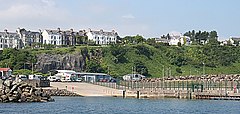
Glynn is a small village and civil parish in the Mid and East Antrim Borough Council area of County Antrim, Northern Ireland. It lies a short distance south of Larne, on the shore of Larne Lough. As of the 2011 census, the Glynn ward had a population of 2,027 people.
Randall MacSorley MacDonnell, 1st Earl of Antrim, PC (Ire), rebelled together with Tyrone and Tyrconnell in the Nine Years' War but having succeeded his brother, Sir James mac Sorley MacDonnell, as Lord of the Route and the Glynns in 1601, he submitted to Mountjoy, the Lord Deputy of Ireland, in 1602.
Bonamargy Friary is situated in County Antrim, Northern Ireland, off the Cushendall Road on the approach to Ballycastle. The name Bonamargy means ‘foot of the Margy River’, the river formed by the joining of the Cary River and Shesk Rivers.
Kinbane Castle is located in County Antrim, Northern Ireland, on a headland between Ballycastle and Ballintoy. The name comes from the Irish for "white head", referring to the limestone of the promontory. Nowadays, the castle is largely destroyed. Kinbane Castle is a State Care Historic Monument sited in the townland of Cregganboy, in Moyle District Council area, at grid ref: D0876 4383. The area surrounding Kinbane Castle is a Scheduled Historic Monument, grid ref: D0879 4381. The site also has views of Rathlin Island and Dunagregor Iron Age fort.
The Battle of Glentaisie, was an Irish battle fought in the north of Ulster on 2 May 1565. The result was a victory for Shane O'Neill over the Clan MacDonald of Dunnyveg. The conflict was a part of the political and military struggle, involving the English and occasionally the Scots, for control of northern Ireland. Although the MacDonalds were a Scottish family, based principally on the island of Islay in the Hebrides, they had long been associated with the Gaelic polity rather than the Kingdom of Scotland.
Clan MacDonald of Dunnyveg, also known as Clan Donald South, Clan Iain Mor, Clan MacDonald of Islay and Kintyre, MacDonalds of the Glens (Antrim) and sometimes referred to as MacDonnells, is a Scottish clan and a branch of Clan Donald. The founder of the MacDonalds of Dunnyveg is Eòin Mòr Tànaiste Mac Dhòmhnaill, a son of Iain Mic Dhòmhnaill and Margaret Stewart of Scotland, daughter of King Robert II. Members of the clan actually pronounced and spelled their name M'Connall due to the Gaelic pronunciation of the name Mac Domhnuill thus giving rise to the surname McConnell and its variants. While historically recognised as a clan by the Court of the Lord Lyon, it is now an armigerous clan as it no longer has a chief. The last chief was Sir James MacDonald, 9th of the Clan MacDonald of Dunnyveg or Clan Donald South, who died in London in 1626.
The MacDonnells of Antrim, also known as the MacDonnells of the Glens, are a branch in Ireland of the Scottish-based Clan Donald. Initially part of Clan MacDonald of Dunnyveg, the MacDonnells of Antrim became their own branch in 1558 when Somhairle Buidhe MacDonnell obtained the lordship of the territory in Ireland from James MacDonald, 6th chief of the Clan MacDonald of Dunnyveg. The MacDonnells of Antrim were a sept of the Clan Donald of the royal Clann Somhairle, that the English crown had attempted to cultivate since the early 14th century in its efforts to influence the course of politics in Scotland. The MacDonnells established a growing presence in Ireland throughout the 15th and 16th centuries, and played a crucial role in the politics of 17th century Ireland. The MacDonnell's achieved much success in Ireland largely to cultural and familial connections to the Gaelic nobility of Ireland. Today the surname is predominantly spelled McDonnell in Ireland and abroad, although many McConnells are also of the same family, as that is the Gaelic pronunciation of the Mac Domhnaill. Most of the leadership of the Clan wrote their name as a variant of McConnell up until the 17th century, including Sorley Boy MacDonnell himself. Many of the present-day McDonnells have a common descent from Sorley Boy MacDonnell.
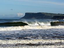
The Antrim Coast and Glens is an area of County Antrim in Northern Ireland, designated as an Area of Outstanding Natural Beauty in 1988.
Dunaneeny Castle is a ruined castle on the outskirts of Ballycastle in County Antrim, Northern Ireland. The castle was home to the chiefs of Clan MacDonald of Dunnyveg and later the MacDonnells of Antrim. The castle is purported to be the birthplace of Scottish-Irish chief Sorley Boy MacDonnell.
Rathlin Castle, also known as Bruce's Castle, was a castle on Rathlin Island off the coast of County Antrim in Northern Ireland.
Causeway Coast and Glens is a local government district covering most of the northern part of Northern Ireland. It was created on 1 April 2015 by merging the Borough of Ballymoney, the Borough of Coleraine, the Borough of Limavady and the District of Moyle. The local authority is Causeway Coast and Glens Borough Council.
James MacDonald, alias McDonnell, 6th Chief of Clan MacDonald of Dunnyveg, Scottish-Gaelic lord, died 1565.
Ballycastle Castle was a castle located at Ballycastle in County Antrim in Northern Ireland.