
County Antrim is one of the six counties of Northern Ireland, located within the historic province of Ulster. Adjoined to the north-east shore of Lough Neagh, the county covers an area of 3,086 square kilometres (1,192 sq mi) and has a population of 651,321, as of the 2021 census. County Antrim has a population density of 211 people per square kilometre or 546 people per square mile. It is also one of the thirty-two traditional counties of Ireland.

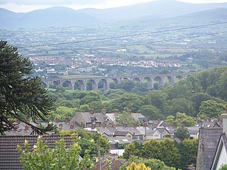
Ahoghill is a large village and civil parish in County Antrim, Northern Ireland, four miles from Ballymena. It is located in the Mid and East Antrim Borough Council area. It had a population of 3,417 people at the 2011 Census.
Bessbrook is a village in County Armagh, Northern Ireland. It lies about three miles (5 km) northwest of Newry and near the Newry bypass on the main A1 Belfast-Dublin road and Belfast-Dublin railway line. Today the village of Bessbrook straddles the three townlands of Maghernahely, Clogharevan and Maytown. Bessbrook is near Newry railway station. It had a population of 2,892 at the 2021 Census. The model village of Bessbrook, County Armagh is a visible memorial to the commercial endeavours of the Richardson family over a number of generations.

Fivemiletown is a village and townland in County Tyrone, Northern Ireland. It is 16 miles (26 km) east of Enniskillen and 26 miles (43 km) west-south-west of Dungannon, on the A4 Enniskillen-to-Dungannon road.

Newtownabbey is a large settlement north of Belfast city centre in County Antrim, Northern Ireland. It is separated from the rest of the city by Cavehill and Fortwilliam golf course, but it still forms part of the Belfast metropolitan area. It surrounds Carnmoney Hill, and was formed from the merging of several small villages including Whiteabbey, Glengormley and Carnmoney. At the 2021 census, Metropolitan Newtownabbey Settlement had a population of 67,599, making it the third largest settlement in Northern Ireland and seventh on the Island of Ireland. It is part of Antrim and Newtownabbey Borough Council.
Bleary is a small village and townland in County Down, Northern Ireland. It is near the County Armagh border and the settlements of Craigavon, Lurgan and Portadown. In the 2011 Census its population was counted as part of Craigavon. It lies within the Armagh City, Banbridge and Craigavon area.

Gilford is a village in County Down, Northern Ireland. The village sits on the River Bann between the towns of Banbridge, Tandragee and Portadown. It covers the townlands of Loughans, Ballymacanallen and Drumaran. It had a population of 1,933 people in the 2011 Census. Gilford is within the Armagh, Banbridge and Craigavon district.

Keady is a village and civil parish in County Armagh, Northern Ireland. It is south of Armagh and near the border with the Republic of Ireland. It is situated mainly in the historic barony of Armagh with six townlands in the barony of Tiranny. It had a population of 3,051 people in the 2011 Census.

Aghalee is a village, townland and civil parish in County Antrim, Northern Ireland. It is three miles from the southeast corner of Lough Neagh on the main road between Lurgan and Antrim and about 13 kilometres west of Lisburn. The village lies on the steep wooded slopes of Friar's Glen and is beside the now disused Lagan Navigational Canal. In the 2001 Census, Aghalee had a population of 774.
Balnamore is a small village in County Antrim, Northern Ireland. It is within the townland of Ballynacree-Skein and lies 3 km west of Ballymoney. It is part Causeway Coast and Glens District Council. Historically it was known as Ballinamore.

Cogry-Kilbride is a village in County Antrim, Northern Ireland, about 4 km west of Ballyclare. The village encompasses the two townlands of Cogry and Kilbride. It had a population of 1,195 people in the 2001 census. Kilbride is also a civil parish. It is situated in Antrim and Newtownabbey district.

Dervock is a small village and townland in County Antrim, Northern Ireland. It is about 3.5 miles (6 km) northeast of Ballymoney, on the banks of the River Bush. It is situated in the civil parish of Derrykeighan and the historic barony of Dunluce Lower. It had a population of 714 people in the 2011 Census.

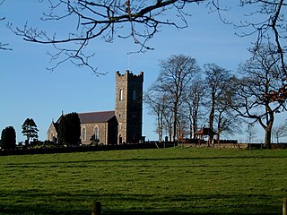
Drumbeg is a small village, townland and civil parish on the south bank of the River Lagan in County Down, Northern Ireland. The village is covered by the Lisburn City Council area and forms part of the suburban fringe of Belfast.

Newtownhamilton is a small village and civil parish in County Armagh, Northern Ireland. It lies predominantly within Tullyvallan townland. The civil parish is within the historic barony of Fews Upper. In the 2011 Census it had 2,836 inhabitants.
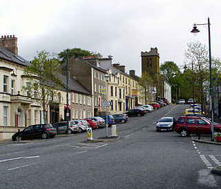
Richhill is a large village and townland in County Armagh, Northern Ireland. It lies between Armagh and Portadown. It had a population of 2,738 people in the 2021 Census.
Tartaraghan is a small village and civil parish in County Armagh, Northern Ireland. In the 2001 Census it had a population of 90 people. It is within Craigavon Borough Council area. Tartaraghan is also the name of the parish of which the village is part. The name was formerly spelt Taghterraghan and is thought to come from Irish Teach Tíreacháin, meaning "Tíreachán's house". However, the origin Tart Aracháin has also been put forth.

Belleeks is a small village and townland in south County Armagh, Northern Ireland. In the 2011 Census it had a reported population of 375. It lies within the Newry, Mourne and Down District Council area and the historic barony of Upper Fews.

Derrymore is a small village and townland in County Antrim, Northern Ireland. In the 2001 Census it had a population of 243 people. It lies on the shores of Lough Neagh, within the Armagh City, Banbridge and Craigavon Borough Council area.

Kilcoo is a small village and civil parish in County Down, Northern Ireland. It lies between Rathfriland and Castlewellan and is within the Newry, Mourne and Down District Council area. The village is on the A25 Dublin Road 6 kilometres (4 mi) south-west of Castlewellan. Kilcoo had a population 1415 people in the 2001 Census.


