
Canada has a vast geography that occupies much of the continent of North America, sharing a land border with the contiguous United States to the south and the U.S. state of Alaska to the northwest. Canada stretches from the Atlantic Ocean in the east to the Pacific Ocean in the west; to the north lies the Arctic Ocean. Greenland is to the northeast with a shared border on Hans Island. To the southeast Canada shares a maritime boundary with France's overseas collectivity of Saint Pierre and Miquelon, the last vestige of New France. By total area, Canada is the second-largest country in the world, after Russia. By land area alone, however, Canada ranks fourth, the difference being due to it having the world's largest proportion of fresh water lakes. Of Canada's thirteen provinces and territories, only two are landlocked while the other eleven all directly border one of three oceans.

The Mourne Mountains, also called the Mournes or Mountains of Mourne, are a granite mountain range in County Down in the south-east of Northern Ireland. They include the highest mountains in Northern Ireland, the highest of which is Slieve Donard at 850 m (2,790 ft). The Mournes are designated an Area of Outstanding Natural Beauty and it has been proposed to make the area Northern Ireland's first national park. The area is partly owned by the National Trust and sees many visitors every year. The Mourne Wall crosses fifteen of the summits and was built to enclose the catchment basin of the Silent Valley and Ben Crom reservoirs.

This is a list of the extreme points of Ireland – the points that are farthest north, south, east or west in Ireland. It includes the Republic of Ireland and Northern Ireland.
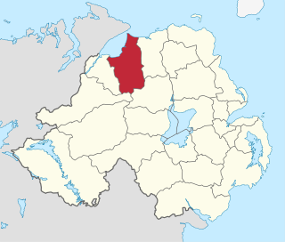
Limavady Borough Council was a local government body in Northern Ireland. In May 2015 it merged with Coleraine Borough Council, Ballymoney Borough Council and Moyle District Council under local government reorganisation in Northern Ireland to become Causeway Coast and Glens District Council.

The Glens of Antrim, known locally as simply The Glens, is a region of County Antrim, Northern Ireland. It comprises nine glens (valleys), that radiate from the Antrim Plateau to the coast. The Glens are an area of outstanding natural beauty and are a major tourist attraction in north Antrim.
Glenariff or Glenariffe is a valley in County Antrim, Northern Ireland. It is one of the Glens of Antrim. Like other glens in that area, it was shaped during the Ice Age by giant glaciers.

Galtymore or Galteemore is a mountain in the province of Munster, Ireland. At 917.9 metres, it is one of Ireland's highest mountains, being the 12th-highest on the Arderin list, and 14th-highest on the Vandeleur-Lynam list. Galtymore has the 4th-highest topographic prominence of any peak in Ireland, which classifies Galtymore as a P600, or "major mountain". It is one of the 13 Irish Munros.
Meigh is a small village and townland near Slieve Gullion in County Armagh, Northern Ireland. It had a population of 444 people in the 2001 Census. It lies within the Newry, Mourne and Down District Council area.

Mount Leinster is a 794-metre-high (2,605 ft) mountain in the Republic of Ireland. It straddles the border between Counties Carlow and Wexford, in the province of Leinster. It is the fifth-highest mountain in Leinster after Lugnaquilla 925 metres (3,035 ft), Mullaghcleevaun 849 metres (2,785 ft), Tonelagee 817 metres (2,680 ft), and Cloghernagh 800 metres (2,600 ft), and the highest of the Blackstairs Mountains. A 2RN transmission site tops the peak with a mast height of 122 metres (400 ft).

Galloway Forest Park is a forest park operated by Forestry and Land Scotland, principally covering woodland in Dumfries and Galloway. It is claimed to be the largest forest in the UK. The park was granted Dark Sky Park status in November 2009, being the first area in the UK to be so designated.

The Five Mile River is a 10.1-mile-long (16.3 km) river in central Massachusetts, part of the Chicopee River watershed. It rises north of Dean Pond in the Town of Oakham within Rutland State Forest and flows south through Dean Pond to Brooks Pond, 2.5 miles (4.0 km) northeast of North Brookfield, then continues south to its mouth at the north end of Lake Lashaway, also in North Brookfield.
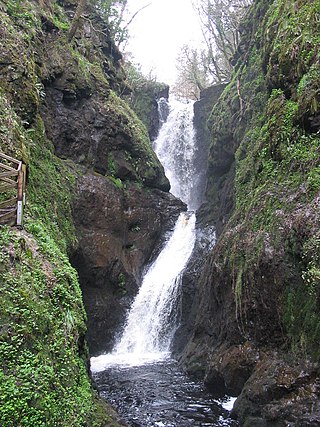
Glenariff Forest Park is an 1185 hectare forest in County Antrim, Northern Ireland. It is part of Glenariff glen itself. The forest is managed by the Northern Ireland Forest Service, the state body responsible for forestry in the province, which is part of the Department of Agriculture, Environment and Rural Affairs.

Tievebulliagh is a 402-metre-high (1,319 ft) mountain in the Glens of Antrim, Northern Ireland. It forms part of the watershed between Glenaan to the north and Glenballyemon to the south. It is situated about 4.4 km from Cushendall.

The River Roe is a river located in County Londonderry, Northern Ireland. It flows north from Glenshane in the Sperrin Mountains to Lough Foyle, via the settlements of Dungiven, Burnfoot, Limavady and Myroe. The River Roe's length is 34.25 miles (55.12 km)
The Roe Valley Country Park is a forested area containing part of the River Roe, south west of Limavady, County Londonderry, Northern Ireland. It is maintained by the Northern Ireland Environment Agency, which is part of the Department of the Environment of Northern Ireland.

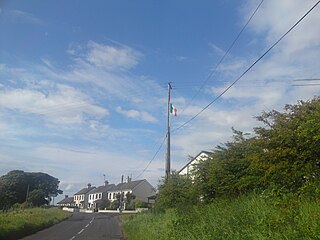
Altnahinch Dam is a large dam located near Loughguile, County Antrim, Northern Ireland. It is situated on the edge of Slieveanorra Forest in the southern uplands of Glenbush and was constructed in 1967 using stone quarried from the newly founded Corkey Quarry almost 3 miles away. The reservoir is fed from a number of tributaries in the greater Glenbush area, Altnahinch Burn and more famously the River Bush itself which flows from the top of Glenbush, through the reservoir and eventually into the sea at Portballintrae.

The Cliffs of Magho are a 9-kilometre-long (5.6 mi) limestone escarpment located in the townland of Magho, County Fermanagh, Northern Ireland. The NNW-facing cliffs overlook the western reaches of Lower Lough Erne and define the northern edge of Lough Navar Forest, a major plantation managed by the Forest Service of Northern Ireland. A popular viewpoint atop the cliffs is accessed by a forest drive.

The Alberta–British Columbia foothills forests are a temperate coniferous forests ecoregion of Western Canada, as defined by the World Wildlife Fund (WWF) categorization system. This ecoregion borders Canada's taiga and contains a mix of subarctic forest and temperate forest species as a result. This makes the region an ecotone region, or a region that acts as a buffer between two other biomes.
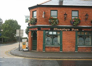
Corkey or Corky is a small village in County Antrim, Northern Ireland. Located 11 miles east of Ballymoney, it is within the Ballymoney Borough Council area, and is at the edge of the Glens of Antrim. The villages of Loughguile and Cloughmills are nearby. It had a population of 202 people in the 2011 Census.

Hope Castle is a historic building located in Castleblayney, County Monaghan, Ireland.The building still stands, although unoccupied. Over the years, Hope Castle has been inhabited for various uses, such as homes to many, military barracks, a hospital, convent, and was most recently used as a hotel before its demise in 2010.


