Donard Forest

Last updated

Donard Forest
A path in Donard Forest, Newcastle (2) - geograph.org.uk - 467058.jpg
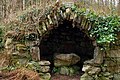
A path within Donard Forest
Map
Relief Map of Northern Ireland.png
Red pog.svg
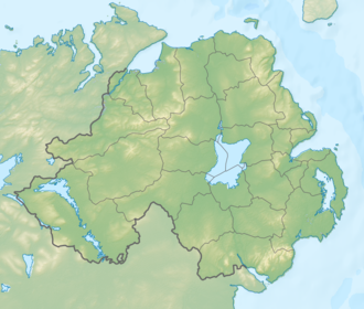
Location of Donard Forest
Geography
LocationDown,Northern Ireland,United Kingdom
Coordinates 54°12′11″N5°54′07″W / 54.203°N 5.902°W / 54.203; -5.902 Coordinates: 54°12′11″N5°54′07″W / 54.203°N 5.902°W / 54.203; -5.902
Area296.82 hectares (733.5 acres)
Administration
Governing body Forest Service Northern Ireland

Donard Forest is located near Newcastle, County Down, Northern Ireland. It borders Donard Park at the foot of the Mourne Mountains. The Glen River flows through the forest where it is crossed by three stone bridges. The north east section of the forest contains a Heritage Stand of Scots and Corsican pine planted in 1927. [1] A south east section, beside the Glen River, was the former site of Donard Lodge. The lodge was built in the 1830s by the Annesley family and demolished in 1966 after falling into ruin. [2] The Annesleys planted a number of exotic trees in the area surrounding the house, including Giant Redwoods and Monkey Puzzles. [1] There is also a small stone shelter, built in 1842, a short distance from the river.

Related Research Articles

Newcastle, County Down Town in Northern Ireland

Newcastle is a small seaside resort town in County Down, Northern Ireland, which had a population of 7,672 at the 2011 Census. It lies by the Irish Sea at the foot of Slieve Donard, the highest of the Mourne Mountains. Newcastle is known for its sandy beach, forests, and mountains. The town lies within the Newry, Mourne and Down District.

County Down County in Northern Ireland

County Down is one of the six counties of Northern Ireland, one of the nine counties of Ulster and one of the traditional thirty-two counties of Ireland. It covers an area of 961 sq mi (2,490 km2) and has a population of 531,665. It borders County Antrim to the north, the Irish Sea to the east, County Armagh to the west, and County Louth across Carlingford Lough to the southwest.

Mourne Mountains Mountain range in Northern Ireland

The Mourne Mountains, also called the Mournes or Mountains of Mourne, are a granite mountain range in County Down in the south-east of Northern Ireland. They include the highest mountains in Northern Ireland, the highest of which is Slieve Donard at 850 m (2,790 ft). The Mournes are designated an Area of Outstanding Natural Beauty and it has been proposed to make the area Northern Ireland's first national park. The area is partly owned by the National Trust and sees many visitors every year. The Mourne Wall crosses fifteen of the summits and was built to enclose the catchment basin of the Silent Valley and Ben Crom reservoirs.

Tollymore Forest Park

Tollymore Forest Park was the first state forest park in Northern Ireland, established on 2 June 1955. It is located at Bryansford, near the town of Newcastle in the Mourne and Slieve Croob Area of Outstanding Natural Beauty. It covers an area of 630 hectares at the foot of the Mourne Mountains and has views of the surrounding mountains and the sea at nearby Newcastle. The Shimna River flows through the park where it is crossed by 16 bridges, the earliest dating to 1726. The river is a spawning ground for salmon and trout and is an Area of Special Scientific Interest due to its geology, flora and fauna. The forest has four walking trails signposted by different coloured arrows, the longest being the "long haul trail" at 8 miles (13 km) long. It was listed in The Sunday Times top twenty British picnic sites for 2000. The Forest Park has been managed by the Forest Service since they purchased it from the Roden Estate in 1941.

Donard Park

Donard Park is a public park located in Newcastle, County Down, Northern Ireland. It is next to the Glen River, which forms the boundary along one side and is at the foot of Slieve Donard, the highest mountain in Northern Ireland, part of the Mourne Mountains. It is owned and run by Down District Council.

Belfast and County Down Railway Former Irish railway linking Belfast with County Down

The Belfast and County Down Railway (BCDR) was an Irish gauge railway in Ireland linking Belfast with County Down. It was built in the 19th century and absorbed into the Ulster Transport Authority in 1948. All but the line between Belfast and Bangor was closed in the 1950s, although some of it has been restored near Downpatrick by a heritage line, the Downpatrick and County Down Railway.

Castlewellan Human settlement in Northern Ireland

Castlewellan is a small town in County Down, in the south-east of Northern Ireland close to the Irish Sea. It is beside Castlewellan Lake and Slievenaslat mountain, 11 miles (18 km) southwest of Downpatrick. It lies between the Mourne Mountains and Slieve Croob. It had a population of 2,782 people in the 2011 Census.

Slieve Donard Highest mountain in Northern Ireland

Slieve Donard is the highest mountain in Northern Ireland and the wider province of Ulster, with a height of 850 metres (2,790 ft). The highest of the Mourne Mountains, it is near the town of Newcastle on the eastern coast of County Down, overlooking the Irish Sea. It is also the highest mountain in the northern half of Ireland, and 7th highest on the island.

Drumquin Human settlement in Northern Ireland

Drumquin is a small village and townland in County Tyrone, Northern Ireland. It lies between Omagh and Castlederg, on the banks of the Drumquin River (Fairywater). It is situated in the civil parish of Longfield West and the historic barony of Omagh West. It had a population of 291 people in the 2001 Census.

Hut Dwelling

A hut is a small dwelling, which may be constructed of various local materials. Huts are a type of vernacular architecture because they are built of readily available materials such as wood, snow, ice, stone, grass, palm leaves, branches, hides, fabric, or mud using techniques passed down through the generations.

Eglinton, County Londonderry Human settlement in Northern Ireland

Eglinton is a village in County Londonderry, Northern Ireland. It lies 5.5 miles (8.9 km) east-north-east of Derry, to which it serves as a sleeper village, and 9.5 miles (15.3 km) west-south-west of Limavady. Eglinton had a population of 3,679 people in the 2011 Census, an increase of 16% on the 2001 Census population of 3,165. It lies within Derry and Strabane district. The City of Derry Airport, also known as Eglinton Aerodrome and formerly as Londonderry Eglinton Airport, lies a short distance from the village.

Backbone State Park State park in Iowa

Backbone State Park is Iowa's oldest state park, dedicated in 1919. Located in the valley of the Maquoketa River, it is approximately three miles (5 km) south of Strawberry Point in Delaware County. It is named for a narrow and steep ridge of bedrock carved by a loop of the Maquoketa River originally known as the Devil's Backbone. The initial 1,200 acres (490 ha) were donated by E.M. Carr of Lamont, Iowa. Backbone Lake Dam, a relatively low dam built by the Civilian Conservation Corps (CCC) in the 1930s, created Backbone Lake. The CCC constructed a majority of trails and buildings which make up the park.

Shimna River River in County Down, Northern Ireland

The Shimna River is a river in County Down, Northern Ireland. It rises on the slopes of Ott Mountain, in the Mourne Mountains, and enters the Irish Sea at Newcastle, on Dundrum Bay. It is acidic and nutrient-poor, as a result of which its most common flora are mosses and liverworts, including the rare Portuguese feather-moss and Holt's mouse-tail moss. Its principal fish are salmon and sea trout, and it is managed by the Shimna Angling Club. The river is an Area of Special Scientific Interest (ASSI).

Glen River (County Down)

Glen River is a short river in County Down, Northern Ireland. The two-mile (3.2 km) course flows north-east from the foot of Slieve Commedagh and Slieve Donard in the Mourne Mountains into Dundrum Bay at Newcastle, descending 1,500 feet (460 m).

Mar Lodge Estate is the largest remnant of the ancient Earldom of Mar in Aberdeenshire, Scotland and is now owned by the National Trust for Scotland.

Thomas Marlay (c.1680–1756) was an Irish politician and judge, who ended his career as Lord Chief Justice of Ireland. He is remembered chiefly for beginning the rebuilding of Celbridge Abbey, and as the grandfather of the statesman Henry Grattan.

Lacey-Keosauqua State Park State park in Iowa

Lacey-Keosauqua State Park is located southwest of Keosauqua, Iowa, United States. The park is located along the Des Moines River in Van Buren County. First dedicated in 1921, it is the largest state park in size in Iowa. In 1990, three areas were named nationally recognized historic districts and listed on the National Register of Historic Places.

Mount Panther

Mount Panther is an historic country house located between Dundrum and Clough in Northern Ireland. The house dates from the 1700s and has been derelict for some years. In 2009 it was offered for sale for £5m along with 140 acres of farm and parkland. In 2014 it was considered a complete ruin with a reduced demesne of 80 acres. It is a listed building of County Down since 1980.

The Mourne Conduit was a water main which ran 42 kilometres (26 mi) from the Silent Valley Reservoir to Carryduff, near Belfast and was built between 1893 and 1901 for the Belfast City and District Water Commissioners. This was supplemented by additional pipelines twice in the 20th Century. This system supplied water to Greater Belfast and North Down for more than 100 years. It is labelled as the Mourne Aqueduct in Ordnance Survey maps from the early 20th century.

References

  1. 1 2 "Donard Forest". NI Direct. Retrieved 17 December 2014.
  2. Carson, Charles J. T. (2009). Technology and the Big House in Ireland, C. 1800-c. 1930. Cambria Press. pp. 123–124. ISBN   9781604976359.