
Ballintoy is a small village, townland and civil parish in County Antrim, Northern Ireland. It is alongside the B15 coast road, 28 km (17 mi) north-east of Coleraine, 8 km (5.0 mi) west of Ballycastle and between it and Bushmills. It is in the historic barony of Cary. The village lies about one kilometre from Ballintoy Harbour, a small fishing harbour at the end of a very small, narrow, steep road down Knocksaughey hill which passes by the entrance to Larrybane and Carrick-a-Rede Rope Bridge. The harbour is host to a dawn service on Easter Sunday each year.
Donegore is the name of a hill, a townland, a small cluster of residences, and a civil parish in the historic barony of Antrim Upper, County Antrim, Northern Ireland. Donegore lies approximately 5 miles (8 km) east of Antrim town. 154 acres of the townland lies in the civil parish of Grange of Nilteen.
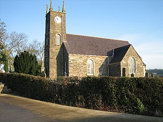
Parkgate is a small village in County Antrim, Northern Ireland. It lies at the foot of Donegore Hill, near the Six Mile Water. It is about midway between Ballyclare and Antrim town. It lies within the Borough of Antrim. It had a population of 676 people in the 2011 Census.

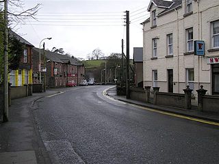
Doagh is a village and townland in County Antrim, Ireland. It is in the Six Mile Water Valley, about two miles south-west of Ballyclare, and had a population of 1,388 people in the 2011 Census. It is known as Doach in Scots.

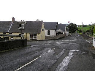
Dunadry is a small village and townland 3 miles (5 km) from Antrim in County Antrim, Northern Ireland. It is situated in the civil parish of Grange of Nilteen and the historic barony of Antrim Upper. It is within the Antrim and Newtownabbey Borough Council area. It had a population of 430 people in the 2011 Census..
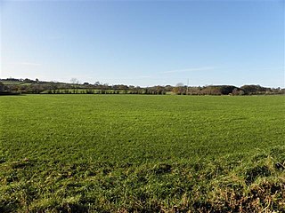
Dunamuggy is a townland of 172 acres in County Antrim, Northern Ireland. It is situated in the civil parish of Donegore and the historic barony of Antrim Upper.
Cullybackey or Cullybacky is a village in County Antrim, Northern Ireland. It lies 3 miles north-west of Ballymena, on the banks of the River Main, and is part of Mid and East Antrim district. It is a predominantly Protestant area. It had a population of 2,569 people in the 2011 Census.
Dromara is a village, townland and civil parish in County Down, Northern Ireland. It lies 10 kilometres (6.2 mi) to the southwest of Ballynahinch on the northern slopes of Slieve Croob, with the River Lagan flowing through it. It is situated in Dromara and the historic barony of Iveagh Lower, Lower Half. In the 2011 Census it had a population of 1,006 people.
Carnalbanagh is a small village and townland in County Antrim, Northern Ireland, 13 km east-north-east of Ballymena. It is situated in the civil parish of Tickmacrevan and the historic barony of Glenarm Lower, and is part of Mid and East Antrim district. It lies above Glenarm and is close to Mount Slemish.

Solar is a townland of 42 acres in County Antrim, Northern Ireland. It is situated in the civil parish of Carncastle and the historic barony of Glenarm Upper.
Antiville is a townland of 165 acres in County Antrim, Northern Ireland. It is situated in the civil parish of Larne and the historic barony of Glenarm Upper.

Ault,, is a townland of 367 acres in County Antrim, Northern Ireland. It is situated in the civil parish of Tickmacrevan and the historic barony of Glenarm Lower.
Unshinagh Mountain is a townland of 635 acres in County Antrim, Northern Ireland. It is situated in the civil parish of Tickmacrevan and the historic barony of Glenarm Lower.

White Park, County Antrim is a townland of 170 acres in County Antrim, Northern Ireland. It is situated in the civil parish of Ballintoy and the historic barony of Cary.

Ballyclaverty is a townland of 339 acres in County Antrim, Northern Ireland. It is situated in the civil parish of Donegore and the historic barony of Antrim Upper.
Grange of Nilteen is a civil parish in County Antrim, Northern Ireland. It is situated in the historic barony of Antrim Upper. It is 3.5 miles east of Antrim on the Six Mile Water River.
Rathbeg is a townland in County Antrim, Northern Ireland. It is situated in the civil parishes of Grange of Nilteen and Donegore, both in the historic barony of Antrim Upper.
Killycluggin is a townland in the civil parish of Templeport, County Cavan, Ireland. It lies in the Roman Catholic parish area of Templeport and the barony of Tullyhaw.


